buildingcincinnati
Jeddah Tower 3,281'
-
Joined
-
Last visited
Everything posted by buildingcincinnati
-
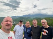
 Yes...I do plan on attending!
 -
From what I understand, dozens of blocks were being leveled in the 1960s-1980s for urban renewal. That's why Larimer Square and a lot of LoDo is so important.
-
I deserve that. I am a freaking ghost. Who do we know who lives in Denver...or knows Denver? I mean, this is approaching the civic district of Denver...next thread will have a Puerto Rican Day spread from Denver's Civic Center Park. But just outside of it, all of the urban renewal towers built between 1968 and 1983 (right?). All I can say is that I always fly over Denver from the SE to the NW, usually around evening, and it looks amazing from the plane.
-
Can anyone identify Denver's skyscrapers very well? I visited in June and have a few photos I'm trying to tag and identify...most of these can be seen from the lower 16th Street Mall, meaning they're probably on 17th, 18th, or Broadway. Here are the pics. Thanks! Kevin
-
Avondale is a Cincinnati neighborhood located northeast of Downtown, surrounded by the neighborhoods of Corryville, Clifton, North Avondale, Paddock Hills, Evanston, and Walnut Hills. Its population was 12,466 in the 2010 census. Please visit the <i>Building Cincinnati</i> galleries to view thousands of photographs of other Greater Cincinnati communities. 2010 <i>1. Oak Street</i> <i>2. The Vernon Manor, now offices, on Oak Street</i> <i>3. Vernon Manor, Oak Street</i> <i>4. Vernon Manor, Oak Street</i> <i>5. Cincinnati Children's Hospital Medical Center, Burnet Avenue</i> <i>6. Cincinnati Herald Building, Burnet Avenue</i> <i>7. Ronald McDonald House, Burnet Avenue</i> <i>8. Oak Street</i> <i>9. Vernon Manor, Oak Street</i> <i>10. Oak Street</i> <i>11. Hauck Garden, Oak Street</i> <i>12. Oak Street</i> <i>13. Civic Garden Center, Reading Road and Oak Street</i> <i>14. Burnet Avenue</i> <i>15. Burnet Avenue and "Pill Hill"</i> <i>16. University Hospital</i> <i>17. Cincinnati Children's Hospital Medical Center, Burnet Avenue</i> 2009 <i>18. </i> <i>19. Cincinnati Herald Building, Burnet Avenue</i> 2006 <i>20. Harvey Avenue</i> <i>21. Reading Road, at Hickman Avenue</i> <i>22. Harvey Avenue</i> <i>23. Beldare Avenue and West Street</i> <i>24. From Vine Street Hill Cemetery</i> <i>25. Tower Street</i> <i>26. Reading Road, at Whittier Street</i> <i>27. Hearne and Wilson avenues</i> <i>28. Hearne Avenue</i> 2005 <i>29. Vine Street</i>
-
Ha...these were taken back in 2007. I need to get out and take some new ones!
-
Addyston is a small village along the Ohio River and U.S. 50, just west of Cincinnati. Its population was 938 in the 2010 census. Please visit the <i>Building Cincinnati</i> galleries to view thousands of photographs of other Greater Cincinnati communities. <i>1. Main Street</i> <i>2. Main and Church streets</i> <i>3. 2nd Street</i> <i>4. Main Street</i> <i>5. Main Street</i> <i>6. Main Street</i> <i>7. 1st Street</i> <i>8. Sekitan Avenue</i> <i>9. Main Street</i> <i>10. 1st Street</i>
-
SO SORRY I wan't able to make it, everyone. As some of you may know, my Mom had brain surgery for a malignant tumor recently, and I wasn't able to get away for the day. There was just to much that needed attention around here. I hope everyone had a great time in Columbus -- despite the rain. And at least none of you were struck by lightning. Damn.
-
FYI...My Mom is in the hospital right now...she should be back home by then, but if she's not it could affect my attendance.
-
Jake would take us to Lion's Den.
-
Damn, we're up over two dozen!
-
Count me in. I'll just need someone to remind me a week or so out.
-
I haven't been a contributor to UO for years, but I really felt like I should visit and pay my respects to Robert Pence. I met Robert on two occasions...once during a UO meet in Dayton so many years ago and another time who knows when or where. From my limited contact with him I knew that he was very friendly, knowledgeable, and a hell of a photographer. He had seen more than I'll likely see in my lifetime. I could tell he wasn't so well back then, eight or so years ago, by his voice. I just hoped he'd be around long enough to continue to contribute his great insights and photography, which he did. He is a UO icon. If ever this site develops a Hall of Fame, he should certainly be in it. R.I.P. Robert Pence....
-
Thanks, people! BC will continue as always. The Business Courier has the rights to reproduce my stories. In return, I get a nude lady and a load of Book of the Month Club dung. Sorry about those Monty Python references. Anyway, I'm sorry I don't have time for UO anymore. It was the soil in which I grew. Now I've left and I don't have time for it. But I haven't forgotten about you guys -- I think about UO often and I'm glad to see how this thing has continued to grow. BTW, I used to be with Cincinnati.com. They were not the least bit helpful, they have no current real estate writer, and they could've made great use of me if they tried.
-
I don't know about that. What's left of the West End is still pretty dense, Clifton Heights, Fairview, Mount Auburn, etc. are as well. Maybe not OTR dense, but small lot dense. But I guess this could be an argument about what one considers "dense". If you mean attached buildings, then you are right. But I consider streets like Victor, Stratford, or McGregor fairly dense.
-
Yeah, when Ronny and I went on the tour of the Banks in March, we couldn't really see that. You can see the vegetation from Walnut Street, but it's not apparent what is actually going on up there.
-
I agree. There's a place to discuss Miller's financial disability. It's called a bar, private e-mail, topical blog, Google hangout, or a deftly constructed listserv. Or, one could seek to discredit him in the Court of Public Opinion. Here, it doesn't serve much purpose. I agree that COAST needs to be held to account, but this just isn't the place. Says your absentee moderator who is getting a bunch of e-mails....
-
The following set of 56 photos was taken on October 22, 2011, during an Urban Ohio meetup and tour through Downtown. Following a walk through Fountain Square, down E Fourth Street, through Great American Tower at Queen City Square and Lytle Park, and then past The Banks development, we headed back up into the heart of Downtown. Carew Tower, until early this year Cincinnati's tallest skyscraper, has an observation deck on the 49th floor. $2. Recommended. After an extended period of time taking photos, a roar could be heard from the streets below. Protesters from Occupy Cincinnati were making their way down E Fifth Street -- toward Fountain Square -- for a rally. Later, we went down to check it out. The final two photos are just pretty, from Walker Street in Mount Auburn. Photos from the observation deck generally start looking northward and move in a clockwise direction. Like what you see? There are now 4,461 photos of Greater Cincinnati neighborhoods available here. Comment and share! 1. Onward! 2. Over-the-Rhine. (L-R) Elm, Race, and Vine streets. Macy's and Kroger buildings prominent, also School for Creative and Performing Arts, Music Hall, Washington Park. The University of Cincinnati is at the top right of the photo. 3. Over-the-Rhine. Race Street left, Vine Street right. 4. Up the hillside, from Main and Mulberry in Over-the-Rhine, to Dorsey Street and Christ Hospital in Mount Auburn, to the steeple-free Old St. George Church in Clifton Heights. 5. I-71, with Gilbert Avenue winding northeastward toward Walnut Hills. In the foreground, construction on Horseshoe Casino Cincinnati. Portions of Mount Adams and East Walnut Hills are also visible. 6. A closer look at the casino construction site. Visible are such buildings as the Hamilton County Justice Center, the Hamilton County Administration Building, the Flatiron Building, and 800 Broadway (Times-Star Building). 7. Even closer. Reading Road splits the Downtown casino site from the Pendleton neighborhood. 8. Newish signage on the Fifth Third Building. 9. Nada, at E Sixth and Walnut streets Downtown. The Lois & Richard Rosenthal Center for the Contemporary Arts is at left. 10. Government Square bus hub, E Fifth and Main streets. Surrounding buildings include the Potter Stewart United States Courthouse, John Weld Peck Federal Building, and PNC Center. 11. Rusty mechanicals. 12. Looking over I-71 at Mount Adams and beyond. Notable: The Holy Cross Church and Monastery, the Celestial, the Edgecliff and Edgecliff Point condominium towers. On the other (same) side of the Ohio River, one can make out the red-brick St. Rose Church. 13. A close-up of Mount Adams and Cincinnati's East End. Notable: Holy Cross Church and Monastery, the Celestial, Holy Cross-Immaculata Church, and St. Rose Church. 14. Closer. 15. Columbia Parkway (U.S. 50) winds its way out of Downtown, past Park Place at Lytle, Adams Landing, and the Palisades of Mount Adams. 16. Approach to the Purple People Bridge, and an amphitheatre at Sawyer Point Park. 17. I-471 going southeastward into Northern Kentucky. The City of Newport is in the foreground, St. Elizabeth Fort Thomas is the complex at the top right. 18. Great American Tower at Queen City Square. I-471 and Northern Kentucky in the background. 19. Again, zoomed out. The Daniel Carter Beard (Big Mac) Bridge (I-471), the approach to the Purple People Bridge, and Newport's SouthShore condo tower. 20. The Tower and Newport. Here you can see the Purple People Bridge leading to Newport on the Levee, the utilitarian Taylor Southgate Bridge, U.S. Bank Arena, part of Great American Ball Park, and reflections off of the back of Scripps Center. 21. A shot that kind of combines the last two. 22. So photogenic on a sunny day. 23. U.S. Bank Arena and Taylor Southgate Bridge. 24. Taylor Southgate Bridge, Newport, and more reflections. Was my desktop for a while. 25. First phase of The Banks development, with the E Second and Walnut street intersection at the bottom of the photo. Portions of the Great American Ball Park, Cincinnati Reds Hall of Fame, and National Underground Railroad Freedom Center are visible. 26. The Banks and Phyllis W. Smale Riverfront Park construction, plus the confluence of the Ohio and Licking Rivers. Across the Ohio, Newport is on the left and Covington is on the right. A small portion of the John A. Roebling Suspension Bridge is visible at right. 27. PNC Tower and parking. Eventually, that parking will be capped by development. 28. Boater on the Ohio, having passed under the John A. Roebling Suspension Bridge. 29. Paul Brown Stadium, home of the Cincinnati Bengals. In the background, the Clay Wade Bailey Bridge carries several U.S. highways into Kentucky, and the double-decked Brent Spence Bridge carries I-71 and I-75. 30. Duke Energy Convention Center and the intersection of W Fifth and Elm streets. 31. Looking northwest toward the West End. Front to back, such highlights as the Cincinnati Bell Telephone Building, the beautiful City Hall, Uptown Towers, the prison-like Hays/Porter Elementary School, and the City West HOPE VI development. 32. A closer look at the Cincinnati Bell Telephone Building and some urban trees. 33. Similar to two photos back, except this one now shows the Betts Longworth Historic District, an unattractive Duke Energy substation, the Fire Museum of Greater Cincinnati and Lloyd Library and Museum, and the Waldo Apartments. 34. Looking over City West at the Cincinnati Museum Center at Union Terminal and the CSX Queensgate Yard. 35. Looking northwest. City West and Stargel Stadium, Taft IT High School, Stanley Rowe Towers, I-75, and the Western Hills and Hopple Street viaducts. 36. The Singing Mural on the side of WCET's studios, with the suburban-style Court Street Center I office building in the foreground. 37. Back to Over-the-Rhine, watching W McMicken Avenue, Central Parkway, and Central Avenue bend toward the northwest. At the top right, you can see some of the hillside development in Clifton Heights and Fairview. 38. Here come the Occupiers. 39. ... 40. ... 41. Occupy Cincinnati rally on Fountain Square. No comments..they tell their own story. 42. ... 43. ... 44. ... 45. ... 46. ... 47. ... 48. ... 49. ... 50. ... 51. ... 52. ... 53. At Mynt Martini on Fountain Square. What rally? 54. BUZZZZZZZZZZZZZZZZZZZ.... 55. Remember flowers? 56. And color?
-
No more career politician's
-
It was fun. I had to cut out early at about 5 pm...I have NO idea what happened after that!
-
Oops...nice catch. I wrote this post too fast!
-
^ Yes, future phase. It will eventually be brought up to street level.
-
The following set of 60 photos was taken on October 22, 2011, during an Urban Ohio meetup and tour through Downtown. We started at Fountain Square and made our way down E Fourth Street. We stopped in the arcade at Downtown's newest skyscraper, the Great American Tower at Queen City Square. Heading back outside, we continued down E Fourth Street to Lytle Park. After Lytle Park, we walked down to The Banks and checked out the construction there and at Smale Riverfront Park. In Part II, we head to the observation deck at the top of Carew Tower, then descend back to Fountain Square to see what the hell was going on with the Occupy Cincinnati rally. Like what you see? There are now 4,404 photos of Greater Cincinnati neighborhoods available here. Comment and share! 1. Tyler Davidson Fountain, "Genius of Water", Fountain Square. 2. Closer. 3. The City of Cincinnati flag waves in the breeze. In the background is the Chemed Center (left) and the Tri-State Building (aka the Traction Building, right). 4. Looking eastward through the Government Square bus hub, with the Park Place at Lytle condos in the distance. 5. E Fourth Street. 6. E Fourth Street. 7. This font caught my eye, E Fourth Street. 8. PNC Tower. 9. Interactive display, E Fourth Street. 10. Great American Tower at Queen City Square. 11. Farther... 12. ...and farther. 13. Inside the tower's lobby/atrium/arcade. 14. 15. 16. 17. Fountain. I believe this is the only photo that actually proves there was a tour, and I wasn't by myself! 18. Fountain closeup. 19. Back on E Fourth Street, a light fixture I liked. 20. Detail, E Fourth Street at Sycamore Street. 21. Lytle Park, a section of Downtown that has an Interstate passing beneath it. If you look closely, you'll see a rare statue of Abe Lincoln sans beard. 22. 23. Literary Club of Cincinnati and the former Phelps Apartments, now a Residence Inn by Marriott. E Fourth Street. 24. Park Place at Lytle, a former industrial building now housing condominiums. 25. Bocce. 26. Bottoms. 27. Taft Museum of Art, Pike Street. 28. Anna Louise Inn, E Third and Pike streets. 29. Abe's feet. 30. Looking northwest toward the Chemed Center and the Chiquita (um...Nielsen?) Center. 31. Big Belly solar garbage can. 32. Leaving the park, we see these stoops on a small row of historic residential buildings on Arch Street. 33. Detail on the former Second District Police Station, Arch Street. 34. Sycamore Street. The Second District Police Station is at the right. 35. PNC Tower. 36. Traffic on Fort Washington Way westbound, a backup due to construction in Northern Kentucky. Fort Washington Way carries I-71 and U.S. 50. 37. Another take on the traffic. 38. Aka E Second and Main streets, right outside of Great American Ball Park. 39. Great American Ball Park. 40. Parking portal, E Freedom Way, at The Banks. 41. Current at The Banks, E Freedom Way. 42. Johnny Rockets, E Freedom Way. 43. Moerlein Lager House, set to open in March 2012 in Smale Riverfront Park. 44. 45. 46. 47. 48. Looking west on Mehring Way toward Paul Brown Stadium. 49. From Mehring Way. 50. Construction at Smale Riverfront Park. 51. 52. 53. John A. Roebling Suspension Bridge. 54. Another shot of Paul Brown Stadium. 55. Assorted shots of construction at The Banks, parking infrastructure, etc. 56. 57. Interesting... 58. ...not sure how I feel about these. Judgement withheld. 59. Classy font on the way to Carew Tower. 60. Okay, totally random. Hustler store on E Seventh Street.
-
^ Yeah, it's sexy like that. I miss living in C-Bus and buzzing around those hoods, but, man, it's so good here.
-
I just worry about how many projects are applying for this particular grant package. Everyone, hit everyone involved to make sure the horrible decision by Kasich on TRAC is ameliorated.