jjakucyk
One World Trade Center 1,776'
-
Joined
-
Last visited
Everything posted by jjakucyk
-
jjakucyk replied to buildingcincinnati's post in a topic in Architecture, Environmental, and PreservationKAO USA plans to expand; Powell Valves moving after 174 years of operation Powell Valves, a 174-year-old industrial valve manufacturer in Cincinnati, is moving for the first time to allow its longtime neighbor, KAO USA, to expand. Check out this story on cincinnati.com: https://www.cincinnati.com/story/money/2020/03/11/kao-usa-expanding-powell-valves-moving-after-174-years-same-location/5013626002/
-
Sign restaurants are so much nicer than Chipelto.
-
I wonder how much it would cost to relocate the rail yards instead, and just get rid of this whole viaduct nonsense altogether. They were built here for historical reasons, and then expanded when urban industrial areas were collapsing, but there's not really any need for it to be so close to downtown. Sharonville had a much larger yard in the past, and getting a couple of warehouse buildings out of the way would provide a similar amount of space out there. Of course, redeveloping the freed up space into more low-density industrial like the rest of Queensgate wouldn't be of any benefit, and I don't see city leaders coming up with anything more creative than that, so oh well.
-
jjakucyk replied to buildingcincinnati's post in a topic in Architecture, Environmental, and PreservationHow most is most?
-
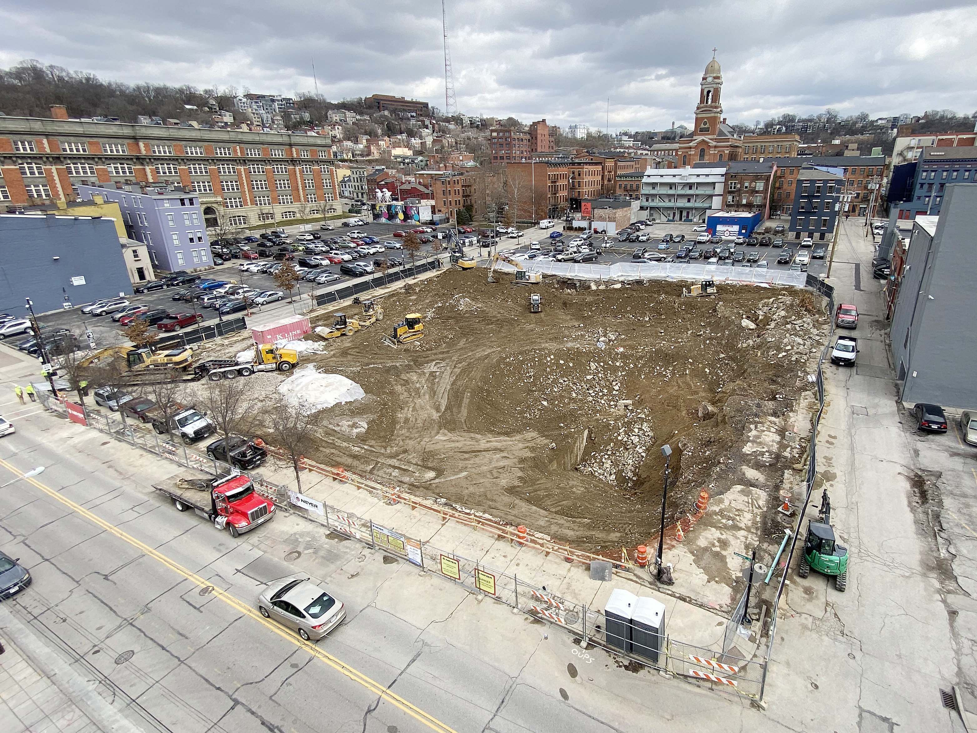
They hauled away a dump truck load from the top left corner when I walked by, but what their ultimate goal is I don't know.
-
It's been seven weeks and they're still pushing dirt around. I wonder if there's some sort of contamination/remediation situation here?

-
Good. They took a rundown but serviceable old building that was a blight on the neighborhood and turned it into something nice (except for the lick-n-stick stone, sigh). Better than demolishing and leaving an empty lot, or building some new cheap crap.
-
I don't know what the relative counts are, but I would posit that 90+% of bikers go through Eden Park rather than taking Gilbert all the way up to McMillan. Even those heading to UC tend to do that since it's a much more pleasant ride and you end up just two to three blocks east of Gilbert at the top anyway. Still, Gilbert could be made much more friendly than it is, and a much better multi-modal link to Walnut Hills. If they can just get the last mile to downtown fixed. This https://goo.gl/maps/Sjx8egihpNo1W7H88 represents a complete misunderstanding of how bikes work. They want you to scrub all your downhill momentum into a turn with maybe a five foot radius. If this was on an uphill, maybe, but not on a fast downhill. Instead, cyclists just merge left to maintain speed, then try in vain to look behind and to the right for any vehicles flying down the offramp at highway speed while also trying to look ahead for cracks in the pavement. By the time all is sorted out, the bike lane has ended. This whole stretch needs to be re-engineered, perhaps in conjunction with removal of the Gilbert Avenue Viaduct too, that has been discussed before. The massive I-71 wall and blank parking garage/lot and bus station are all negatives, but at the same time, the lack of much "there, there" means it could be treated more like an actual multi-modal parkway or allé than a highway.
-
I would argue that while the childless people *could* live anywhere, they're more likely to be sorted out of the neighborhoods with good schools, because of the higher prices and taxes. DINK's can swing it, but if they know they're never having kids, why pay the premium? Singles on the other hand may not be able to afford what should otherwise be a cheap house if not for the school district.
-
You can be happy that a worthwhile institution is doing well and expanding, but still be critical of their running roughshod over a neighborhood with no consequences. The snarky sarcastic comments above are the kind of bottom-feeding platitudes I'd expect out of Fox News, not a forum of supposedly urban-minded citizens. That photo is a classic example of scale incompatibility and anti-contextualism. And for all the trouble, there's still vacant lots and hideous overhead utilities. Why is there no room for civic engagement here?
-
Indeed, Gilbert has no traffic. It was the primary route to the east side back in the day, along with Victory Parkway which feeds into it at Eden Park Drive, but Columbia Parkway and I-71 sucked all that traffic away. Since Gilbert already has a median/turn lane, you can easily just scoot the parking in one lane and make the current parking lane a protected bikeway. No curb modifications needed, and the parking lane can become bus stops and right turn lanes as needed. It's below Elsinore that things get ugly. The highway ramps casino entrance along with the slope makes it a biking disaster. Reading is no better.
-
Would it though? The presence of a traffic signal doesn't guarantee a GREEN traffic signal. It's about 50:50 at best. So yes every stop sign is a guaranteed stop, but if your average stop time is only half as long as at a typical red traffic signal, then it's a wash time-wise, and you don't have to worry about turning vehicles like I mentioned before. I bet it's one of those things that feels slower, but actually isn't. Also, for the streetcar specifically, I bet you could set up the existing signals to be all-way flashing red most of the time, but when a streetcar approaches, it turns the cross street solid red and the main street solid green. Basically it's in the equivalent of "night mode" most of the time, and the streetcar triggers "day mode" temporarily. That way you get the benefits of a simple 4-way stop as well as transit preemption that always works because it never has to wait for a signal phase to time out.
-
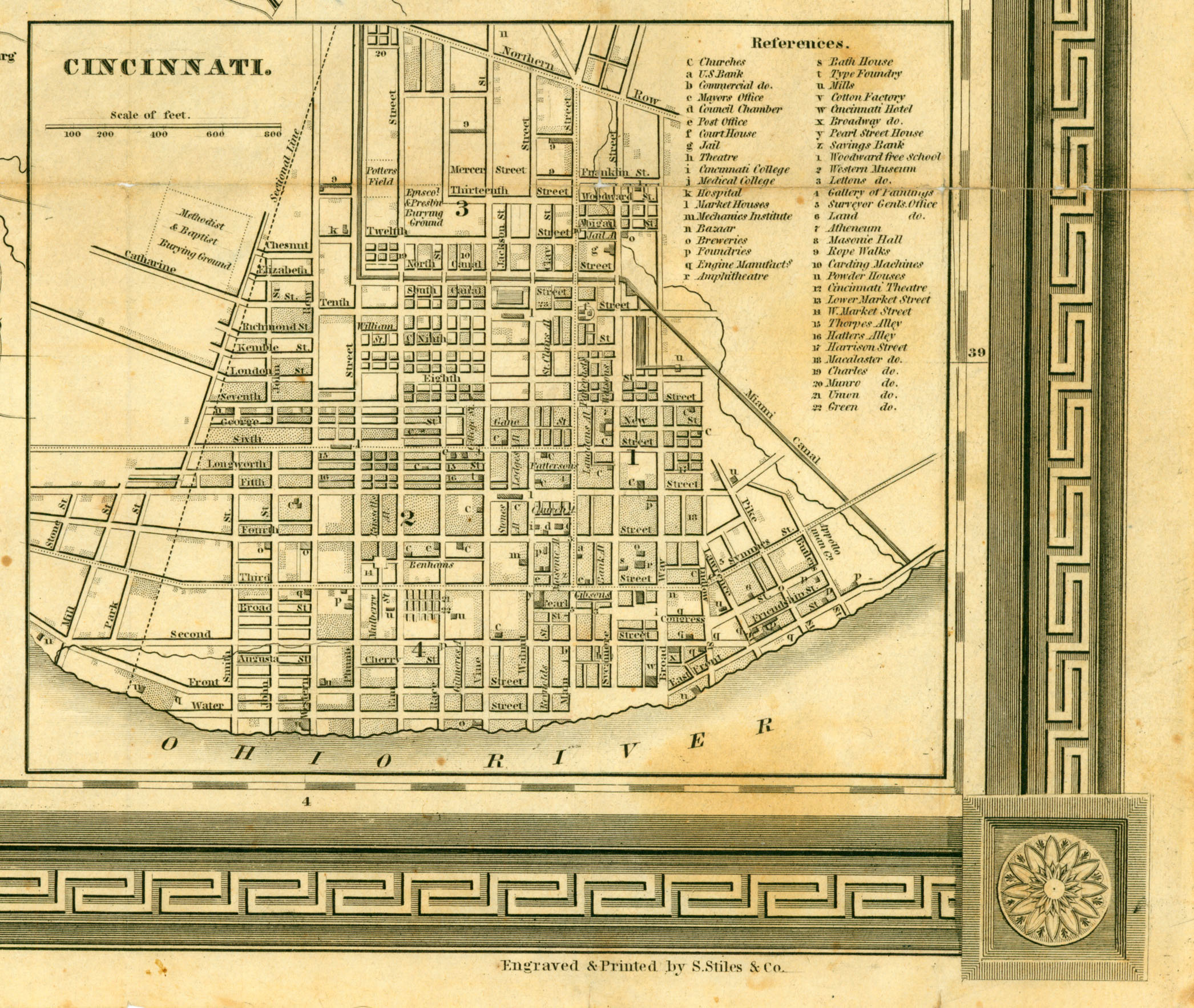
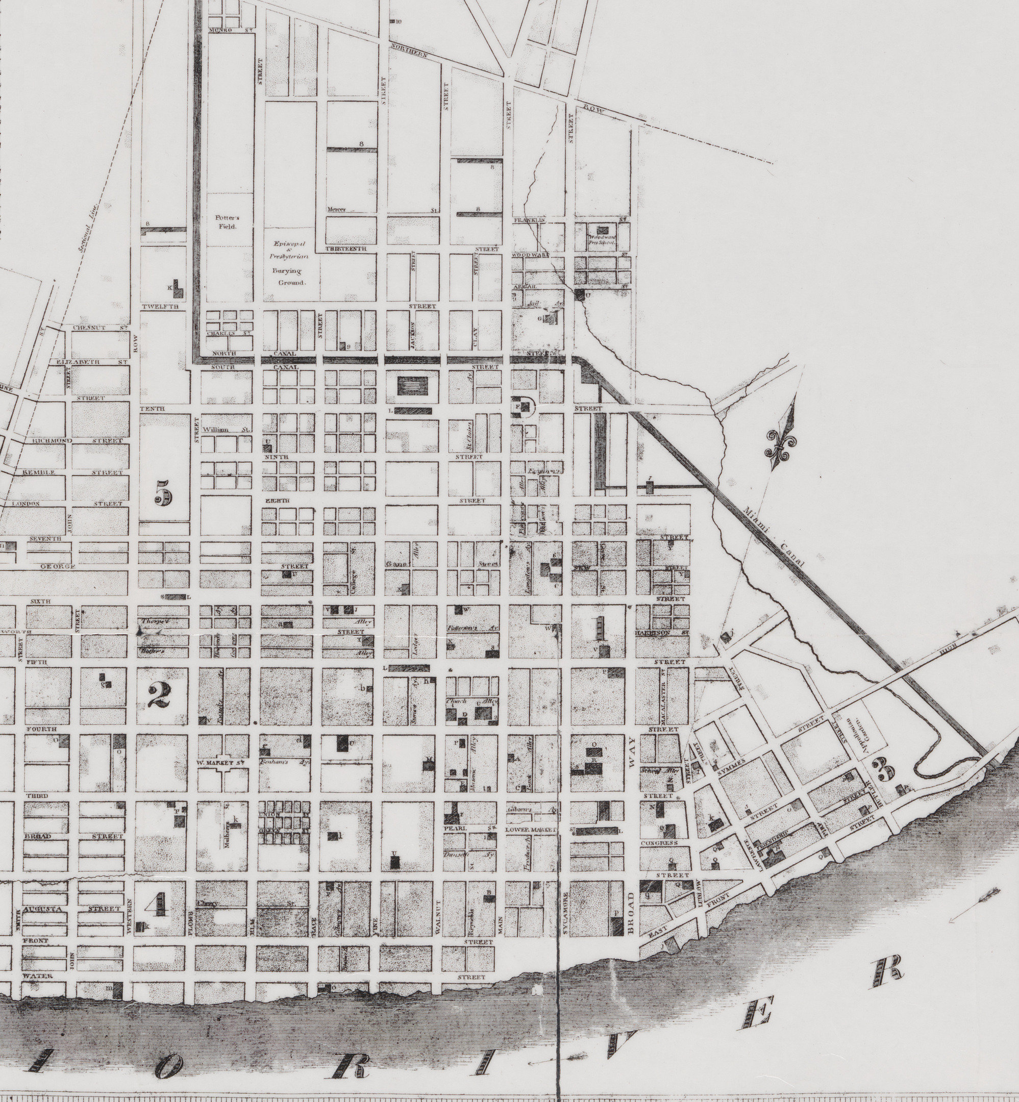
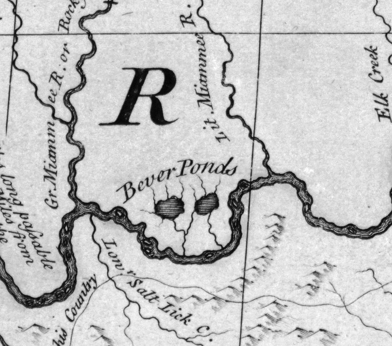
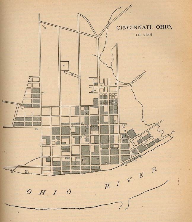
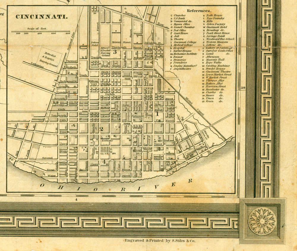
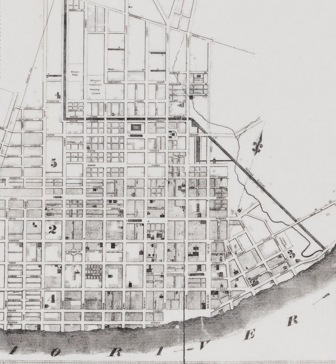
It's entirely possible this was a pond or swamp originally. Old maps show a west fork of Deer Creek winding its way along Sycamore up to Liberty, connecting through the ridge that now exists at Reading, but that's a lot of earthworks for no particularly good reason. I wouldn't be surprised if the old "bever" pond/creek was dug out to drain it very early on when farmers settled there.
-
Woof. Until I saw the pool I thought it was a self-storage facility, or a medical research lab.
-
jjakucyk replied to The_Cincinnati_Kid's post in a topic in Restaurants, Local Events, & EntertainmentHeard about it last week when I was there for lunch. Someone placing an order asked "so when is the last day" and the whole place went silent and everyone looked up inquisitively. Super sad because they're such sweet people and the food is excellent.
-
In OTR it's hard enough to navigate east-west as it is even without that sort of restriction. However, in general Cincinnati seems to be way over-signaled compared to other cities. Four-way stop signs are incredibly rare here because...traffic flow I guess? Instead, they're either one/two way stops, or traffic signals. And yet, there's no real reason for any signals in OTR aside from at Central Parkway and Liberty Streets. Maybe also the mess of Vine/McMicken/Findlay. Go to Chicago and there's four-way stops everywhere, even as close to the Loop as Streeterville and River North. Also, an interesting point made by Jeff Speck that I never really thought about but which makes perfect sense, is that if you have four-way stop controlled intersections, you don't need turning lanes anymore. In fact it's better if you don't, because then everyone just has to take their turn and there's less confusion. So there's never the problem of one person blocking the intersection for a whole "phase" of the signal waiting to make a turn, and you don't have to restrict movements either. Like check this out, this is basically the same cross section as Vine Street, with massive density, but just simple stop signs: https://goo.gl/maps/BBg5ddcriGUu6E8D6
-
They threw in a handful of those bumpouts all the way up to Elder when the street was converted back to two-way in 1999. I don't think they were particularly well done and probably caused drainage problems, as well as left turning vehicles blocking everyone behind them. I guess I never really thought about how they've since disappeared, but they were all removed when the street was rebuilt in 2004. I wonder if the city sold it as "you lose the bumpouts, but you get granite curbs and a strip of brick sidewalk."
-
Right, transit planners and anyone who's used it in other countries (Bogota Colombia is the standard) refer to BRT as essentially light rail but with buses. Nearly exclusively separated busways and/or tunnel operation, off-vehicle fare collection or proof-of-payment, platform-level boarding, multi-door boarding, high-capacity vehicles, full signal priority/preemption, stop passing/queue jumping ability. What US transit agencies propose instead, or what the projects get watered down to, is merely conventional express/limited bus service. You could call it a bait-and-switch or simply a misunderstanding/misrepresentation, but I certainly wouldn't call anything SORTA is proposing BRT.
None of those other lots are really comparable since demand for downtown parking is so hyper local. The OTR-adjacent parts have higher demand due to the courthouse and Kroger, and anything in the downtown "core" is going to be even more squeezed. Fountain Square is the 100% location so that's also going to command a premium. On the other hand, the lots around City Hall are comparatively cheaper since they're just about the only thing there. Same with peripheral areas of downtown, such as along Eggleston and near 3rd and Central. Generally, only The Banks garage south of 3rd Street costs over $100. It's interesting to see which garages have a lot of availability whereas most are booked solid with monthlies. Both Macy's garages have hundreds of available slots despite being relatively inexpensive for the location (*plays ominous music*). Court & Walnut still has 100 available, though it's a bit pricey compared to nearby alternatives, and inconvenient due to the height. 6th & Elm has 150 spots, and overall the riverfront lots like Longworth Hall, Sawyer Point, and 3rd & Central have 100+ open. West 3rd and West 4th also have garages with 300+ spots. https://www.downtowncincinnati.com/parking-downtown/monthly-parking
It goes behind Kroger then up Miami Run to Wooster, and along Wooster either to Pocahontas or something with the new High School entrance. That's the end of the project at this point if I recall, but once you get to Pocahontas then you have easy streets to ride on.
I just see it as another option for downtown office worker parking. No way it should (or even could) be free, since one of the continual issues with opening the RTC is the cost of the lights, ventilation, elevators, and other access controls.
Plus in most of these outer neighborhoods and suburbs, for every person who wants to see more restaurants and other businesses, better walkability, and diverse housing options, there's 10 worry warts who will throw a sh*t fit over replacing the 1-story dry cleaner their grandmother's cousin's best friend's dad went to that one time, not to mention hurr durr commercial creep traffic parking neighborhood character.
I have to do both Wooster and Erie, but the problem with Wooster is the fast moving traffic and for whatever reason going up the hill by McDonalds motorists really ride your ass, probably because they know the left lane is ending up ahead. Erie is no big deal in comparison, except at the Redbank overpass which is kind of sketchy.
They have a plan in place to get from Newtown Road to Mariemont High School (taking over and expanding an existing sidewalk from McDonalds up to Pocahontas or thereabouts. That will be quite a benefit. I routinely do a 37 mile loop from Hyde Park up to Loveland and then back via the bike path, and the climb up Wooster Pike from 50W to Mariemont is the worst part of it.