thebillshark
Key Tower 947'
-
Joined
-
Last visited
Everything posted by thebillshark
-
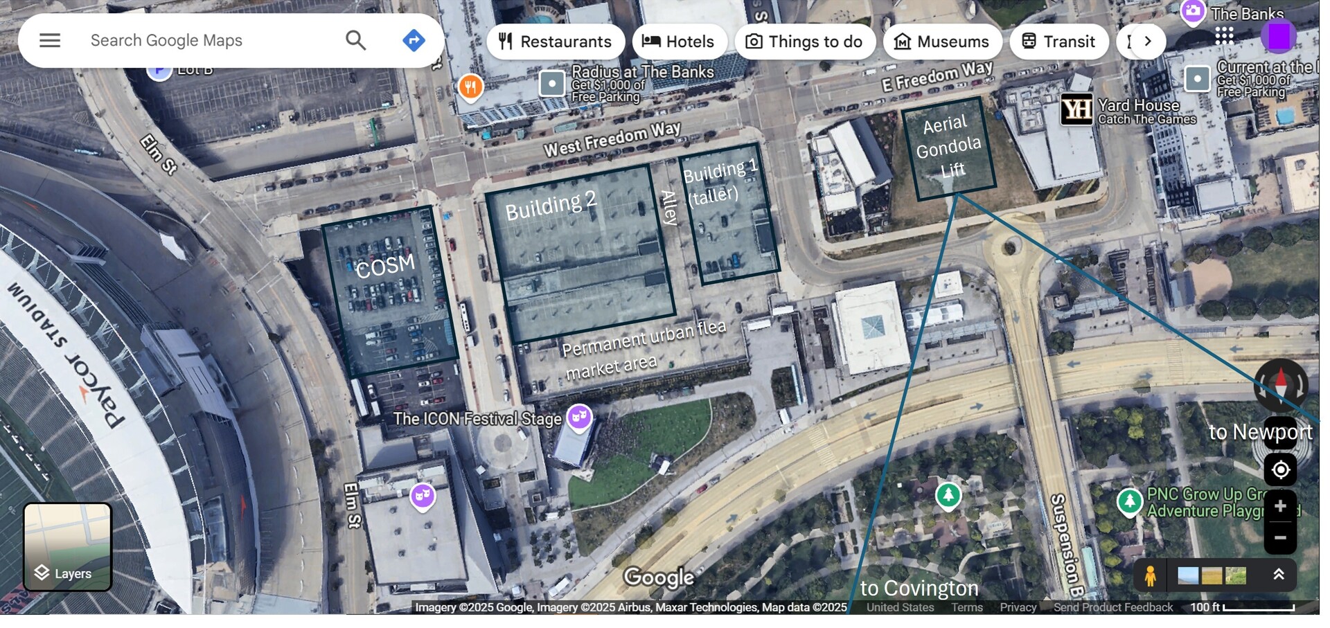
Here's how I would finish out Lot 24 and the surrounding area at the Banks: COSM- see here https://www.cosm.com/ (perhaps this or something like it was the "immersive entertainment and media experience'' suggested by the most recent proposal for Lot 24?) Lot 24 Building 1- a taller skinnier residential building Lot 24 Building 2- residential building with larger footprint, ground floor commercial spaces. Could CRC or even Great Parks run an indoor playground in a ground floor space here? That could become a destination for families during bad weather. With the entrance facing south or east it would be complementary to Carol Ann's carousel. Could help partially replace the 1,000 Hands playground at Sawyer Point that was recently destroyed. Permanent urban flea market area- A foot traffic driver that could operate every weekend, special events, Christmas season. Could have synergies with the music venues (indoor and outdoor), even help support music festivals. Would provide a setback and buffer for the building frontages facing the outdoor music venue. Aerial Gondola lift- would really elevate the Banks experience! see here https://cincinnatiideas.com/gondola-at-the-banks/
-
Should be the location of the terminal for an air gondola over the Ohio River
-
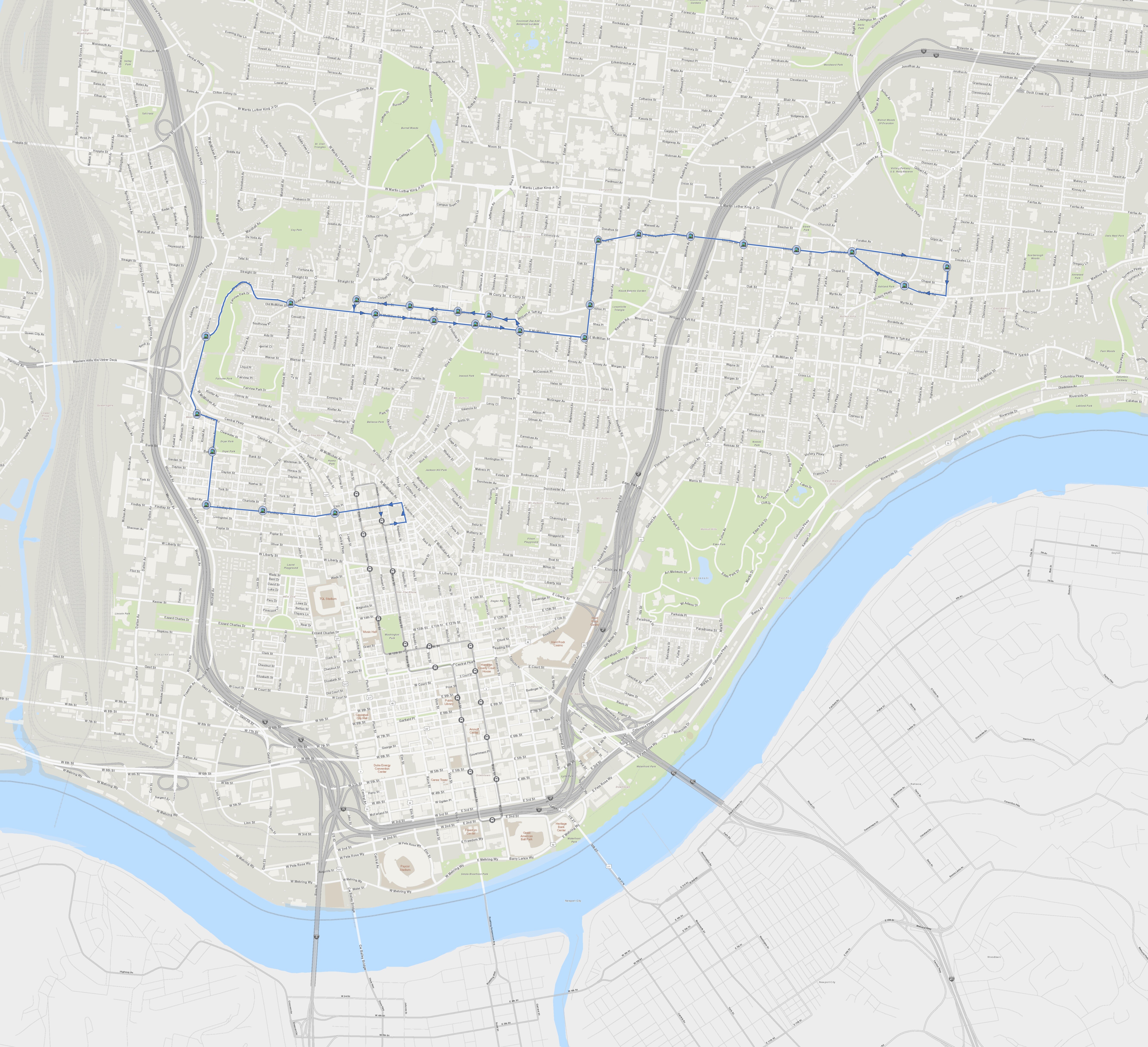
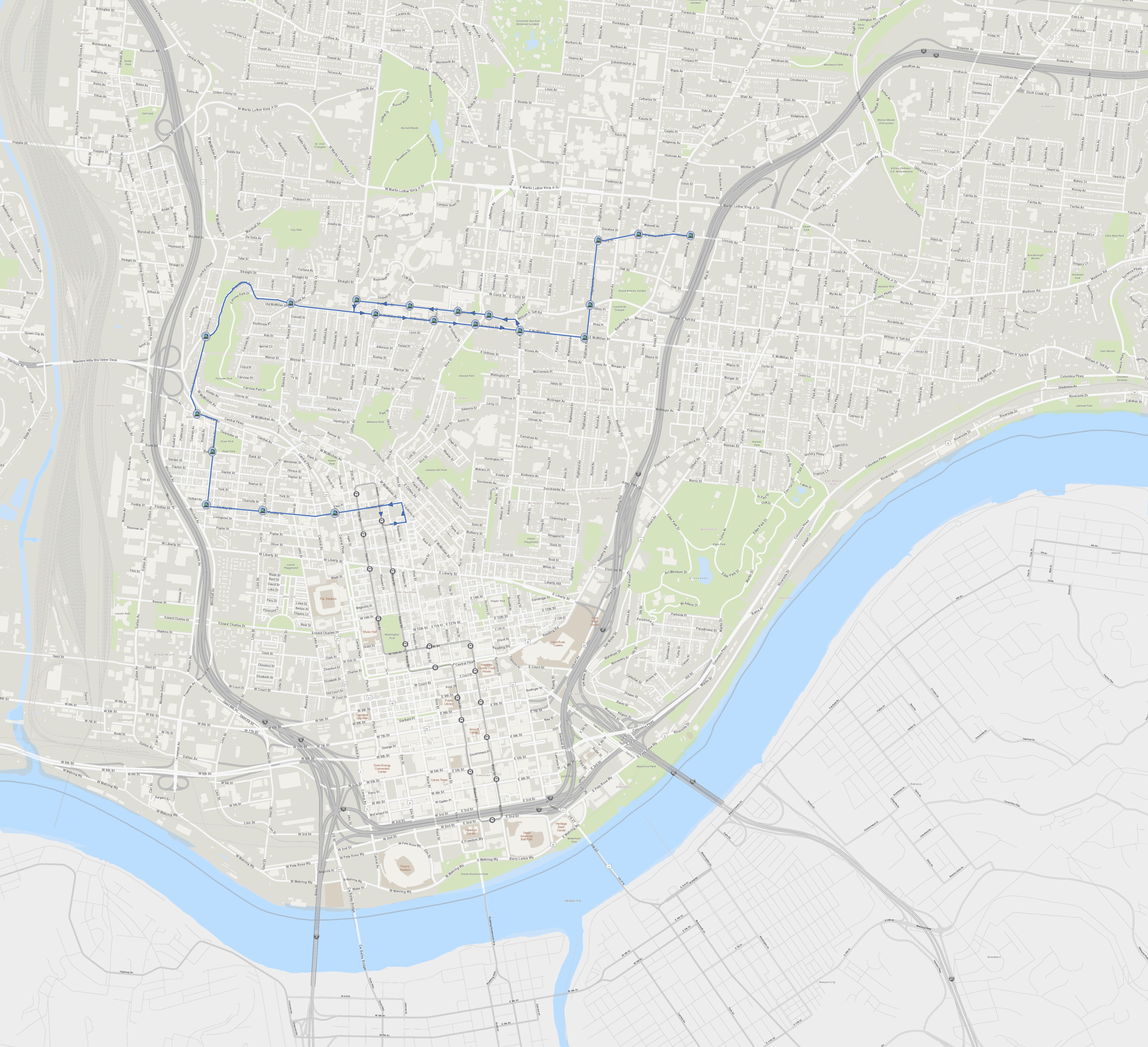
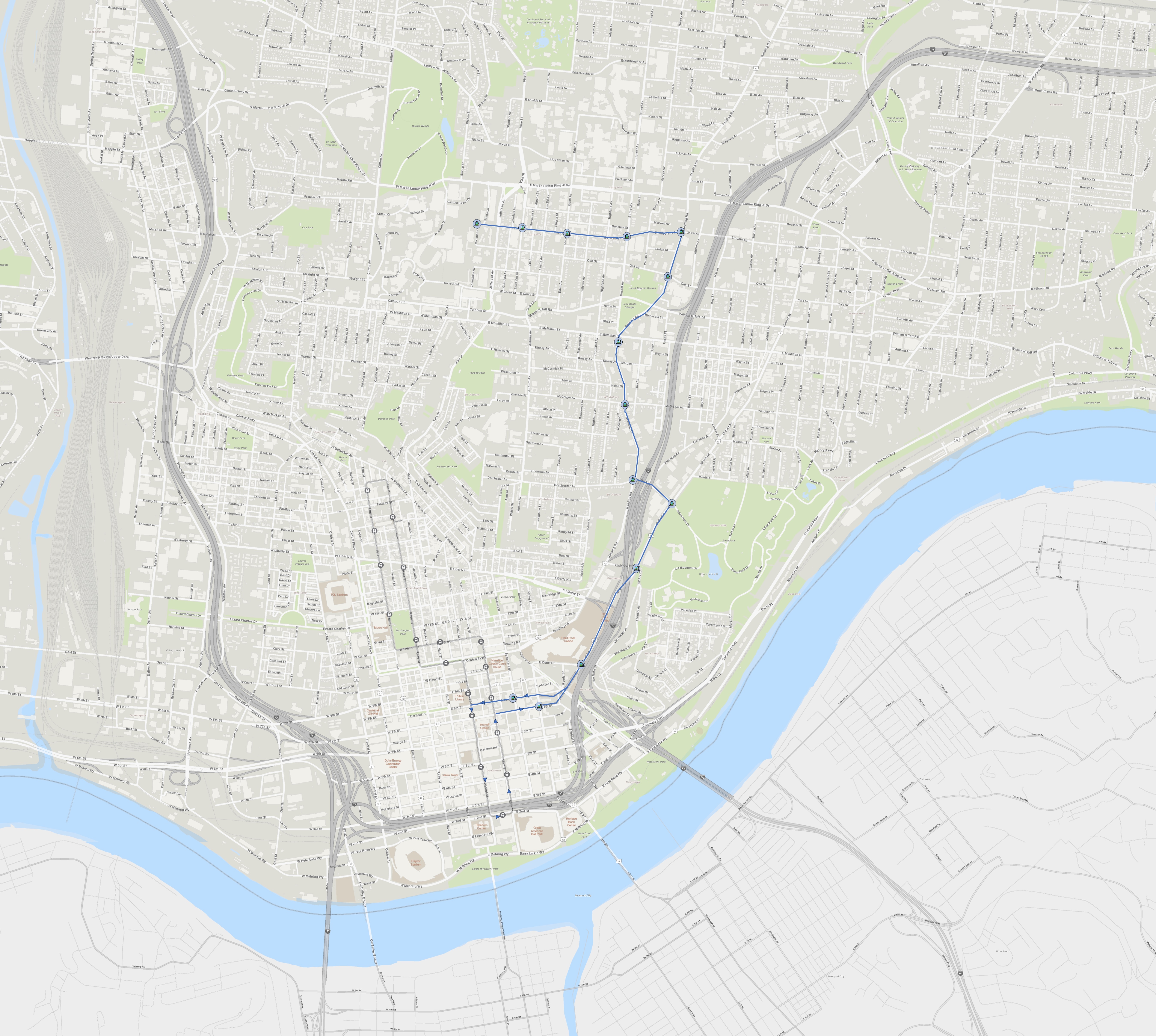
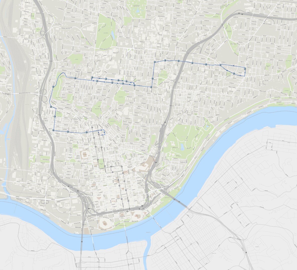
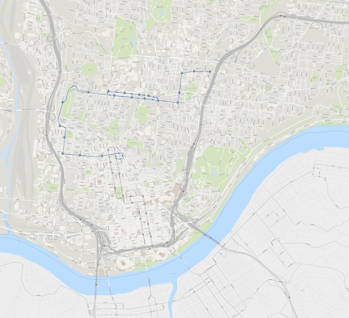
Here is a concept for a pair of streetcar loops Uptown. Both loops would have streetcars going in both directions, clockwise and counterclockwise, so most streets would have a pair of tracks on them. I made 7 maps on the post but here are 3:
-
this is one of my oldest blog entries that has no real-world update: https://cincinnatiideas.com/the-banks-phase-3/ I think a superblock might be too boring here. Not sure if they could fill all the restaurant/retail spaces, there is a lot of supply of places like this now. They need something interesting such as small scale interior streets/alleys with something interesting that draws people in perhaps like a market that somehow wouldn’t take away from Findlay Market (Flea market? Mini-Outlet mall?) and along the southern edge too. this would help the Banks stand out: https://cincinnatiideas.com/gondola-at-the-banks/ and they should do hotel or residential for 180 Walnut
-
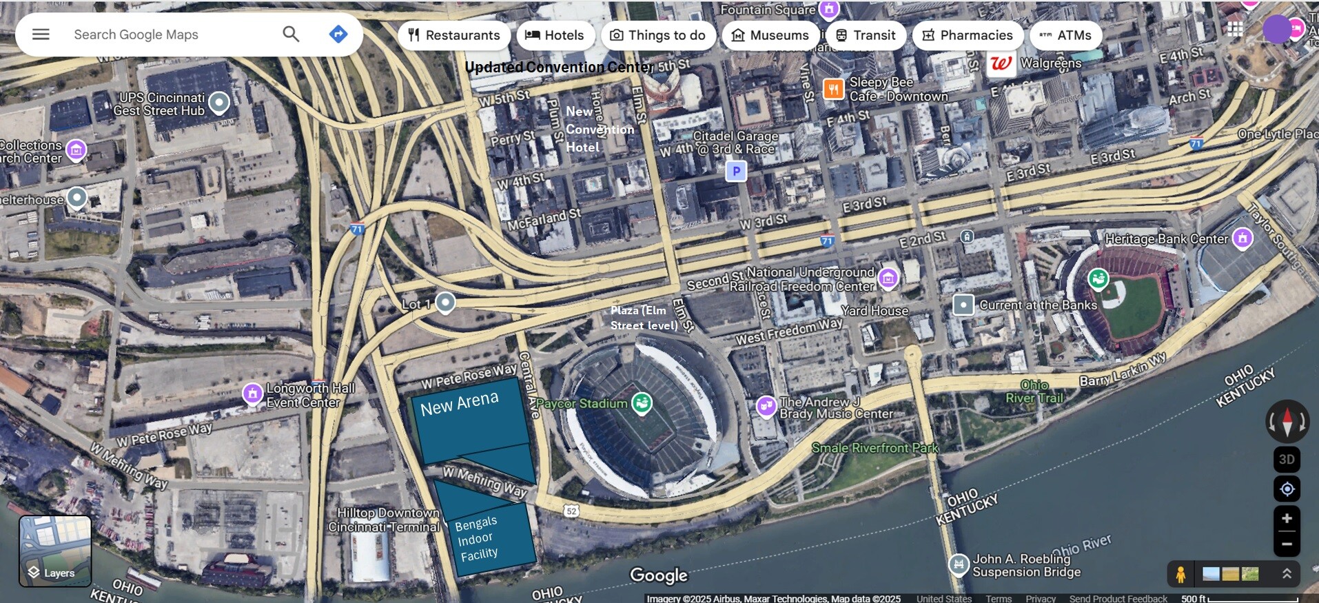
Here that is on a map. Bengals and FC Cincinnati ownership go in together on owning an NBA franchise for the arena. The arena is also used for convention center events. The Bengals build a permanent indoor facility south of Mehring Way big enough for two fields, with perhaps an additional outdoor field somewhere nearby. The approaches to the new arena would need to be spruced up, and there would have to be some thought put into how people get there from the Banks street level elevation on the north side. A little far-fetched?
-
NFL is head and shoulders above rest of major league sports in terms of popularity and getting the city national recognition/impressions. If the Cincinnati area wants teams for these reasons NFL and the Bengals is by far the most effective to have. Additionally I think building a new football stadium elsewhere in the region would just be wasteful. The stadium looks great architecturally and positioned in its current location Edit: however I was not impressed at all with the plan for the stadium renovation/practice fields pitched to the county recently, seemed huge cost for minimal benefits
-
a good rule of thumb for space required by an arena without “limited concourses” is a 400 x 400 ft square. It won’t fit on the remaining Banks street grid. it would fit on the Bengals practice fields. That would be about 0.25 mile from the convention center and about 0.5 mile from the Banks Freedom Way strip of bars/restaurants by GABP.
-
Arena or not, maybe WCET could be a good fit for the main library north building. If I recall correctly from discussions before the main library renovations, there was extra space available on the upper floors (not sure current status)
-
That’s a nicely medium scaled historic building, kind of a quintessential industrial building to that area, I hope it is preserved.
-
I’m going to go counter to the consensus and guess that Cincinnati gets an NBA team. i guess that sports gambling has changed the equation and more teams=more games to play = more revenue for the league from gambling and media rights. I guess the NBA could expand by six teams and Cincinnati could be third in line behind Seattle and Las Vegas.
-
Makes me wonder if they are moving the semi trailer lots to this new property so an arena could be built immediately west of the brewery on the land bound by Liberty, Poplar, John St. and Central Avenue. An arena on Liberty directly west of the brewery would be walking distance to the garages already built for FC Cincinnati stadium. wonder if Sam Adams company or Jim Koch would partner with FC Cincinnati group on an arena project
-
Let me clarify- I thought the idea was for the 43 bus that goes up and down Reading Rd. to jog over to make a stop at the planned "Uptown Multimodal Center" on Harvey, just like the 17 leaves Hamilton Ave briefly to stop at the Northside Transit Center. In that case using Ridgeway (possibly together with MLK) for buses would make the most sense, and in that case Ridgeway would need to be widened for buses. However, I read that they already transferred land for the NIOSH campus, so I don't know if widening Ridgeway is still possible. If the "Uptown Multimodal Center" is just supposed to be for BRT, and possibly the local buses along Burnet (if there is an additional entrance from Burnet Ave)., I guess it's fine how it is. Still, a spur of Wasson Way along the north side of the NIOSH campus to the Uptown Multimodal Center would enhance connectivity.
-
Regarding the Uptown Multimodal Center: The planned NIOSH campus is going to subsume Hickman Ave. If the intention is to have buses jog over from Reading Rd. to stop at the Uptown Multimodal Center on Harvey Ave., then Ridgeway Ave. would probably need to be widened to accommodate this. But I haven't seen any provisions made for that in the plans for this area. It may also be helpful to redo Ridgeway and Reading intersection so that it meets at single point, or alternatively, put a traffic circle there. A spur from Wasson Way could also cross Reading in this area to connect to the Uptown Multimodal Center.
-
For $1.3 Billion it should include my concept for an aerial gondola lift at the Banks...
-
thebillshark replied to The_Cincinnati_Kid's post in a topic in Southwest Ohio Projects & ConstructionHmm… I wonder if an underground parking garage is in the cards for Grant Park? Would be strategic for Vine St development.
-
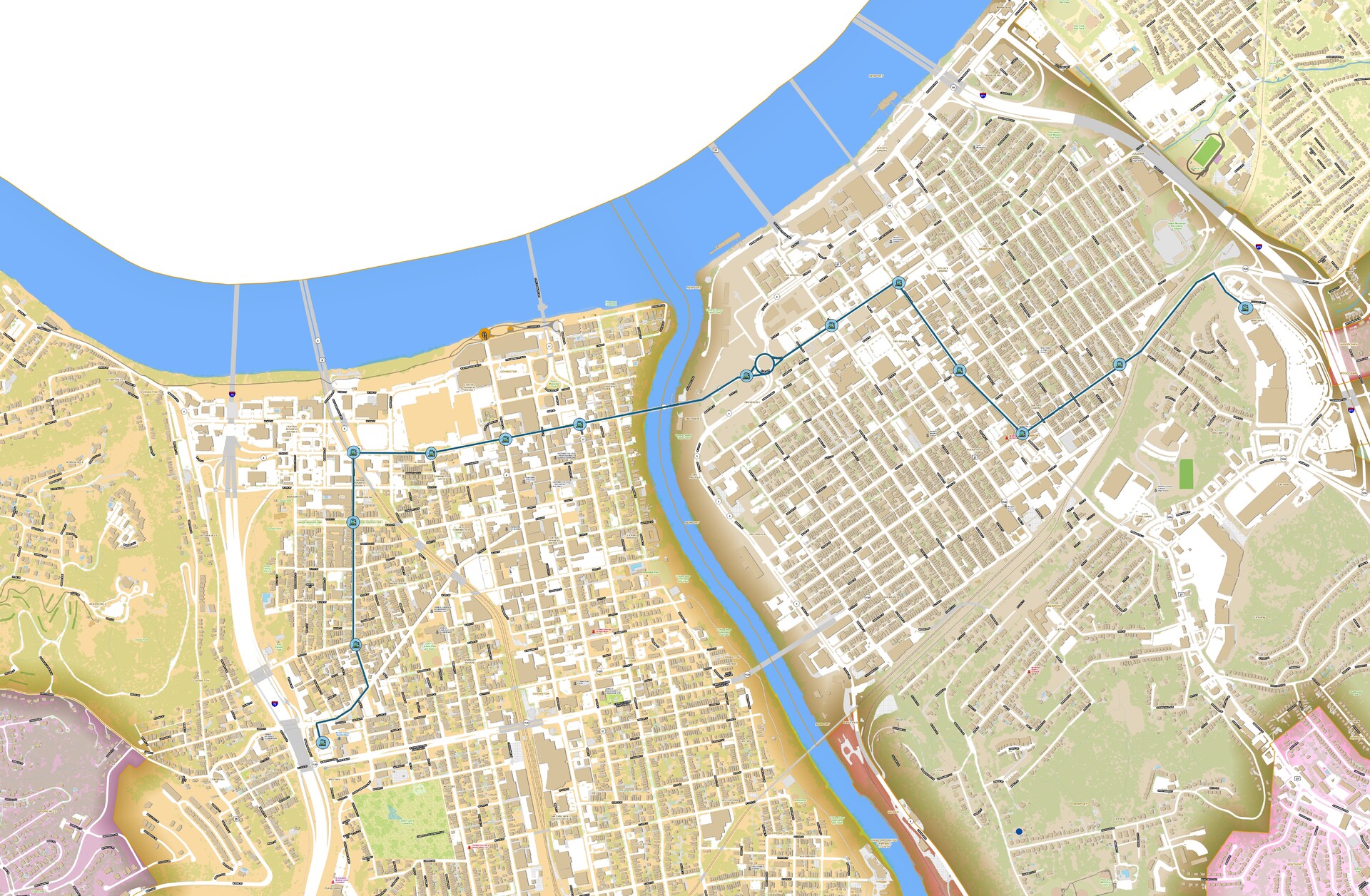
The route could go that way, both involve trade-offs. If it took 3rd street, that would bring it a lot closer to the major destinations of Ovation, Newport on the Levee, and the Purple People Bridge, but would it have to go through a second traffic circle at Taylor Southgate bridge and perhaps encounter more traffic and be slightly less direct. If navigating the traffic circle is not an issue it may be worth going that way for the extra visibility. If it took Saratoga, as Saratoga heads south it looks kind of narrow on each side with potential conflict with parked and parking cars, unless width was taken from the median with trees and added to the road lanes, potentially eliminating the trees altogether. If the route went down Saratoga, it wouldn’t require the additional project of reconfiguring Monmouth to two way travel, but would also be a block away from the main strip.
-
Had this idea for a streetcar route entirely within KY. Would require two directional travel on 4th in Covington and on Monmouth in Newport. Would require its own maintenance facility but if cars were same model as Cincinnati then perhaps they could share personnel and maintenance somehow. (click to enlarge)
-
thebillshark replied to buildingcincinnati's post in a topic in Southwest Ohio Projects & ConstructionIMO The most important thing that could happen to improve the “Fountain District” is completing the Terrace Plaza project.
-
Following up on my post from a few weeks ago. This line could be built in stages: Stage 1 from Findlay Market to Auburn Ave, Stage 2 Auburn Ave to Winslow Ave, Stage 3 Winslow Ave to Woodburn Ave. Or, if a small section of track for a return loop at W Clifton Ave between Calhoun and McMillan was added: Stage 1 from Findlay Market to W Clifton Ave, Stage 2 W Clifton Ave to Winslow Ave, Stage 3 Winslow Ave to Woodburn Ave. (click to enlarge): This line could work in conjunction with 2 more lines: Or even something like this:
-
Of the Queensgate blocks I could maybe see potential future re-development on the following blocks in order starting with 1. There would need to be pedestrian oriented streets in the block interiors dividing up these superblocks. I could also see a relocated District One police station ending up in this area. I wonder if a highway cap is possible in this area. Will the Brent Spence Bridge project be complete and development be happening in Queensgate before Lot 24 at the Banks is developed?
-
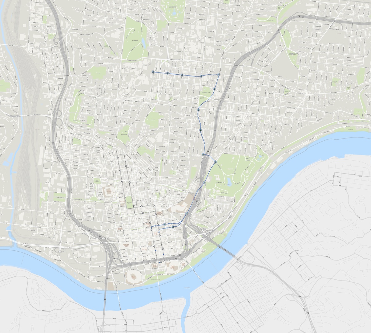
West End to Uptown route. -click to enlarge -Would combine elements of 3 of the top 4 routes of the recent CTSD survey. -operate as separate route from the downtown route. - uses rebuilt Brighton Approach bridge over Central Parkway (bridge would have to be built to support streetcar weight, also this would be a steep grade if possible at all) -uses McMillan to get up the hill -anything after Auburn Ave. could be separated into a Phase 2 if necessary -connects Findlay Market (existing economic hub), West End (catalyze historic rehabs and small scale developments,) south UC campus (existing economic hub), and Innovation District (catalyze large scale developments and form a better connection to UC campus)
-
The vacated block now owned by UC Health on Burnet is absolutely huge. 700 ft. North-south by 365 ft. East-west. Will need to connect (or re-connect?) Stetson St. and Rochelle St. to Burnet Ave. to have a semblance of urbanism/walkability in the area. I don’t know what relationship UC has with UC Health, but it would be feasible location for student housing for UC.
-
Wouldn’t Wasson Way go right by this building?
-
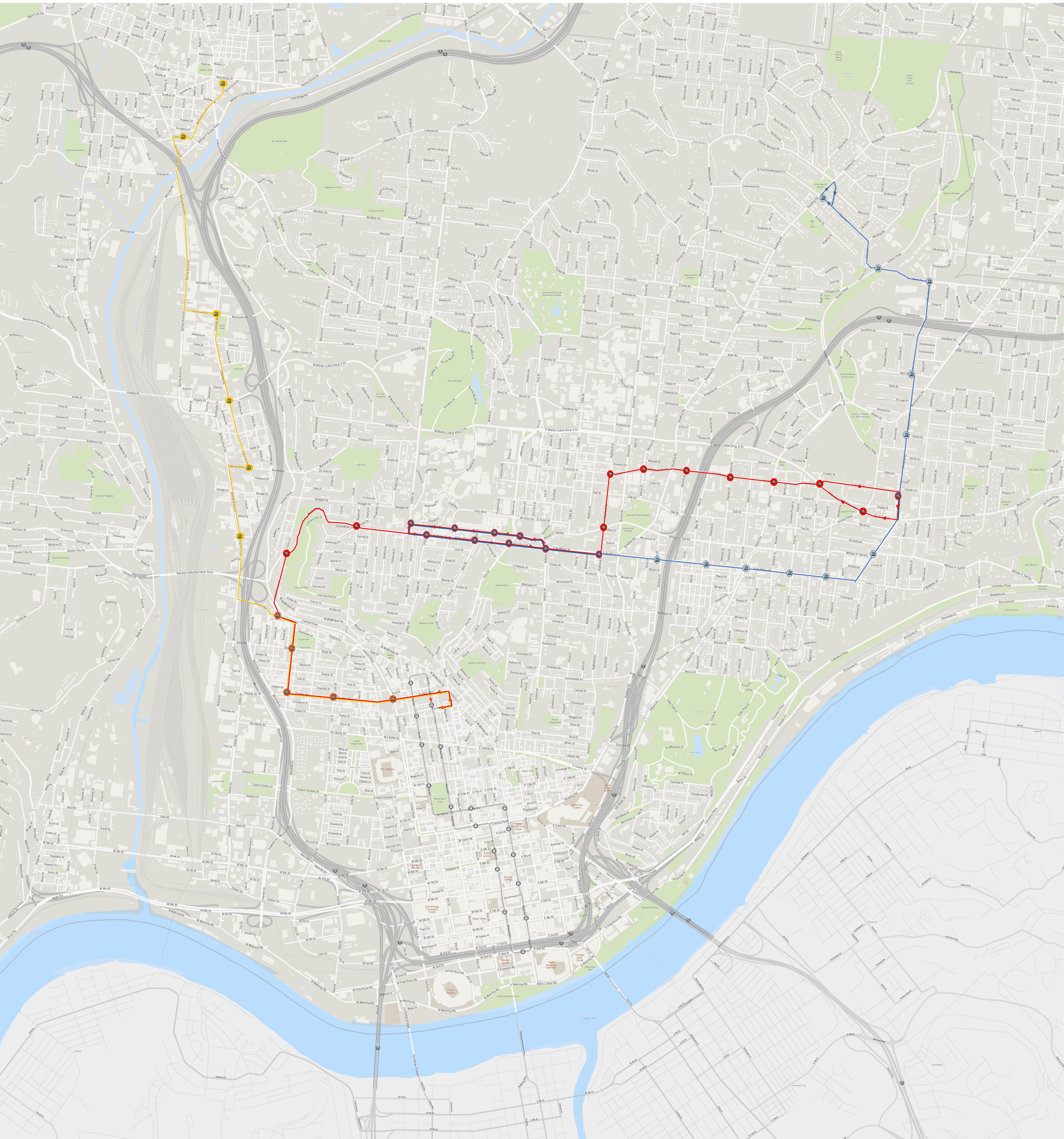
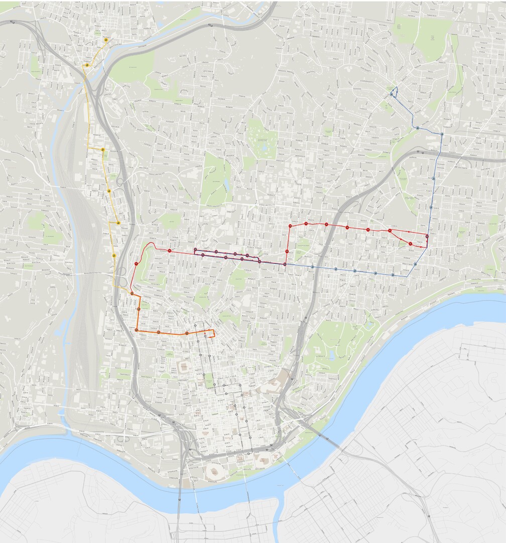
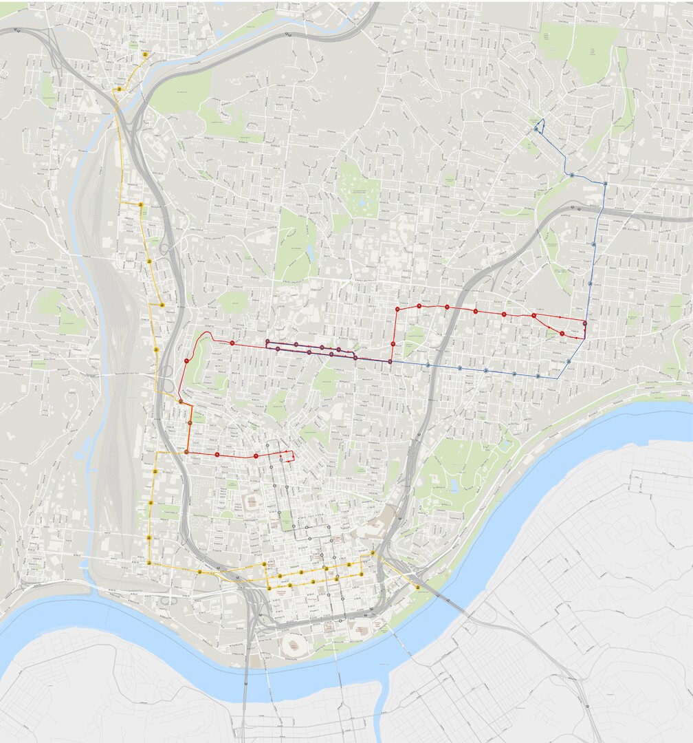
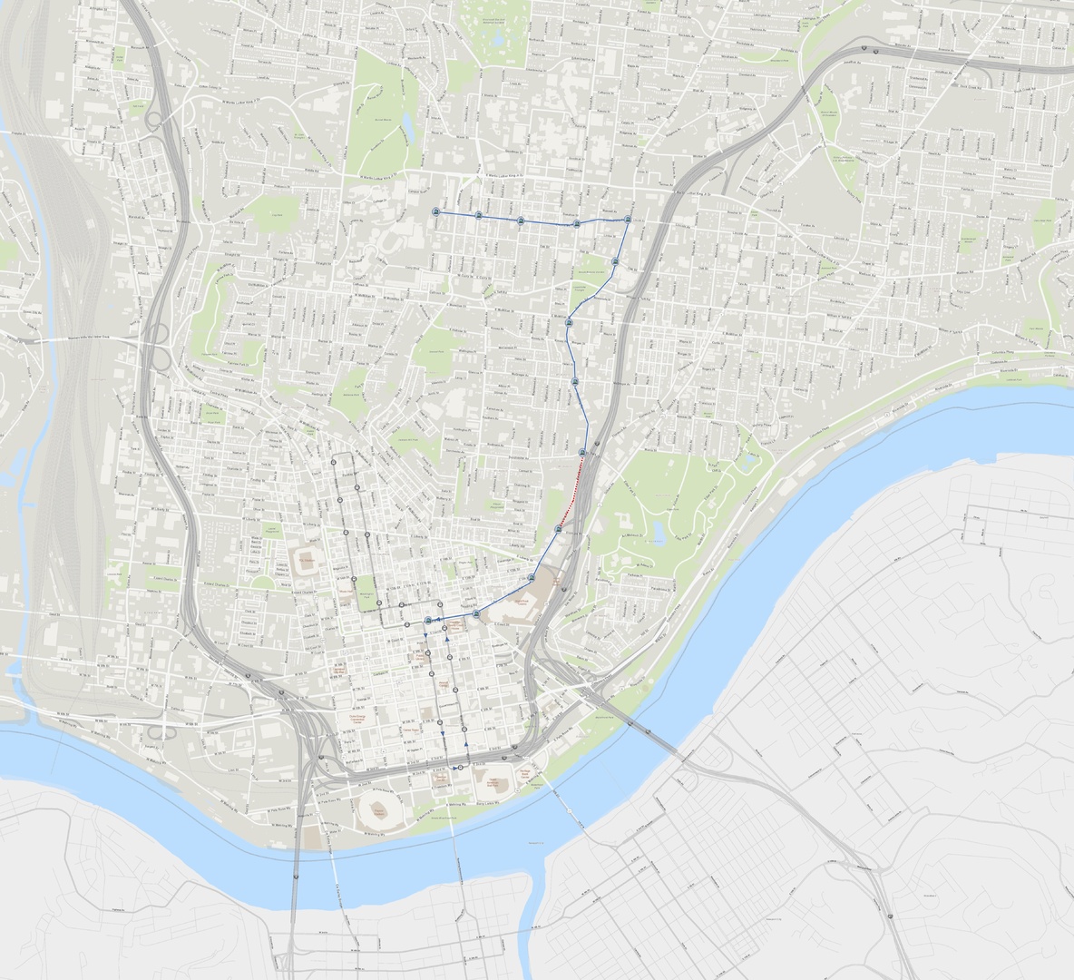
Here are my thoughts on this route: 1. The track separation in Corryville between University and Oak (~515 ft.) is far apart. Also the Daniels/Oak/Eden intersection looks difficult to maneuver. I would instead travel both directions on University if it is wide enough. This may require eliminating parking on one side of University. 2. This comes so close to the Innovation District, why not stay on Reading and up to the Innovation District (Reading & University intersection,) then head west and cross Jefferson directly on to UC's campus and have a terminus there? That would create a direct connection between UC campus and the Innovation District, becoming the preferred travel mode between the two, instead of coming sort of close to both and being out of sight out of mind. Then the route might gain support from both UC and Innovation District developers. That map would look like this: 3. The connection between McMillan (a street with lots of development potential) and a streetcar on Reading is less than ideal. At a minimum the stairs would have to be cleaned up and visibility improved. 4. I cannot imagine how streetcars would traverse the dotted red section on the map above (Reading between Elsinore and Eden Park Drive) heading north with the highway entrances there. Even if you had a dedicated separated counterflow lane, a car could drive the wrong way through it, which could be very bad. One way to get around that would be to use Gilbert through this area instead, which would look like the following map. In this map you cut into the downtown line a little further south using the Gilbert Viaduct. You would lose front door stops at Downtown Kroger, Casino and Pendleton but you would gain a pair stops downtown (Kroger still close,) a stop at Court & Gilbert (potential Casino Hotel, soon to come big bike ramp to Mt. Adams,) and potentially you could add a stop if a new arena or other development was built to the north of the Casino parking garage. 5. If the streetcar turns right from Main Street downtown (for either Reading or Gilbert,) it is likely going to need new track in the right hand lane on Main heading north from the switchover point between 5th and 6th. 6. Of course if you are using Gilbert and going to the Innovation District, using Gilbert all the way up to Lincoln would open up more area for development and get the support of Walnut Hills neighborhood groups:
-
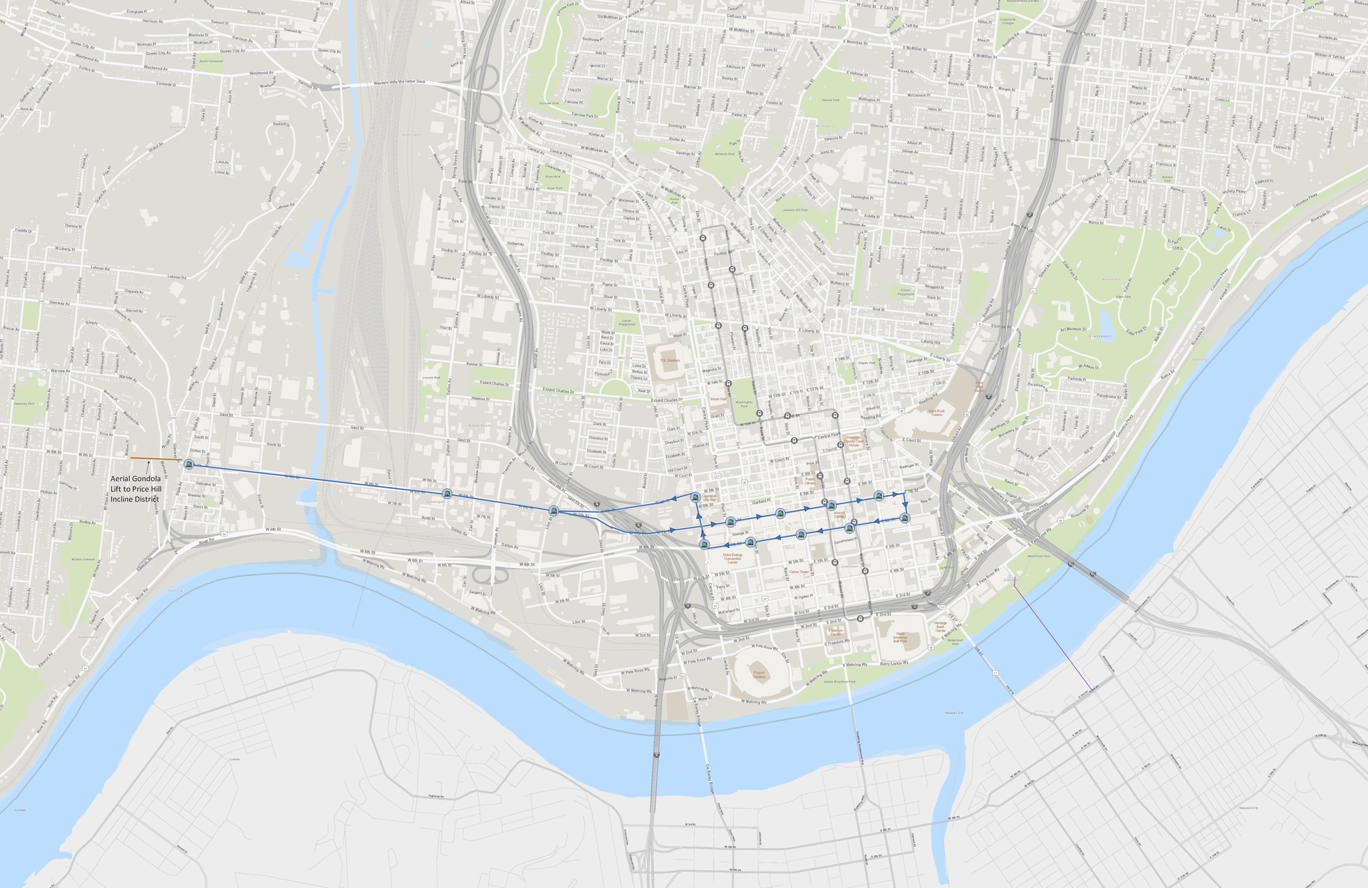
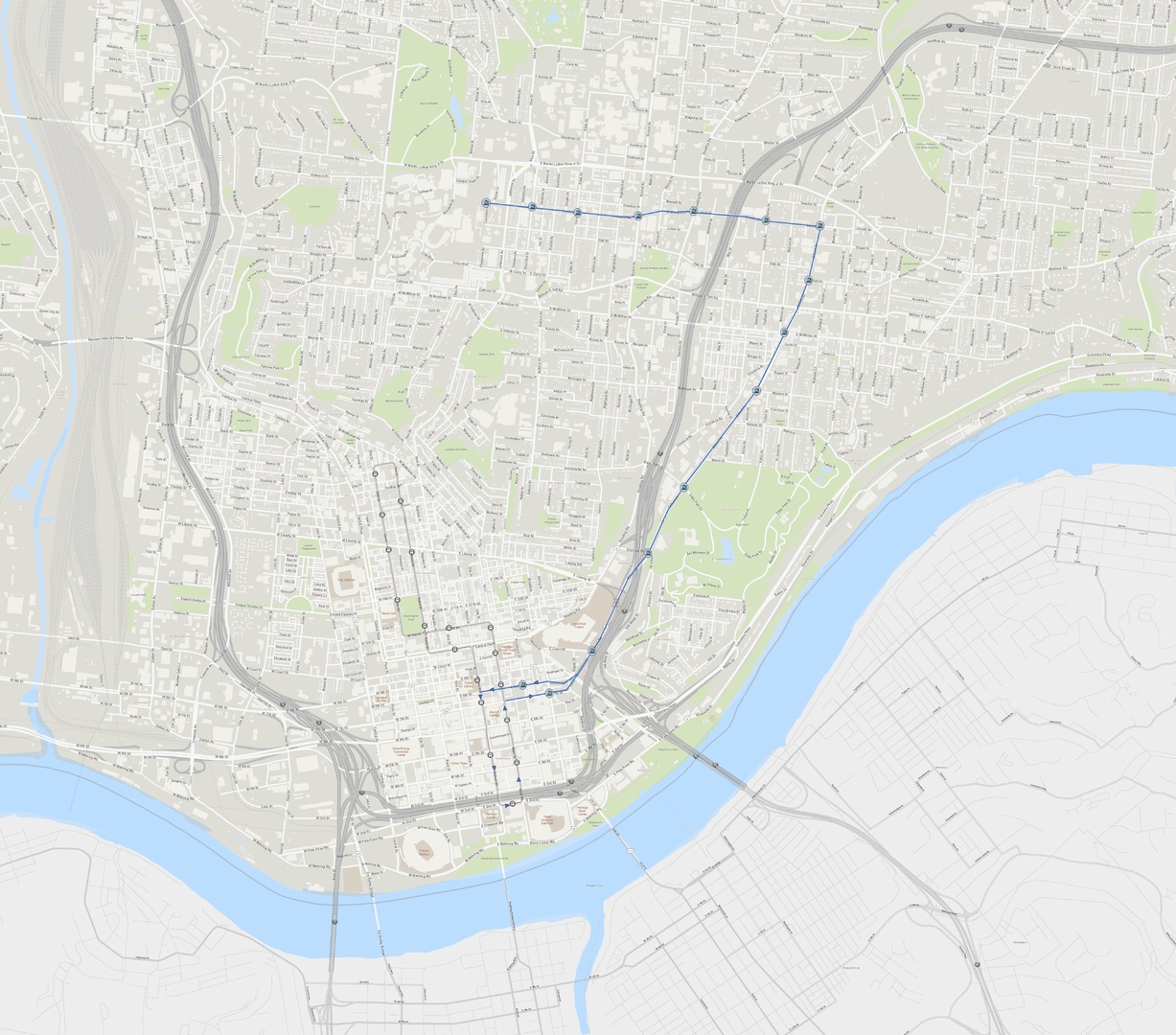
Here is related concept for a streetcar route to Queensgate and Lower Price Hill that could be built off of a pair of tracks using Sixth and Seventh streets downtown. With an aerial gondola lift up to Price Hill Incline District. https://cincinnatiideas.com/streetcar-to-queensgate/