NorthShore64
Premium Member
-
Joined
-
Last visited
Everything posted by NorthShore64
-
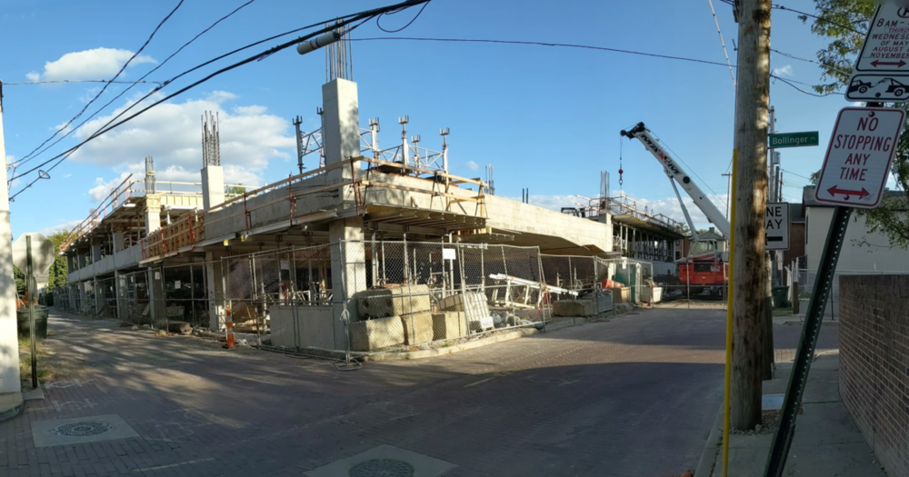
NorthShore64 replied to buildingcincinnati's post in a topic in Central & Southeast Ohio Projects & ConstructionGarage at Pearl and Lincoln progress. View from directly behind the new Graduate hotel.
-
@Pugu I agree to disagree with you over the merits of this project. We (and I'm assuming others) evidently have different measurements for what getting screwed over is or what can be good for Tremont and Cleveland.
-
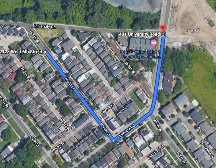
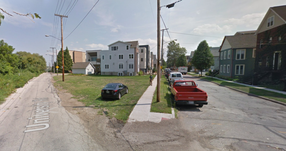
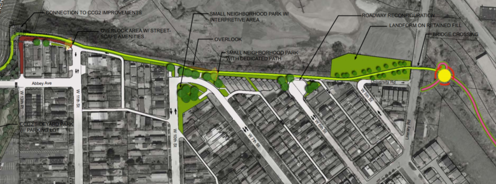
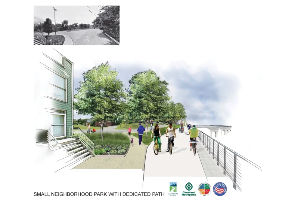
Yes retention of street grids could be separate from complete streets design. This project just happens to reduce a very small segment of the street grid, creating what I believe to be a safer environment for pedestrians and cyclists. If adding both a multi-use path and retaining University as a road could be done so cost effectively, then I would be completely fine with such an arrangement. In this case it doesn't seem to be cheap or easy though do to the site specific conditions of being along a steep hillside. The construction of such a system would not be worth the marginal benefit of keeping a few connections in the street grid. Reducing VMT should always be a factor in urban design and policy decisions. The removal 350 yard of roadway (that is all this proposal affects) will not dramatically increase VMT though. Anyone south of Fairfield/Professor or Literary will have there routes marginally affected if at all. The people who live north of Fairfield/Professor of Literary will have their routes affected by a maximum of 0.3 miles. Personally I see the small inconvenience of a few residents in the neighborhood adding a maximum of 0.3 miles to their vehicle route as a worthwhile sacrifice for completing one of the last missing links in the towpath. Outside of this discussion over neighborhood grid connectivity, I can't wait for the towpath to be finished in Cleveland. Of the many improvements to the city over the past 10 or so years, theses trails in and around the valley are some of my favorite. It will make Cleveland, and Tremont even more special.
-
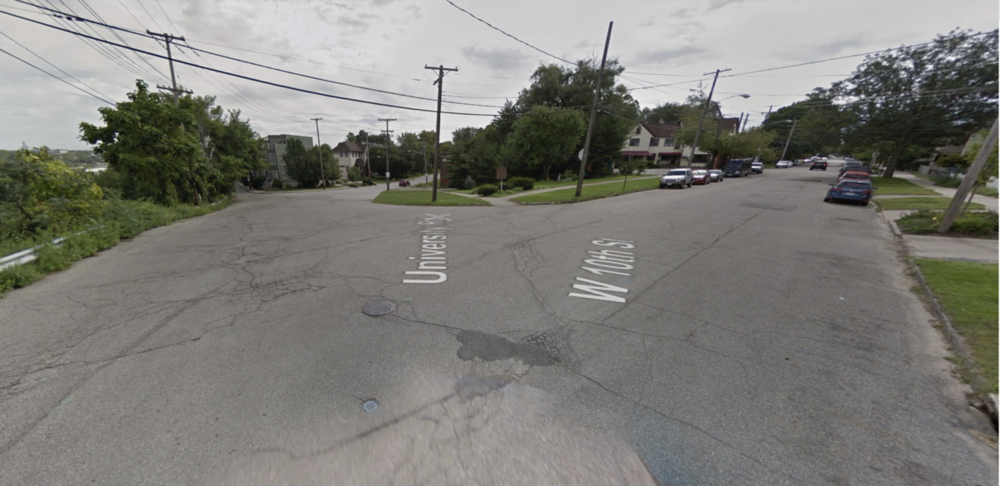
For the route via Fairfield, adding 0.3 miles is not "a LOT more driving." For the route via Literary , adding 0.1 miles is also not "a LOT more driving." Sometimes the safer option may add 0.3 miles of vehicle travel, as it gets rid of the currently dangerous intersection at W10th, W7th and University. People who want to enjoy one of the best vistas in the entire city will also no longer have to stand in the street to take picture or admire the view. The towpath phase 4 proposal is definitively safer for all road users.
-
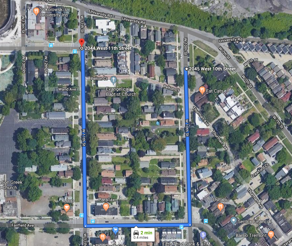
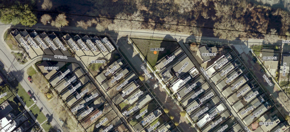
I was referring to those roadblocks placed on the CLE-Shaker border. This is an example of needless reduction in street network connectivity. These kind of barriers (motivated for more nefarious reasons) do not improve the neighborhood. This shows how there are varying degrees to road network interference which may or may not benefit the neighborhood. The Tremont towpath extension benefits the neighborhood in my opinion. There are no dead ends (in the previous cul-de-sac proposal, and in the current revised one). The only reductions in connectivity to the neighborhood for vehicles are: 1. Cars on 1 block of W6th cant turn right onto Univeristy. This is the alternative route. 2. Cars on W7th and W10th will need to go via Farfield to get to Abbey vs. going via University: Almost every house but those on the west side of W10th has vehicle storage in the back accessible via an alley way.
-
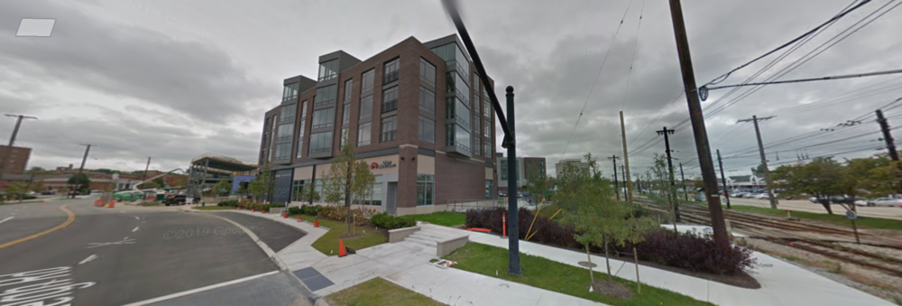
The residential building which frames the plaza to its South/west definitely could have been rotated with its back to Farnsleigh, aiming the plaza towards the station. Aside from this annoying configuration, I love this development. What it used to be: What it is now:
-
In regards to the current form of the proposal, @Mendo is correct, there isn't going to be a cul-de-sac on W 6th (as of the ~2017 revisions to the plan). That'll be a nice property once developed. There aren't many empty lots left in Tremont.
-
Retrofitting the roadways within an existing urban environment can come in degrees. There is a big differences between taking a few blocks away form a primarily one way road on the periphery of a neighborhood for the extension of a core piece of the regions bicycle/trail network and placing roadblocks in the middle of the street (ie. Shaker Heights/CLE border). An issue of street network connectivity needs to be evaluated on a case by case basis. Sometimes it makes no sense at all and serves to reduce the urban character of a neighborhood, while in other cases (like this case in Tremont) it can greatly improve the neighborhood. In my opinion though, there is a relationship that still holds true: an increase in car infrastructure = a decreases in livability The discussion over the merits or theoretical implications of roadway reductions can continue, but maybe not this thread. If it isn't about Tremont or this particular phase of the towpath, it should probably continue elsewhere.
-
If anyone is interested in a CVSR extension:
-
I understand the argument for preserving street networks and preventing dead ends, but University Road may be the least integral piece of roadway in the entire neighborhood (also there are no dead ends in this project). There are many compelling arguments to be had against infrastructure projects reducing neighborhood connectivity, but this is not one of them. This project increases connectivity, just not through preserving roadways. If there are any ways in which the residents are being screwed, its by the existing roadway network design. Any project that gets rid of one of the cities many unnecessarily large intersections while improving the safety and usability of public space for anything other than a car is a win in my book. In regards to building both a multi-use path and roadway, my assumption is that it would be quite expensive given that there really isn't a lot of room to work with in this particular stretch along the bluff. Any money that would theoretically go to a project like that would be better placed on further reducing the roadways in the area and the entire city. West 10th has no need to be as wide as it is. Neither do many other primarily residential streets throughout the city. The limited resources available for roadway infrastructure in Cleveland should almost exclusively go towards making complete streets and reducing the non-permeable surface area creating a more sustainable, enjoyable and safer transportation experience. A good example of something small is the (2013?) intersection improvements on Professor Ave just around the corner from this. TL;DR - The city should reduce road capacity in neighborhoods whenever they can. In nearly every case, reducing roadways = a more livable city.

-
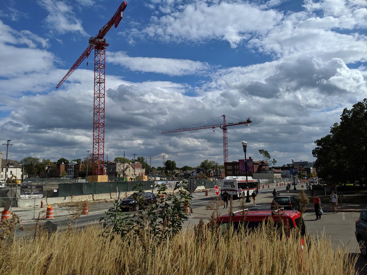
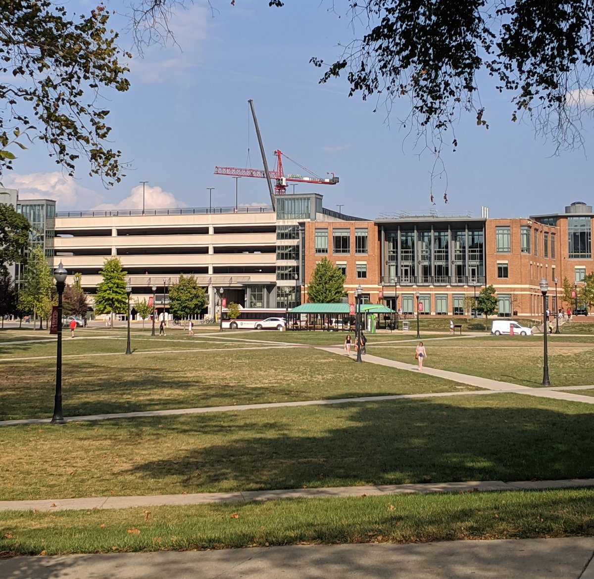
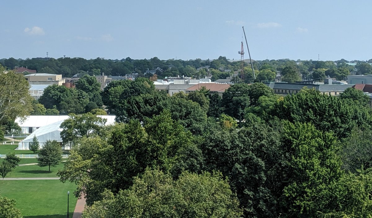
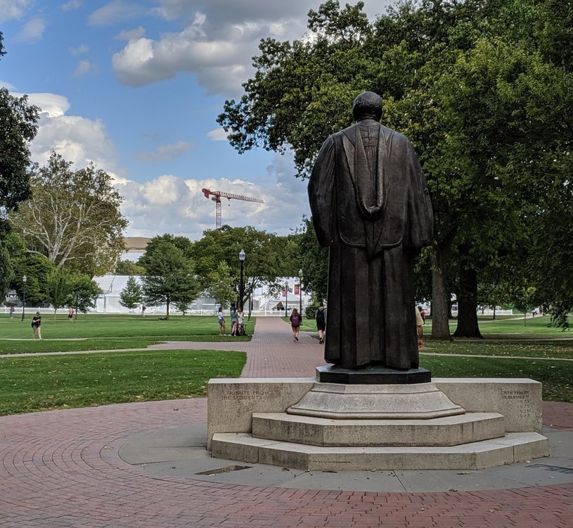
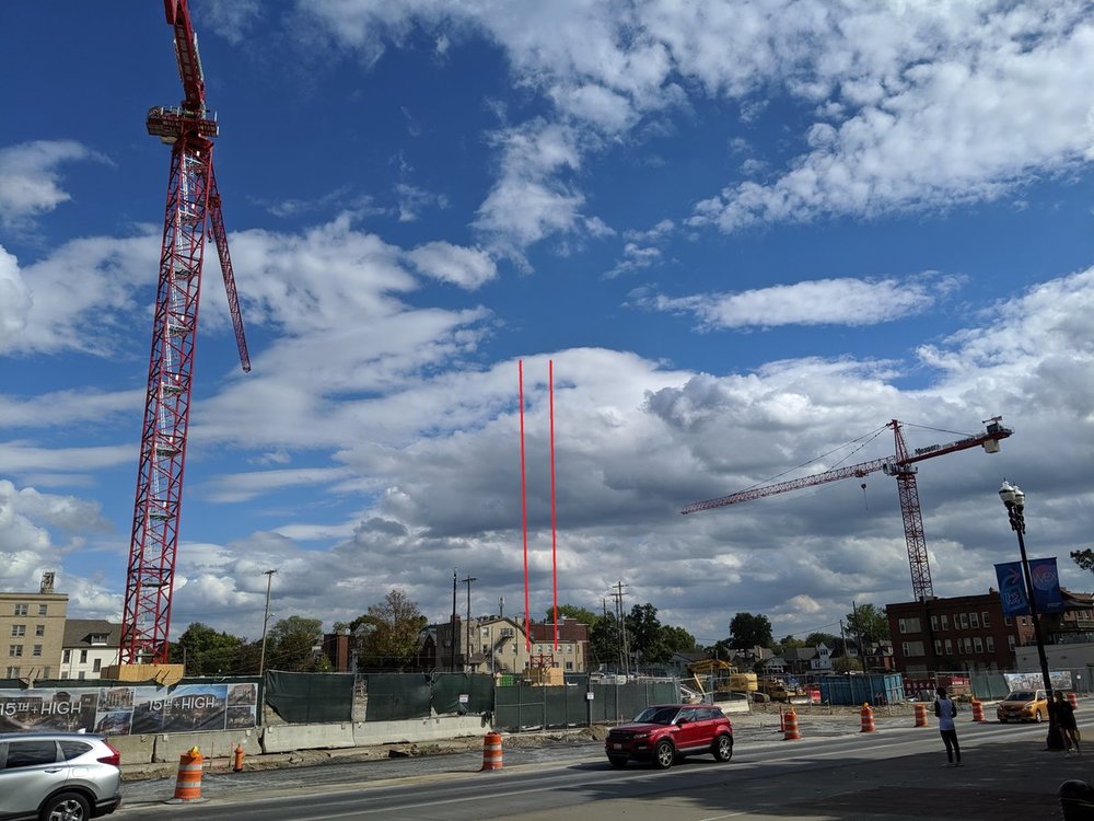
NorthShore64 replied to CMH_Downtown's post in a topic in Central & Southeast Ohio Projects & Construction2nd Tower Crane Pictures You can see the base for the 3rd tower crane in between the two currently standing. I didn't see the mobile crane used to erect the tower cranes on site this afternoon (it was overnight for the 2nd crane).

-
A few more I had on my computer
-
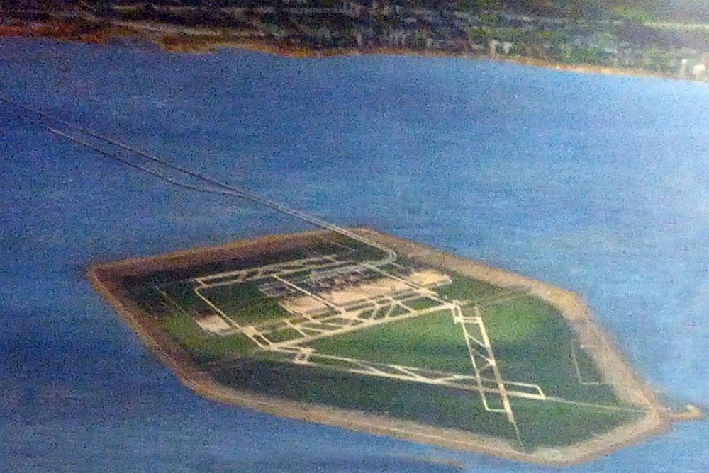
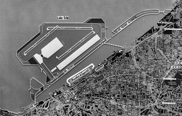
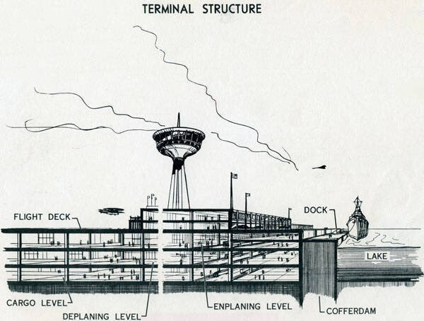
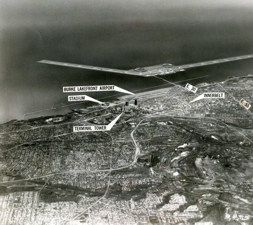
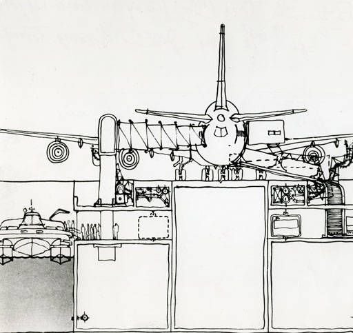
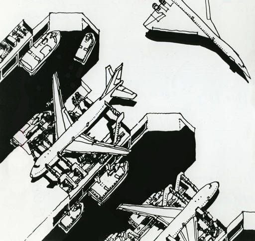
Regarding the Jetport/Airrort Island, PopularMechanics recently had an article on the proposal that had some interesting schematics/designs. That Time NASA Wanted to Build a Floating Airport on Lake Erie Link: https://www.popularmechanics.com/flight/airlines/a28576498/nasa-jetport-lake-erie/
-
NorthShore64 replied to buildingcincinnati's post in a topic in Restaurants, Local Events, & Entertainment(Not much new information than the Reuters article) Six Flags pursuing purchase of Cedar Fair, including Cedar Point: Reuters reports Link: https://www.cleveland.com/business/2019/10/six-flags-pursuing-purchase-of-cedar-fair-including-cedar-point-reuters-reports.html I'm still upset over the Geauga Lake closure. I remember when I first heard about it as a kid and it seeming so inconceivable to me at the time. I had just gotten tall enough to ride the bigger/steel roller coasters, and now it was closing. We at least had Wild Water Kingdom which was a nice water park, but Cedar closed that 3 years ago. As much as I dislike Cedar Fair for this, it would really suck for this proposed acquisition to go through. They aren't technically competitors because they operate in different markets for the most part, but any merger on this scale is bad for consumers. And what For? "As for how Cedar Fair would benefit from the transaction, Speigel said: 'It would make a lot of money for a lot of people on the Cedar Fair side.' "
-
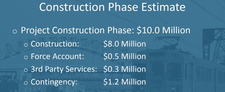
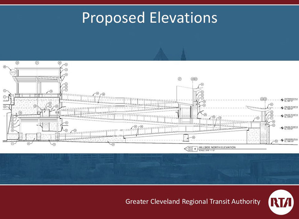
If your interested in some data, demographic, land-use information about the station there is this E. 34th/E. 79th Stations Transit Services Alternatives Analysis presentation from 2015. Average weekday ridership: 155 Link: http://www.riderta.com/sites/default/files/pdf/presentations/2015-02-03E34_E79.pdf In various studies or planning done by RTA have they every consider "moving" the station to Woodland/Buckeye? The Blue/Green line station is under half a mile away, so it would only result in cutting semi-redundant high capacity service. There seems to be more ridership and TOD potential at Woodland/Buckeye with its proximity to Fairfax, more developable land in the immediate proximity and its placement along more prominent corridors. It would move it closer to E105th/Quincy, but I think it still enough distance between stations. A buckeye/Woodland station would cost more than the $10 million they are spending on E79th, but they would get a better return on investment. Who know though, the Opportunity Corridor might change the area a lot bringing in new light industry/warehousing developments and jobs. Also there are some very interesting plans for developemnt in the E79th street corridor.
-
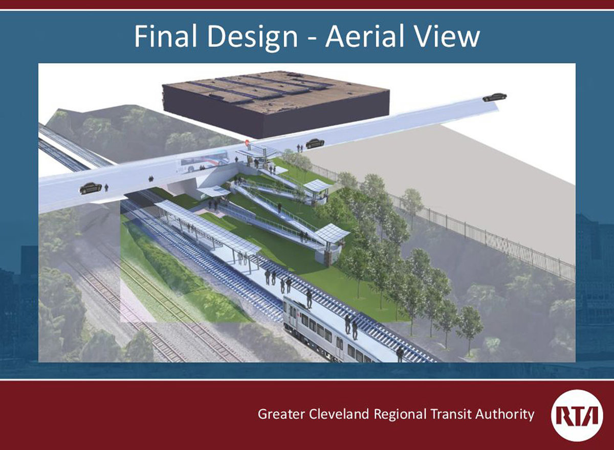
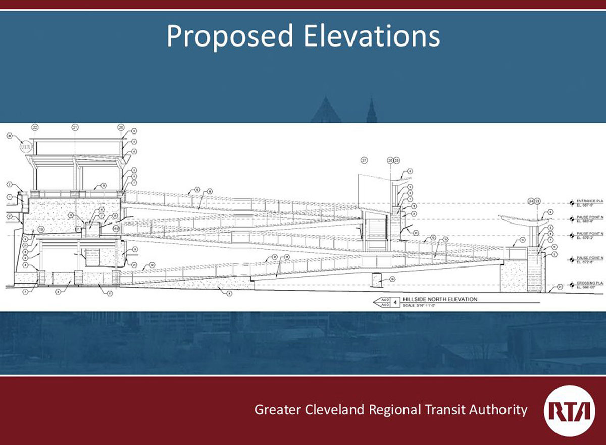
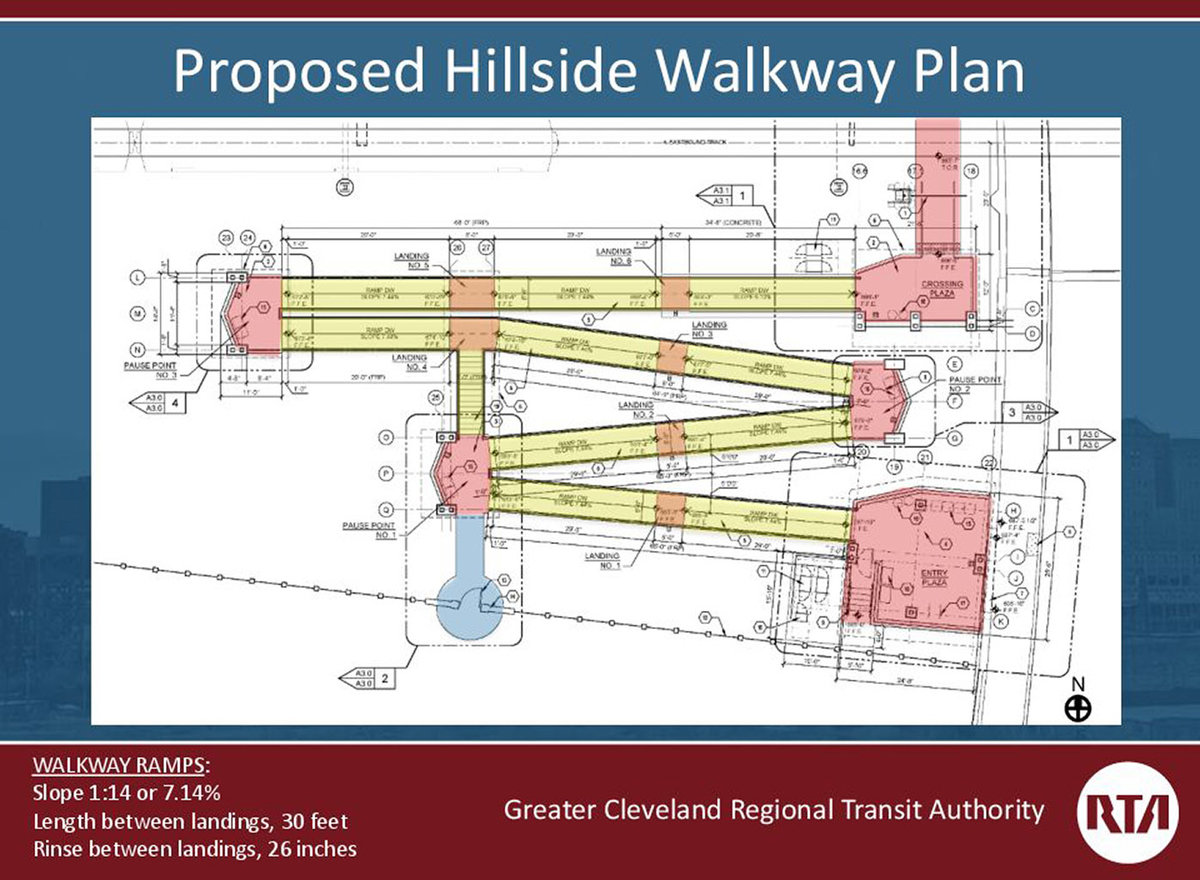
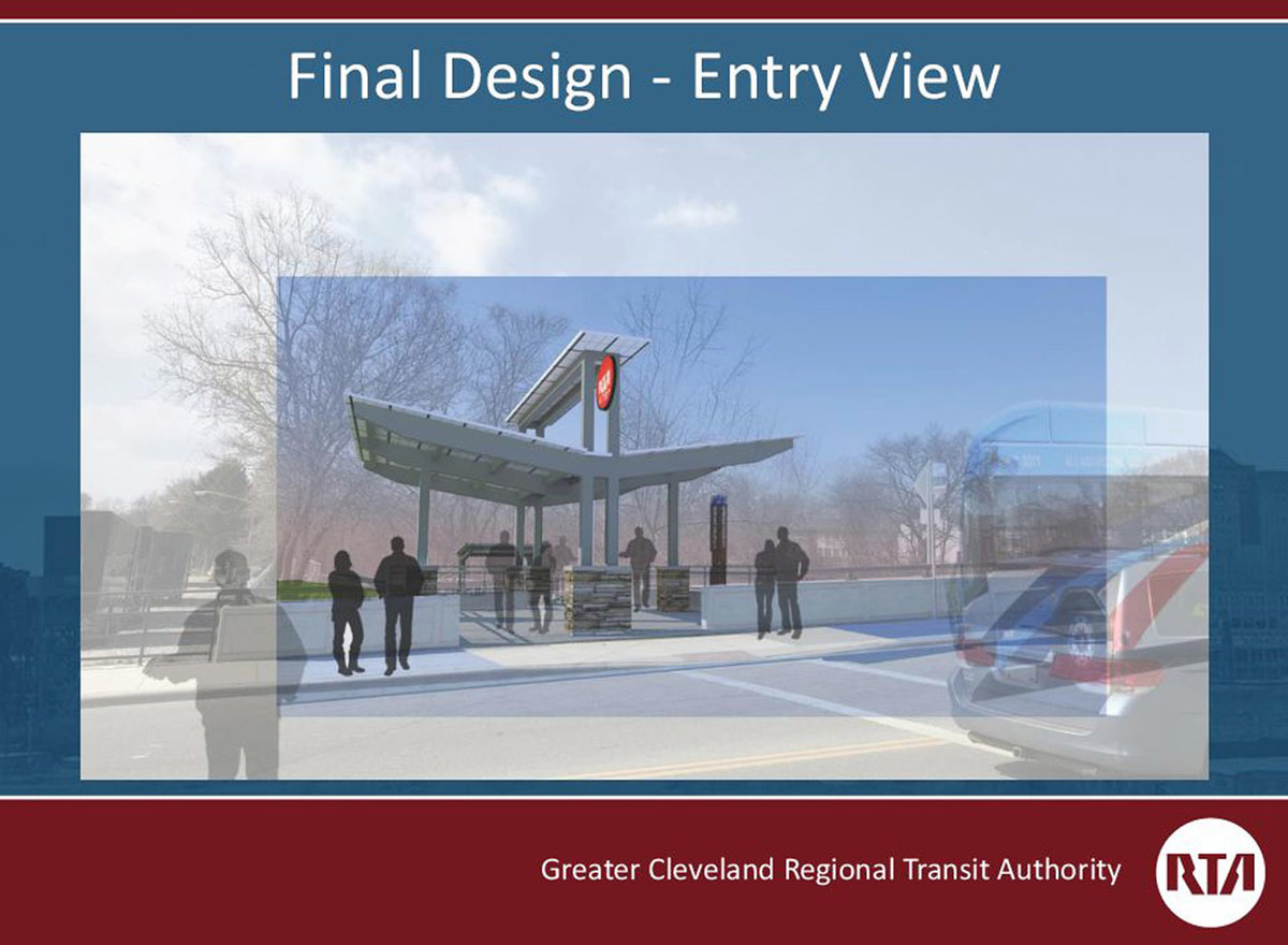
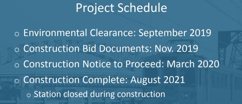
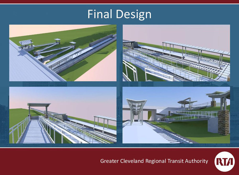
A few more details via RTA presentation on station Link: http://www.riderta.com/sites/default/files/events/2019-05-14E79thStreetStation.pdf
-
E79th Street Red Line station renovations via Oct. 4 Design Review Agenda Link: http://planning.city.cleveland.oh.us/designreview/drcagenda/2019/10042019/index.php


-
There may be a more recent timeline, but as of this spring: "Construction on the fourth and final stage of the Towpath Trail in Cleveland is expected to begin in June and wrap up by the end of 2020." Link: https://www.cleveland.com/metro/2019/04/final-stage-of-towpath-trail-construction-to-start-in-june.html
-
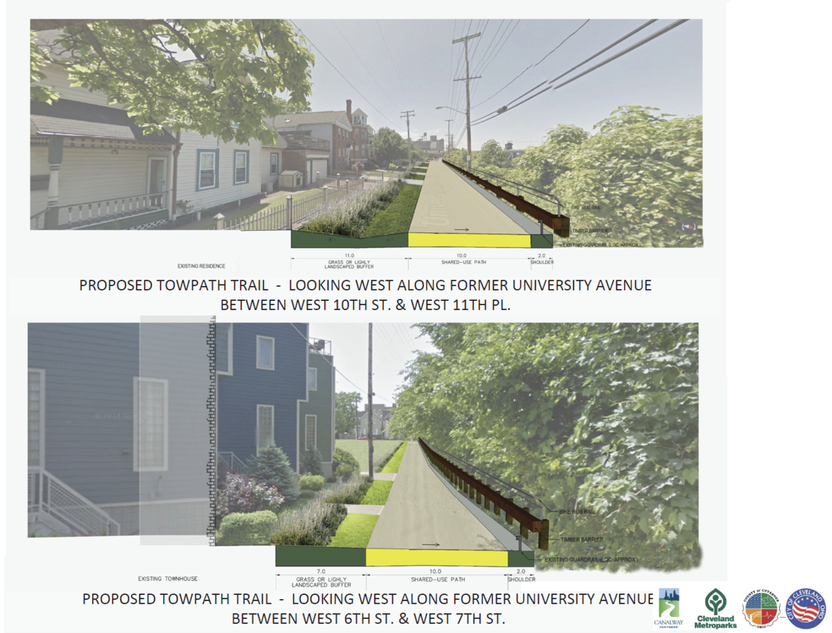
University will be for the most part closed between W5th and W11th, however all (but 1 house's garage at the corner of W10th) have vehicle access behind them via an alley. Only W6th has a cul-de-sac, but it connects an extension of the alley between 5th & 6th, so there aren't any dead ends. Only 14 houses (10 being the townhouses between 7th & 6th) will no longer have a road in front of their property. The cul-de-sac location is currently an empty grass field, and the Univeristy/10th/7th intersection is a needlessly large piece of asphalt. This is just my preference, but I would prefer a beautified multi-use pathway with improved views of downtown than a one way road fronted by a guardrail with overgrown foliage.
-
NorthShore64 replied to CMH_Downtown's post in a topic in Central & Southeast Ohio Projects & Construction
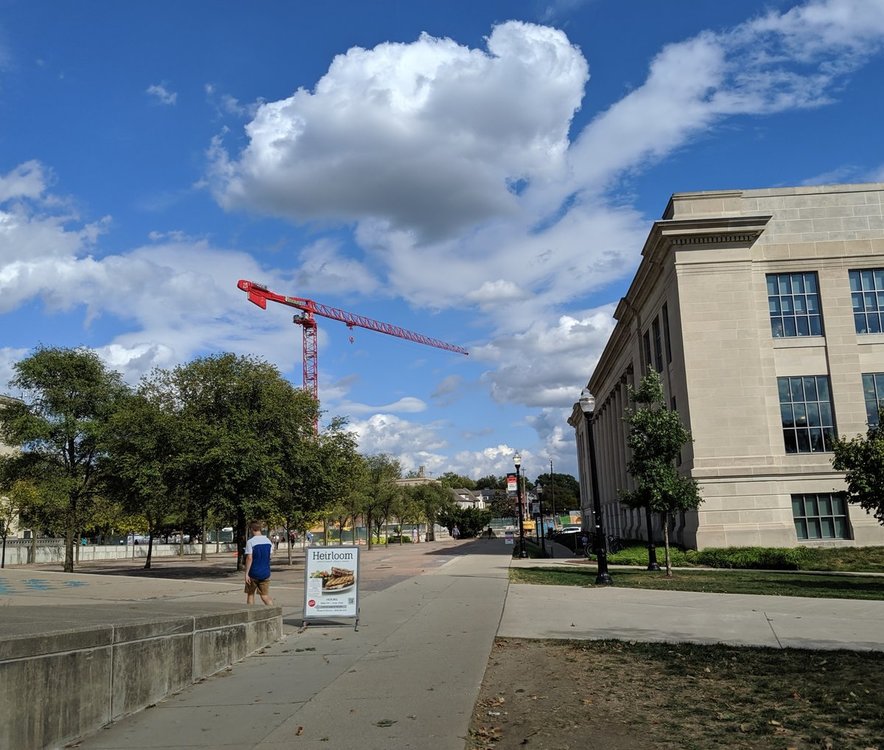
NorthShore64 replied to CMH_Downtown's post in a topic in Central & Southeast Ohio Projects & ConstructionThe tower crane being put up today from Thompson. This one is located between 14th and 15th Avenues. I believe there will be two additional tower cranes to the north of this one.
 Google street view from Sep. 2018. Its at a great location, only ~1/2 a mile from the Tower City base.
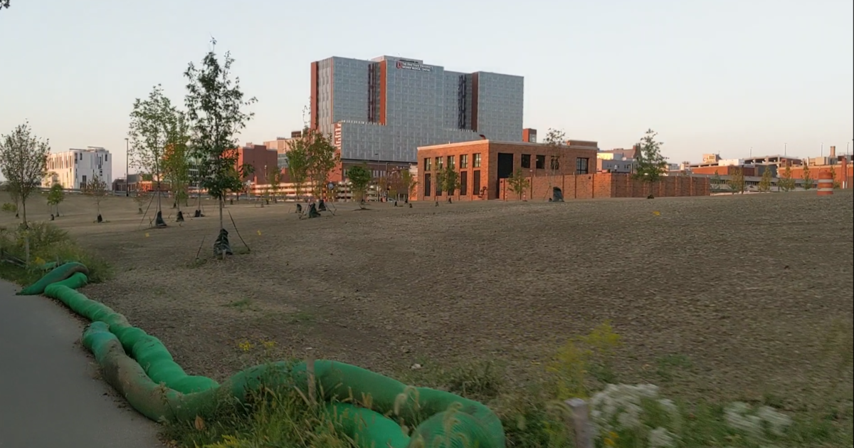
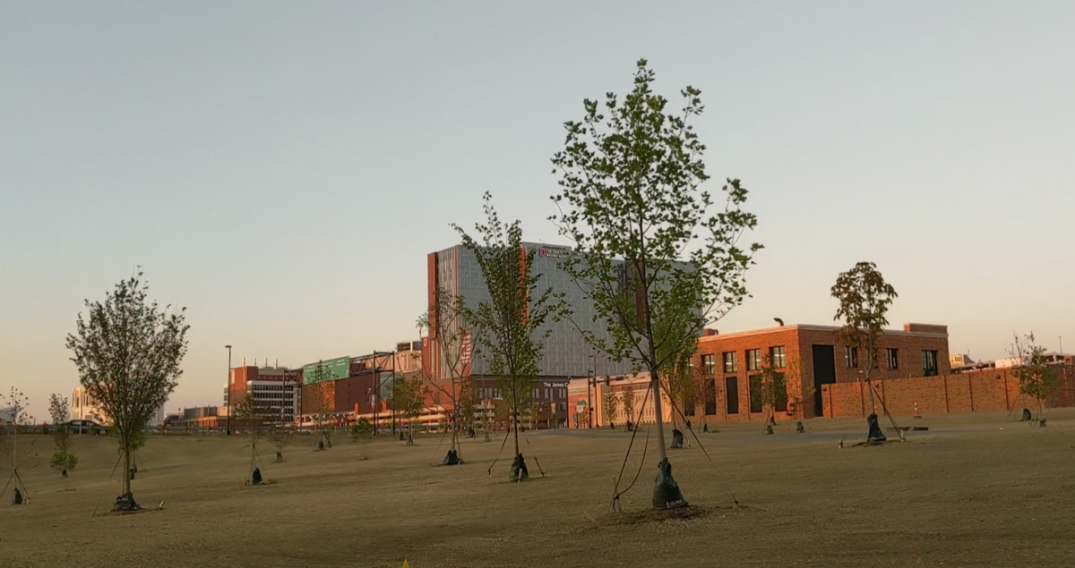
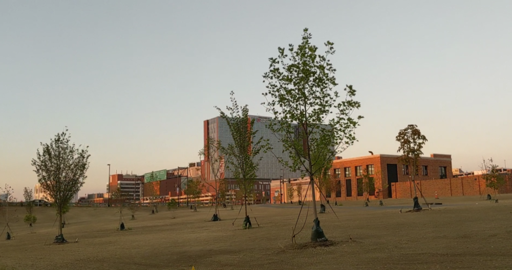
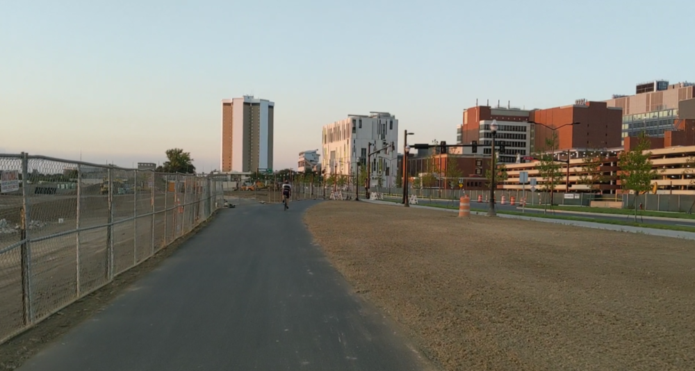
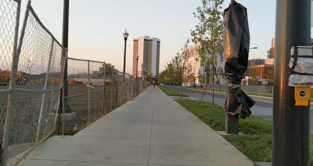
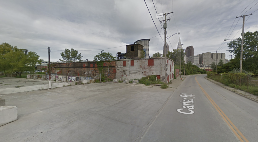 NorthShore64 replied to buildingcincinnati's post in a topic in Central & Southeast Ohio Projects & ConstructionI took these while biking up the Olentangy so they aren't the best quality. The first two are from the trail between King and the 315 off-ramp. All of the landscaping is done between Cannon and the river here. The bike path currently goes up to the future intersection at W 10th where much of the terraforming in this section finishing up. Until the trail section between W 10th and the 315 on-ramp is finished, the trail detours onto Cannon until Herrick. It is in this section where the future hospital tower will be on the right.
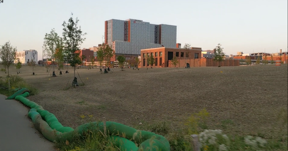
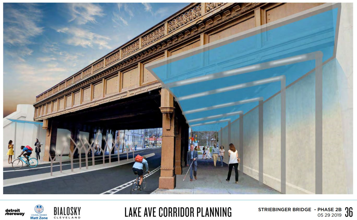
 Regardless of borders, I have a friend who was mugged on this stretch of Lake by the bridge while walking with his dad one day, requiring stitches after getting hit in the back of the head with a pistol. This was 5 or so years ago, but he still doesn’t like to walk down this stretch of Lake because of it. An improved streetscape, bridge underpass and lighting will hopefully improve both perceived/actual crime in the immediate area. If anything it'll be safer for pedestrians/cyclists which is always a win.
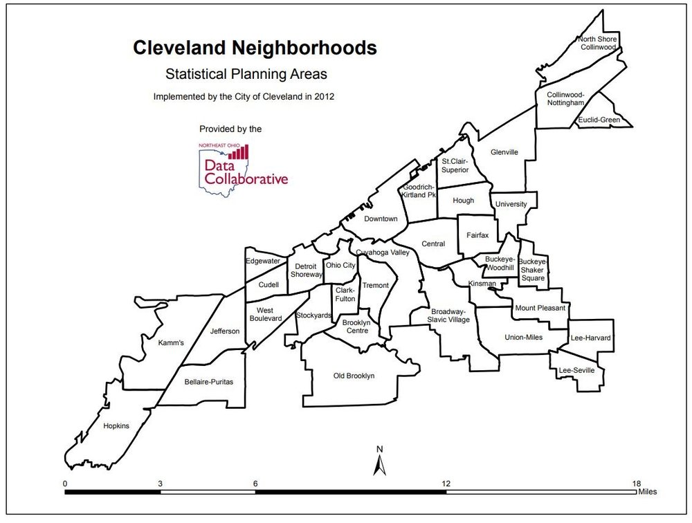
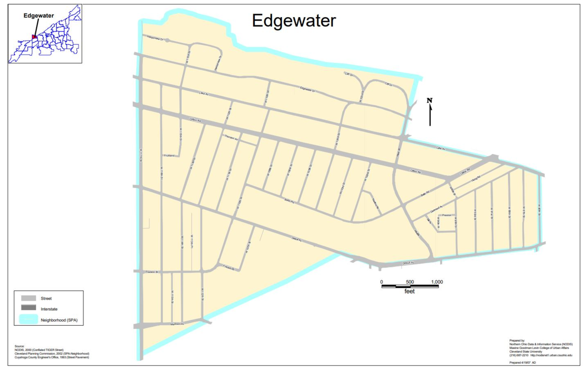
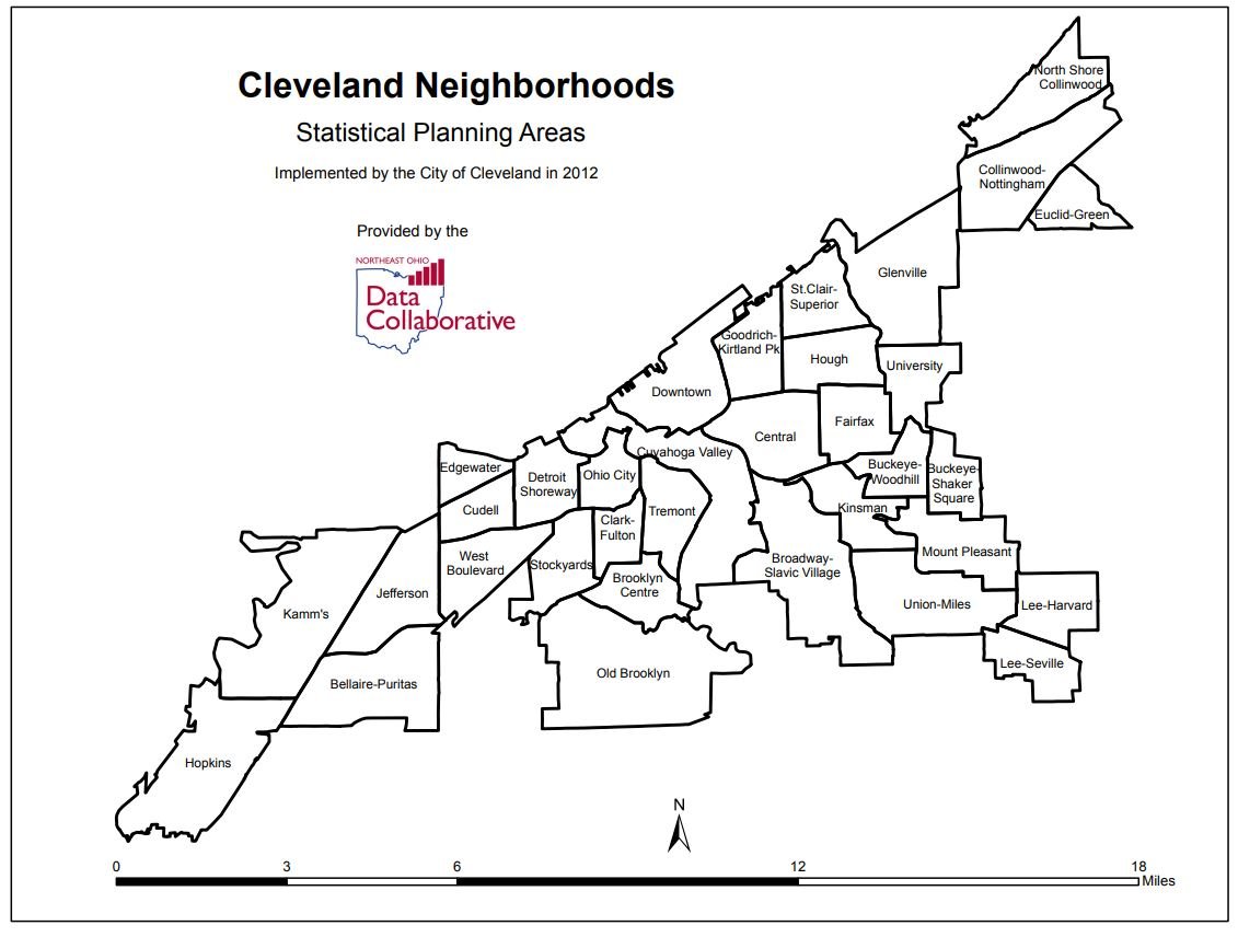
I know what I posted was from Cudell Improvement Inc., but I put it in this thread as it discussed the Lake Avenue redesign which stretches from Detroit to Clifton. This bridge was mentioned previously in this thread and is within the plans for this stretch of the Lake Ave redesign within the Detroit Shoreway CDO presentation. http://content.mindmixer.com/Live/Projects/cleveland/files/228425/2019-05-29 Lake Ave Public Mtg 2_FINAL-sm.pdf?636947533608830000 The former Statistic Planning Area (SPA) boundaries placed this section of Lake at the NS bridge in Edgewater, not Cudell. This was however changed around 2012 (along with other various neighborhood/SPA boundaries) as the new SPA borders place this triangle of land (Census tract 101101 bounded by Lake, Detroit, NS Tracks and W 85th) in Cudell. Edgewater and Cudell are however jointly overseen by the Cudell Improvement Inc., with its eastern border being W 85th. So yes, this short section of Lake Ave isn't in Detroit Shoreway according to the official borders. It is rather ~400 feet away. It also wasn't officially Cudell until revisions to the SPA borders. So even though its technically in Cudell, its seemed more fitting here as it relates to a project which is almost entirely in Detroit Shoreway and is again presented by the DS CDO.
Regardless of borders, I have a friend who was mugged on this stretch of Lake by the bridge while walking with his dad one day, requiring stitches after getting hit in the back of the head with a pistol. This was 5 or so years ago, but he still doesn’t like to walk down this stretch of Lake because of it. An improved streetscape, bridge underpass and lighting will hopefully improve both perceived/actual crime in the immediate area. If anything it'll be safer for pedestrians/cyclists which is always a win.
I know what I posted was from Cudell Improvement Inc., but I put it in this thread as it discussed the Lake Avenue redesign which stretches from Detroit to Clifton. This bridge was mentioned previously in this thread and is within the plans for this stretch of the Lake Ave redesign within the Detroit Shoreway CDO presentation. http://content.mindmixer.com/Live/Projects/cleveland/files/228425/2019-05-29 Lake Ave Public Mtg 2_FINAL-sm.pdf?636947533608830000 The former Statistic Planning Area (SPA) boundaries placed this section of Lake at the NS bridge in Edgewater, not Cudell. This was however changed around 2012 (along with other various neighborhood/SPA boundaries) as the new SPA borders place this triangle of land (Census tract 101101 bounded by Lake, Detroit, NS Tracks and W 85th) in Cudell. Edgewater and Cudell are however jointly overseen by the Cudell Improvement Inc., with its eastern border being W 85th. So yes, this short section of Lake Ave isn't in Detroit Shoreway according to the official borders. It is rather ~400 feet away. It also wasn't officially Cudell until revisions to the SPA borders. So even though its technically in Cudell, its seemed more fitting here as it relates to a project which is almost entirely in Detroit Shoreway and is again presented by the DS CDO.