Pablo
Premium Member
-
Joined
-
Last visited
Everything posted by Pablo
-
-
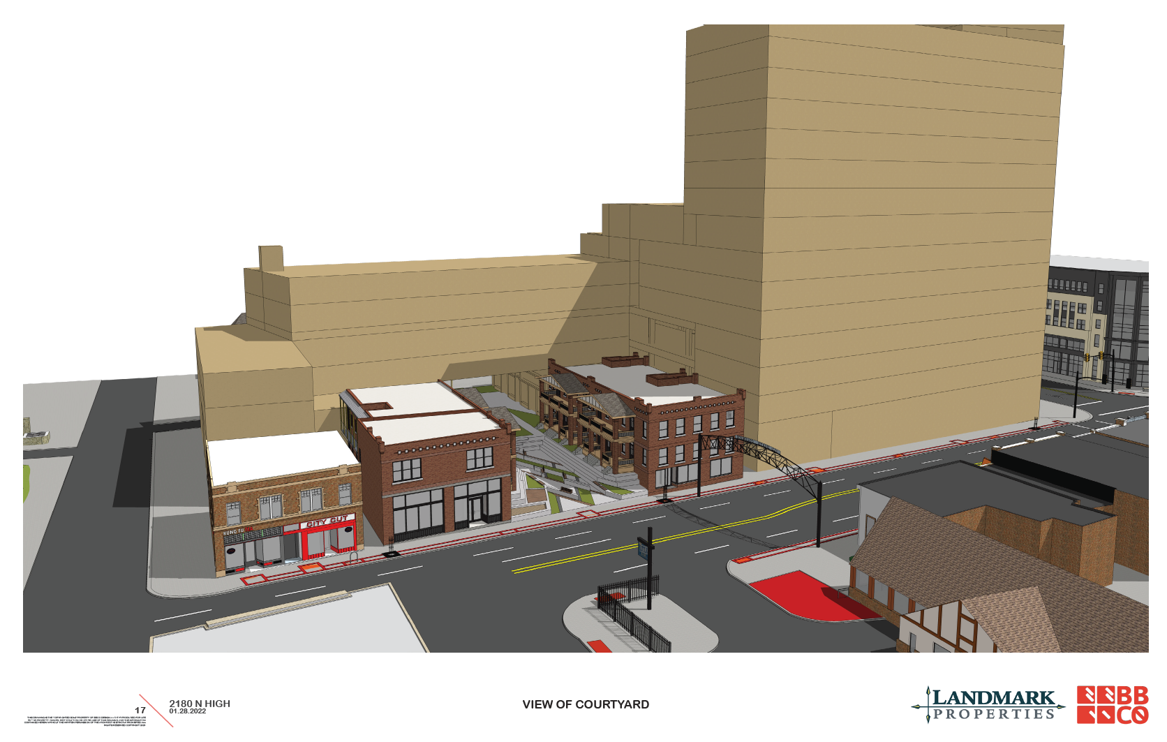
More info is available on the University Impact District Review Board website in the agenda for the meeting on the 24th: https://www.columbus.gov/planning/uidrb/ Looks like the connecting building along Pearl is elevated with a parkette between the two existing row houses. The back half of the row houses are removed in this scheme. They also show retail along Pearl which is strange in my mind.
-
Utilities take time. Power was removed quickly from 4th & 5th - what you saw linger was phone and cable. I think utility companies have no sense of urgency unless there's an outage (even then folks think they are slow). It's first come first serve and there's a backlog in a rapidly growing city.
-
-
-
-
This site isn’t covered by a commission that I’m aware of
-
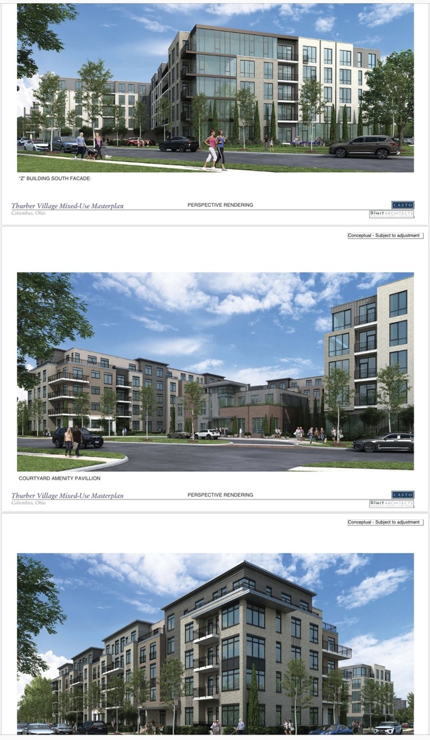
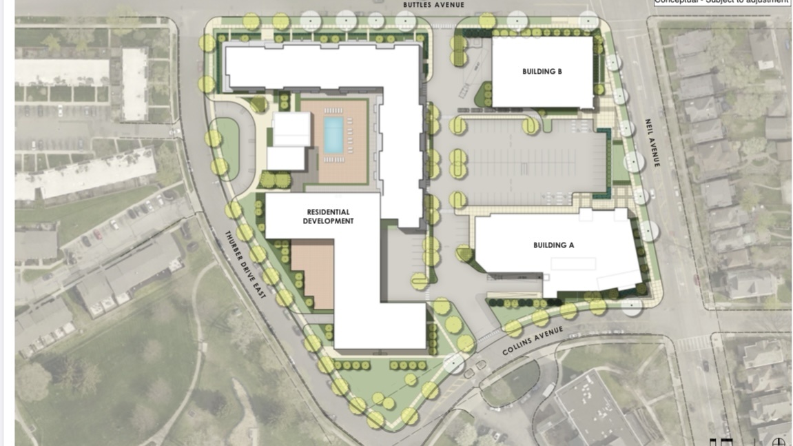
Harrison West published Casto’s plans - looks like 5 story residential and a couple of commercial buildings on Neil. http://harrisonwest.org/wp-content/uploads/2022/02/Casto.pdf
-
Or maybe like River and Rich?
-
Looks like there's an update coming from Casto for the Giant Eagle site. From the Harrison West Society facebook page:
-
-
Pablo replied to Summit Street's post in a topic in Central & Southeast Ohio Projects & ConstructionI wonder if there are tanks still in the ground that would prevent the parking lot from being developed. This used to be a gas station from the 1930s to the 1950s I believe. Before 670 was built, Dennison extended through to Spring St. so Dennison might have been used as a throughfare.
-
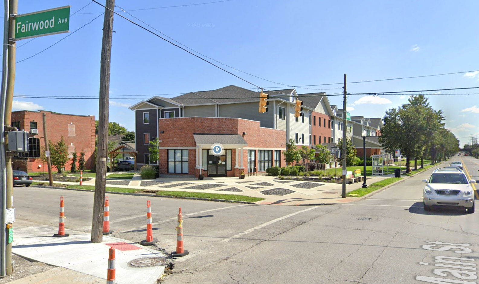
Pablo replied to Summit Street's post in a topic in Central & Southeast Ohio Projects & ConstructionA senior housing project was completed at Main and Fairwood last year. More people in the neighborhood and more eyes on the street are a good thing. There's a lot of vacant land on E Main in the Near East Side.
-
Pablo replied to buildingcincinnati's post in a topic in Central & Southeast Ohio Projects & Construction1988, the Franklin County tower had similar construction. I think it has to do with different trades on site and not stepping on each other.
-
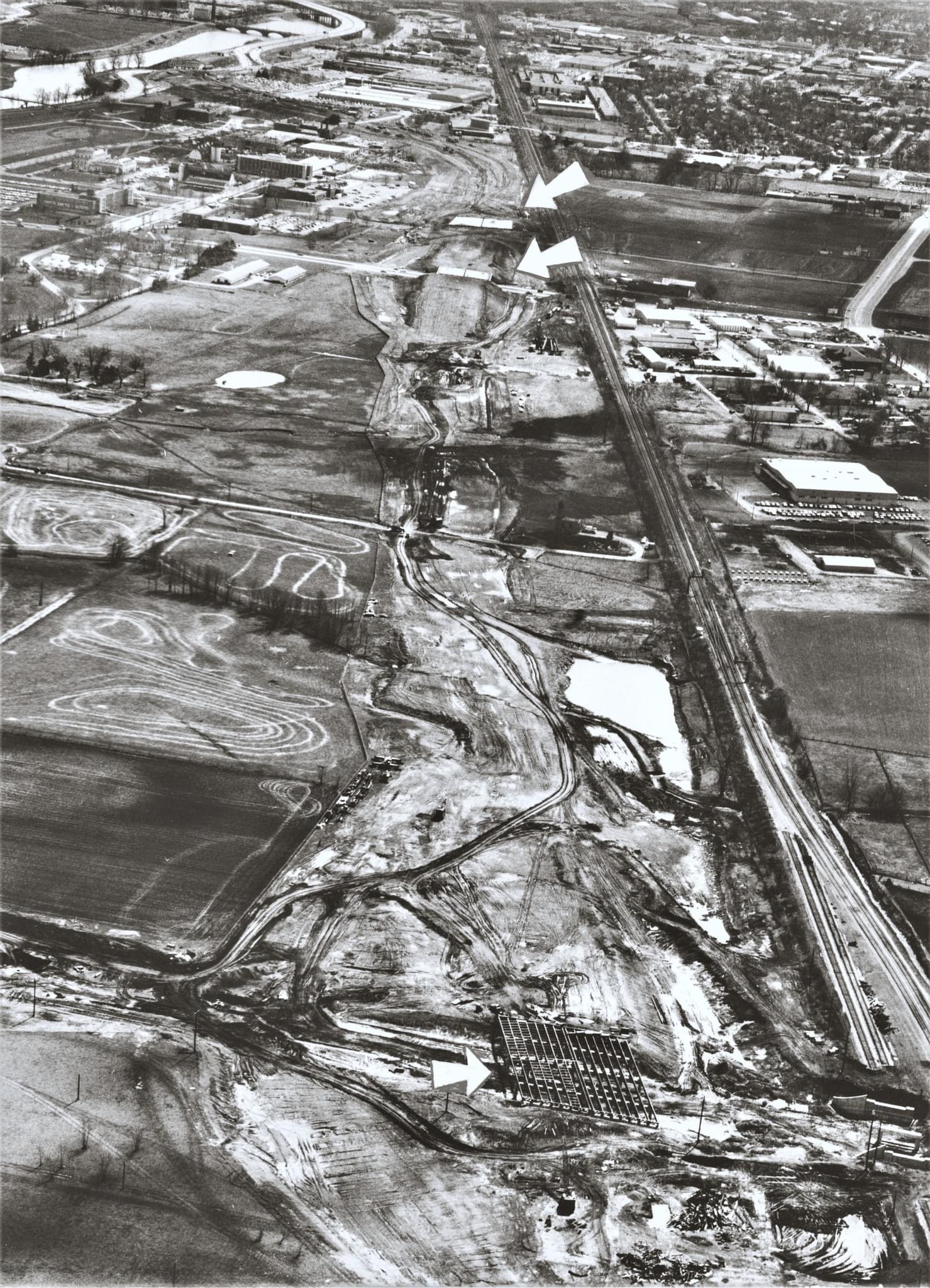
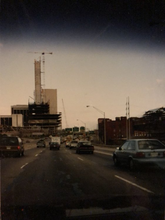
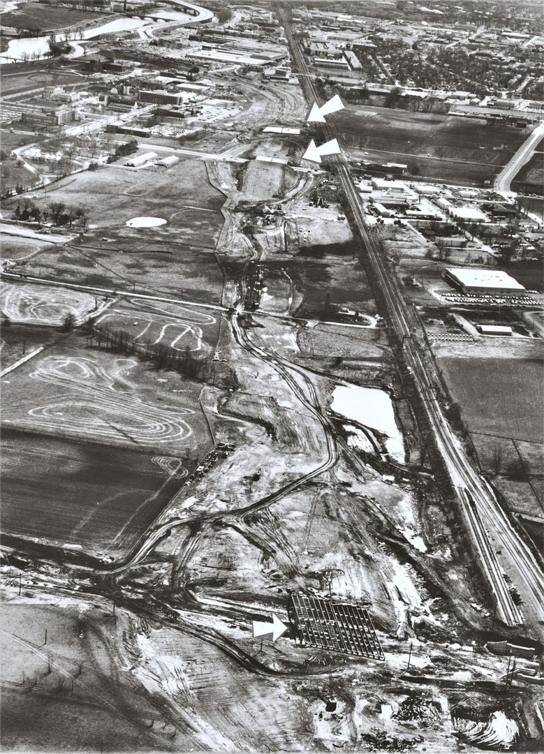
315 construction in 1971 looking south. Arrows point to Ackerman Rd at the bottom of the photo with Lane Ave and Woody Hayes above. Where the construction curved to the left is the Lennox factory. Interesting how the newly constructed 315 bridge over the Olentangy just dumps out onto Olentangy River Rd. Ackerman was the northern terminus of the freeway until the 1980s when 315 was connected to 270.
-
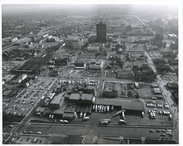
Circa 1975 - the Borden Dairy. Borden was headquartered here in Columbus for a number of years at 180 E Broad (a spin off Hexion is there now). I remember this dairy from my childhood. I took classes at CCAD and we drove by this every Saturday. The view is looking south - that's Spring St at the bottom and Cleveland Ave on the right. The dairy took up the entire block between Long, Washington, Spring and Cleveland. It's now a parking lot serving Columbus State. South of the dairy is Long St and beyond that CCAD and the art museum. https://digital-collections.columbuslibrary.org/digital/collection/p16802coll28/id/140946/rec/4
-
I like that London is keeping their Civic uses downtown. Nelsonville abandoned it's high school, city hall, police and fire and moved to the edge of town removing themselves from the people they serve. Having these uses downtown help the over all economic and civic needs of small towns and big cities.
-
Pablo replied to buildingcincinnati's post in a topic in Central & Southeast Ohio Projects & ConstructionYup, that’s true. I was involved with that project back in 1997 or so. There are strange window locations in some of the hotel rooms because the new floor plate didn’t always align with the old floors.
-
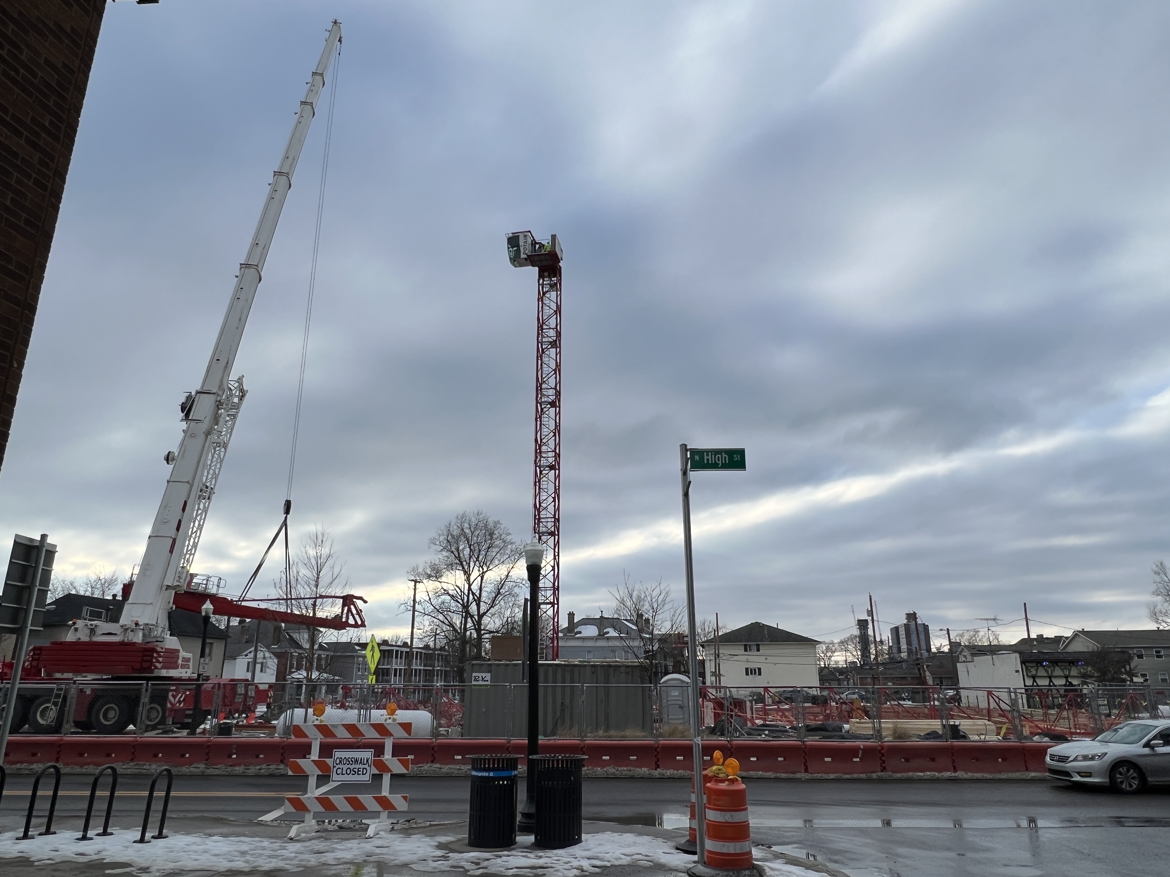
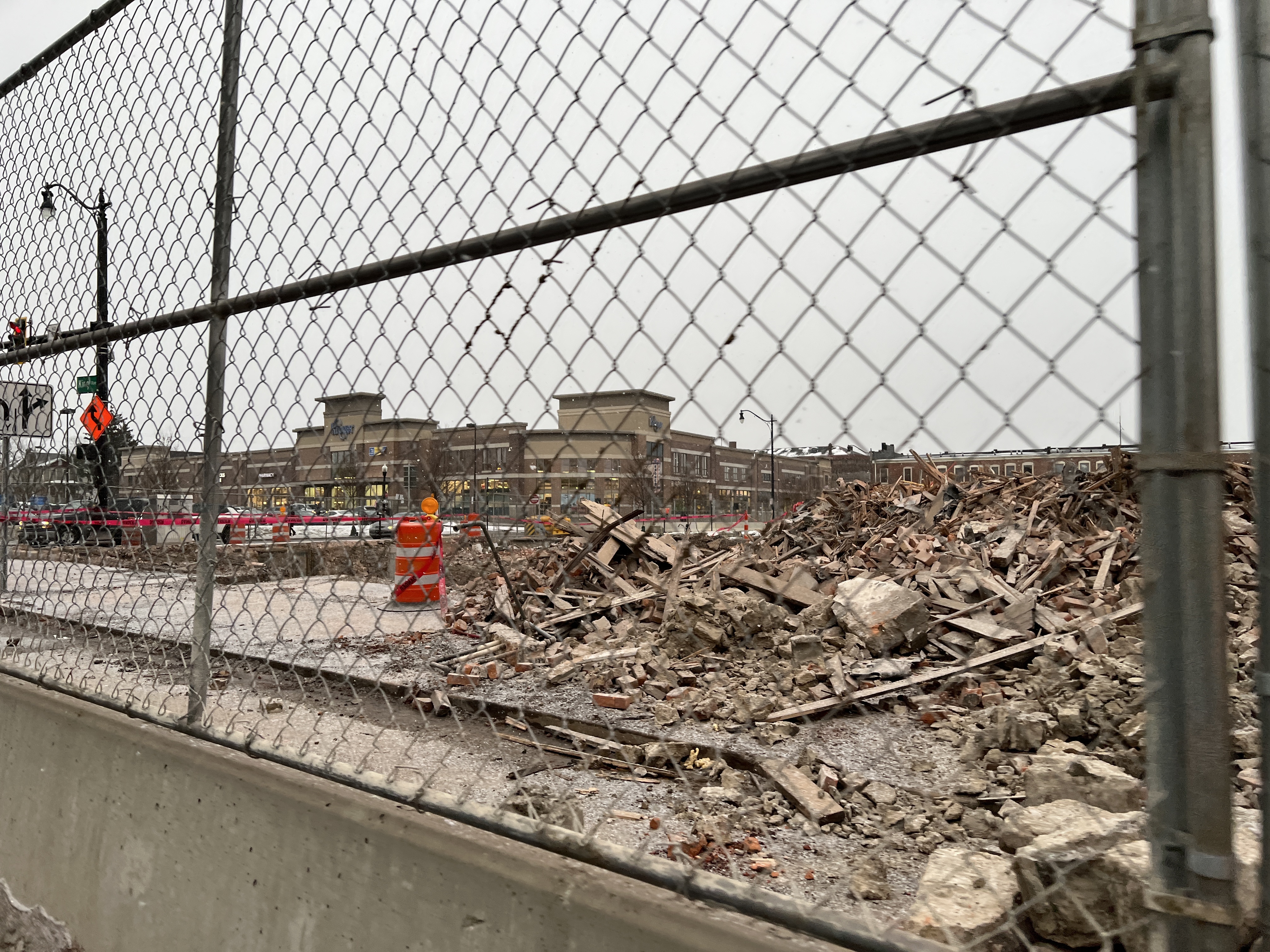
Pablo replied to buildingcincinnati's post in a topic in Central & Southeast Ohio Projects & ConstructionThe building at the corner of King & High has been demolished. I noticed over the last month the outer skin, or veneer, had been removed. I wonder if they found the building had structural issues and they’re just going to rebuild it and use the salvaged brick? The vantage point is King just west of High looking southeast towards the Kroger.

-
Pablo replied to buildingcincinnati's post in a topic in Central & Southeast Ohio Projects & Construction^And, because of the complexity and the legal fees needed to maneuver through the City, a lot of potential small developers are locked out of the process. If it were more straightforward (and less money spent on variances and the like), I believe a smaller developer could construct a building with a smaller footprint thereby creating more architecturally diverse neighborhoods. Currently to build something that makes money a developer needs to build a massive 5 over 1 building to recoup soft costs. I'm not against developers making money but diversity would benefit the community more.
-
Pablo replied to buildingcincinnati's post in a topic in Central & Southeast Ohio Projects & ConstructionWhat's a 3 point shot worth in Value City Arena? $2.99! 🤣 I'll show myself out.....
-
For years that was the customer parking lot for City National Bank (now Chase). It was one of the reasons why the Broad St. median project never advanced - McCoy (the CEO) didn't want access from east bound Broad to his parking lot blocked.
-
Pablo replied to buildingcincinnati's post in a topic in Central & Southeast Ohio Projects & ConstructionLykens is the LC of IV
-
^That was owned by Campus Partners. That was the site of Kelly's Carryout which was deemed a problem business. Looks like it was spun into a LLC in 2019. Hamad made a nice windfall in 2014...

-
That's pretty common consideration for research facilities. I worked on a new lab at Ohio State and the foundation was overdesigned to mitigate vibrations from nearby truck and train traffic.