.justin
Metropolitan Tower 224'
-
Joined
-
Last visited
Everything posted by .justin
-
Yes, it's that project based on the parcel number on the application (010-003021).
-
The original project scope included extensive streetscape work, but the scope was cut back to cut costs. It is replacing some sidewalk, primarily around City Hall, as well as on the corners at intersections. All of the traffic signals are being replaced, and most of the utility work is just fiber connecting the signals. Some curb extensions are being installed on Marconi, but none are being installed on Front St. Both streets have existing street parking which will remain. (Note the image quoted above is just a sample from the streetscape standards, it's not a rendering of the work happening on Marconi and Front)
-
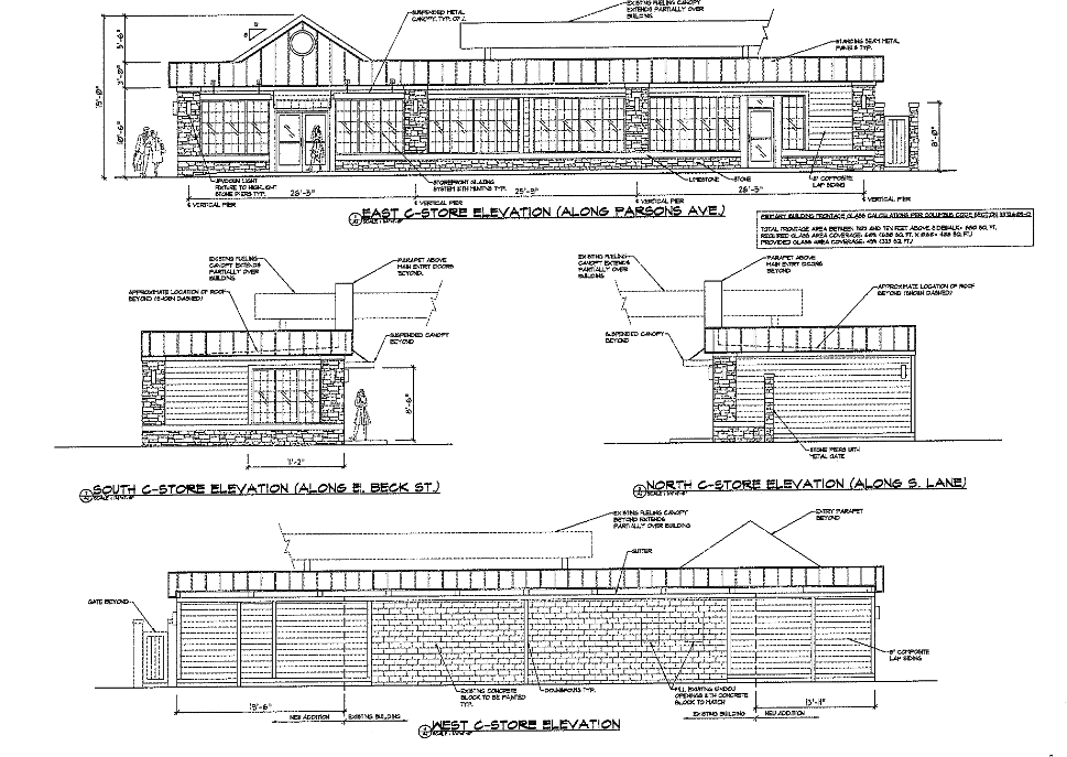
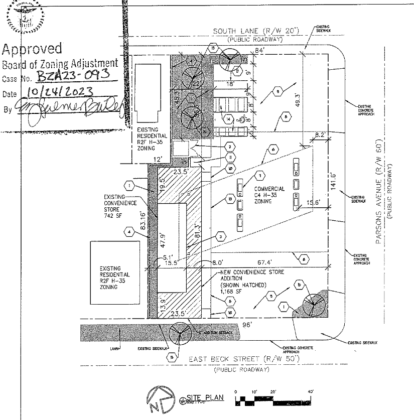
.justin replied to CMH_Downtown's post in a topic in Central & Southeast Ohio Projects & ConstructionIt's going to be opening back up as a convenience store + gas station. The convenience store is being expanded.
-
.justin replied to CMH_Downtown's post in a topic in Central & Southeast Ohio Projects & ConstructionIt would be more about making sure the mechanicals can function in the winter. Many concessions, restrooms, etc likely have their water shut off during the winter to prevent burst pipes.
-
.justin replied to buildingcincinnati's post in a topic in Central & Southeast Ohio Projects & ConstructionThey setback the building from the sidewalk Town St so that its front would line up with the neighboring historic homes. I think it made sense to do that in this context -- having it right up against the sidewalk would look out of place. The way the sidewalk jogs back to the street at the intersection is really awkward though. No idea why they did that.
-
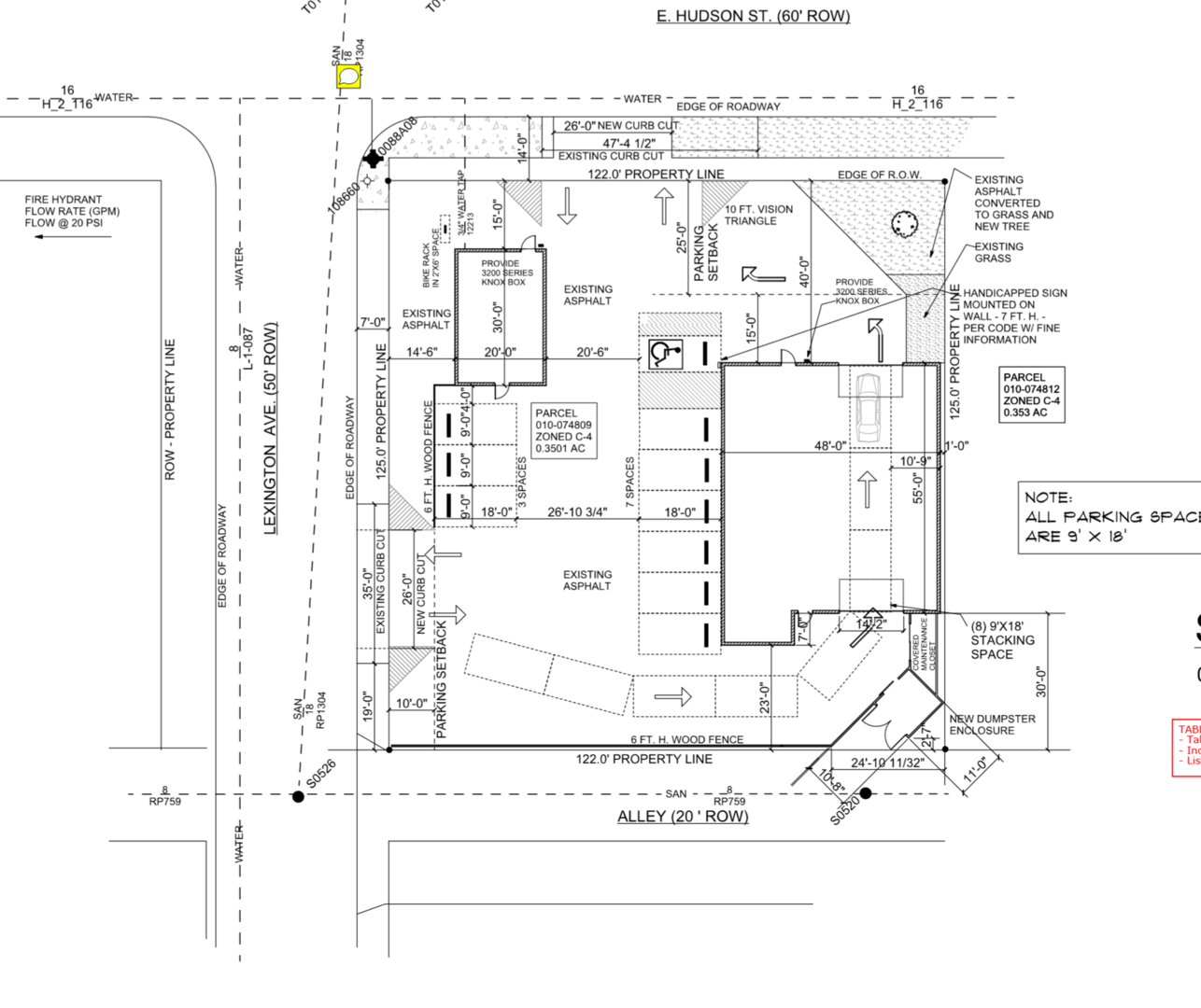
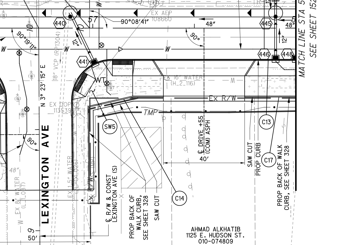
.justin replied to buildingcincinnati's post in a topic in Central & Southeast Ohio Projects & ConstructionTheir submission in June showed this: The Hudson St project actually is building a wider 40 ft drive, so this is a width reduction from that:
-
There is one...it's exclusive to ACC members though: https://columbusunderground.com/100-year-old-underground-bowling-alley-reopens-downtown/
-
.justin replied to buildingcincinnati's post in a topic in Central & Southeast Ohio Projects & ConstructionIt's a shared use path, eventually it will connect to a shared use path along Riverside Dr to connect to Quarry Trails. It won't go all the way down Lane, only from Riverside to Asbury Dr. More info on this page: https://storymaps.arcgis.com/stories/90f4be3c422742fa841a3c523a01b52c
-
I would assume so -- City council approved the construction contract for the new bridge in June.
-
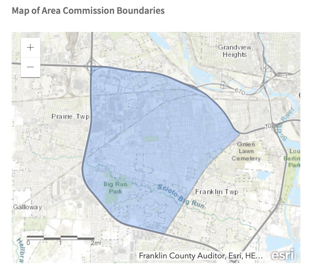
.justin replied to buildingcincinnati's post in a topic in Central & Southeast Ohio Projects & ConstructionThey are probably calling it Greater Hilltop because it's within the Greater Hilltop Area Commission... https://cbusareacommissions.org/greater-hilltop/
-
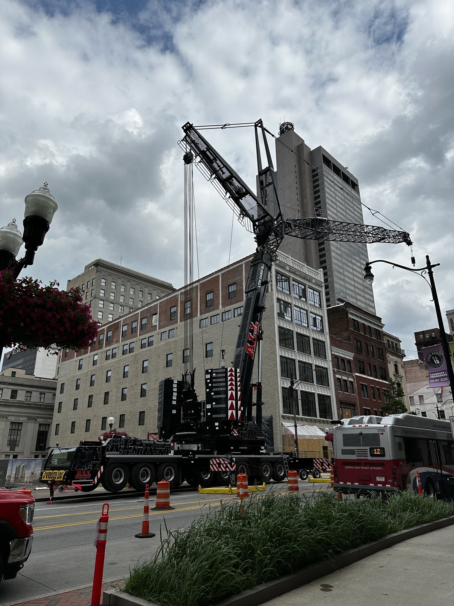
This is from yesterday afternoon...

-
They might not have a developer selected yet, but I know they did another study recently and I suspect the fact that they showed the development cap rendering (rather than the green cap rendering) to Council was deliberate. The High St bridge has a pretty significant slope -- the bridge rises 5 ft going from Livingston to Fulton. The 3rd St bridge only rises about 2 ft in comparison. That probably played a role. They'll also be able to develop the land on the north side of Livingston between 3rd and 4th (where the freeway ramp used to be) as part of the 3rd St cap. The Front St bridge will have a green cap on one side, High St will have green caps on both sides, and 3rd St will have either green caps or development caps on both sides. I believe the retaining walls adjacent to 4th St are being built as "cap-capable" but no cap is being built at this time. (The retaining walls adjacent to Spring, Broad, and Grant also should have been built as "cap-capable" -- at least that was the plan several years ago).
-
.justin replied to Summit Street's post in a topic in Central & Southeast Ohio Projects & ConstructionBRT stations are going to be at Souder and at Belle:
-
I haven't watched the meeting, but the agenda says the developer only brought it forward for a conceptual review. That means the commission provides feedback but doesn't take a vote.
-
New windows have started to go in on the front:
-
.justin replied to CMH_Downtown's post in a topic in Central & Southeast Ohio Projects & ConstructionYou're not alone, I thought the same exact thing.
-
.justin replied to buildingcincinnati's post in a topic in Central & Southeast Ohio Projects & ConstructionThe building on the right is the original proposal from last year. The one on the left is their current proposal.
-
.justin replied to buildingcincinnati's post in a topic in Central & Southeast Ohio Projects & ConstructionThe work at Harrison Park is related to the Lower Olentangy Tunnel (sewer) - https://www.columbus.gov/Templates/Detail.aspx?id=2147515446
-
They actually have revived those plans...the city received grant funding and the project is actually currently out for bid for construction this year. The work is less extensive than originally planned (they aren't going to be installing brick crosswalks) but the signals will be replaced and the streets will be converted to two-way.
-
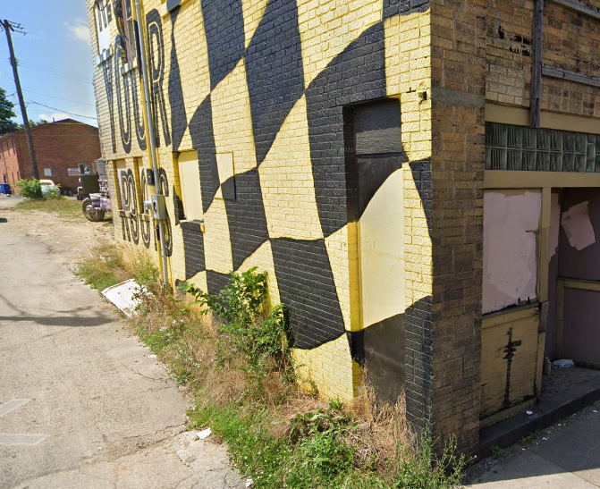
.justin replied to Columbusite's post in a topic in Central & Southeast Ohio Projects & ConstructionPreviously they had been boarded up window openings. They filled in those spaces with bricks in 2021. This is from 2019 street view -
-
.justin replied to buildingcincinnati's post in a topic in Central & Southeast Ohio Projects & Constructionhttps://www.dispatch.com/story/business/2023/01/19/developer-proposes-tallest-building-in-the-short-north/69819885007/ Apparently while the number of stories has grown from 12 to 15, the height (180 feet) is the same as before...
-
From the Business First article published yesterday... "Oestrike said the rear of that main room will be getting a kitchen, set to house a to-be-announced partnered. That’s part of phase three of construction so it won’t be open by March. Jackie O’s is bringing in a food truck that will be the sole initial food provider to the space, but will continue to be there even after the separate kitchen opens. That operator also is still to be announced."
-
Another of the beginnings of construction at 100 N High...
-
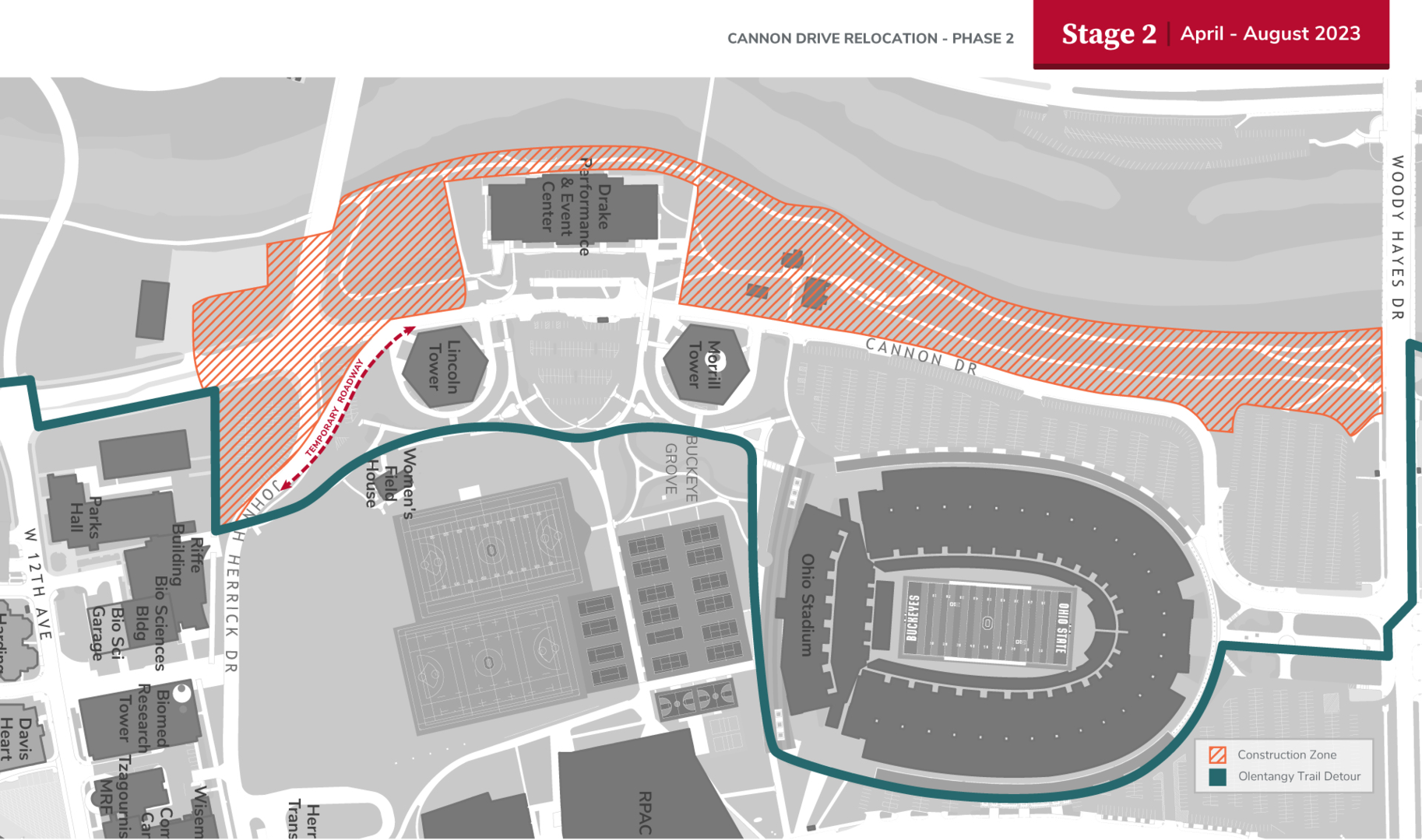
.justin replied to CMH_Downtown's post in a topic in Central & Southeast Ohio Projects & ConstructionI suspect the trees were removed more because of the levee work that they will be doing than the road work. I agree, though, it definitely was sad to see them gone when I rode through there the other day. Also not looking forward to this trail detour at all https://buildingthefuture.osu.edu/cannon-drive-relocation-phase-2
-
I believe a new traffic signal is going to be installed at Broad & McDowell as part of Gravity II...somewhere I have a copy of the construction plans that I found at one point, though I can't find it now.