GISguy
One World Trade Center 1,776'
-
Joined
-
Last visited
Everything posted by GISguy
-
 https://www.cleveland.com/casino/2019/12/jack-entertainments-aerial-walkway-over-ontario-street-gets-cleveland-mayor-frank-jacksons-approval.html
 -
https://www.cleveland.com/cityhall/2019/12/tax-break-for-cleveland-lakefront-development-gets-final-approval-with-mayor-frank-jacksons-signature.html
-
League of American Bicyclists just released State Report Cards for bike friendliness metrics, found here: https://bikeleague.org/content/state-report-cards Ohio's is this link (it's a PDF), spoiler alert, we're ranked 18/50: https://bikeleague.org/sites/default/files/BFS Report Card_2019_Ohio.pdf
-
So it's confirmed, they're definitely moving to Atlanta now. Ok, cool.
-
Rode by on the bus today, it looked like hr block, Sherwin Williams, and Key. There may be one or two more but it's looking pretty empty.
-
Here's the YMCA site
-
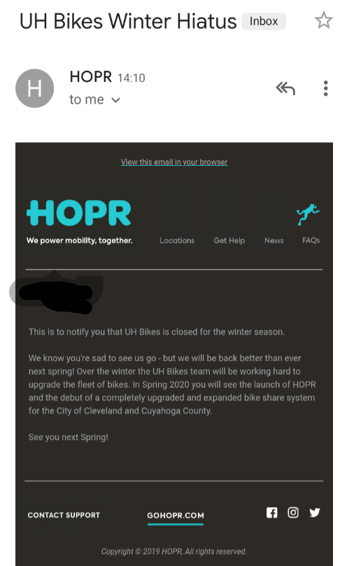
Looks like all 5 bikeshare bikes that are left in service in Cleveland are going away for the winter. I've never heard of this company but hopefully version 2 of the bike share program is way better than the current.

-
Thanks for putting this together, it was great meeting everyone and look forward to the next event!!
-
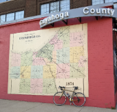
Great map, thanks for sharing.
-
To be fair, reading this dude's responses to folks, it doesn't sound like he expected it to blow up as much as it did. I think it was just a fun idea that ballooned in the twitterverse (but take note, Ohio Legislators, people want rail).
-
This is more than the 3-C's but what an amazing idea to connect all of Ohio by rail...
-
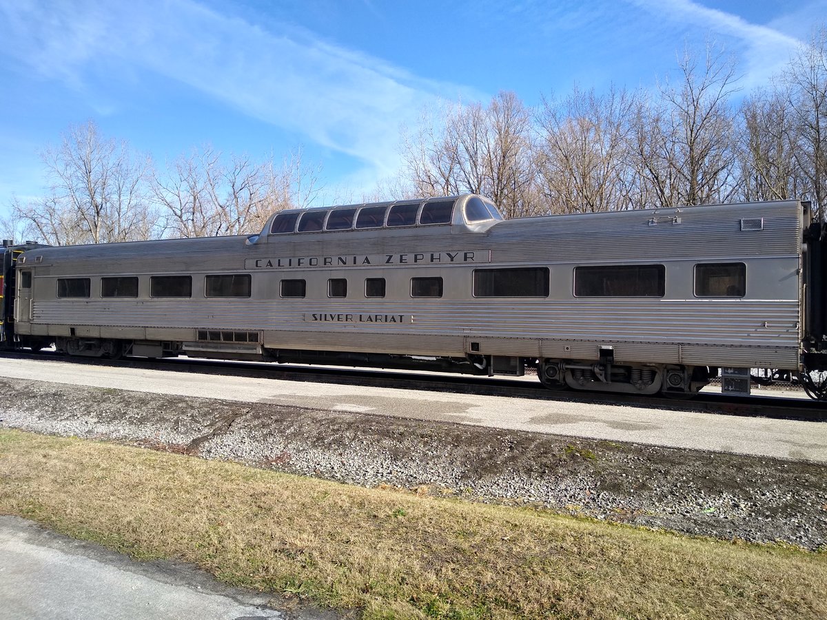
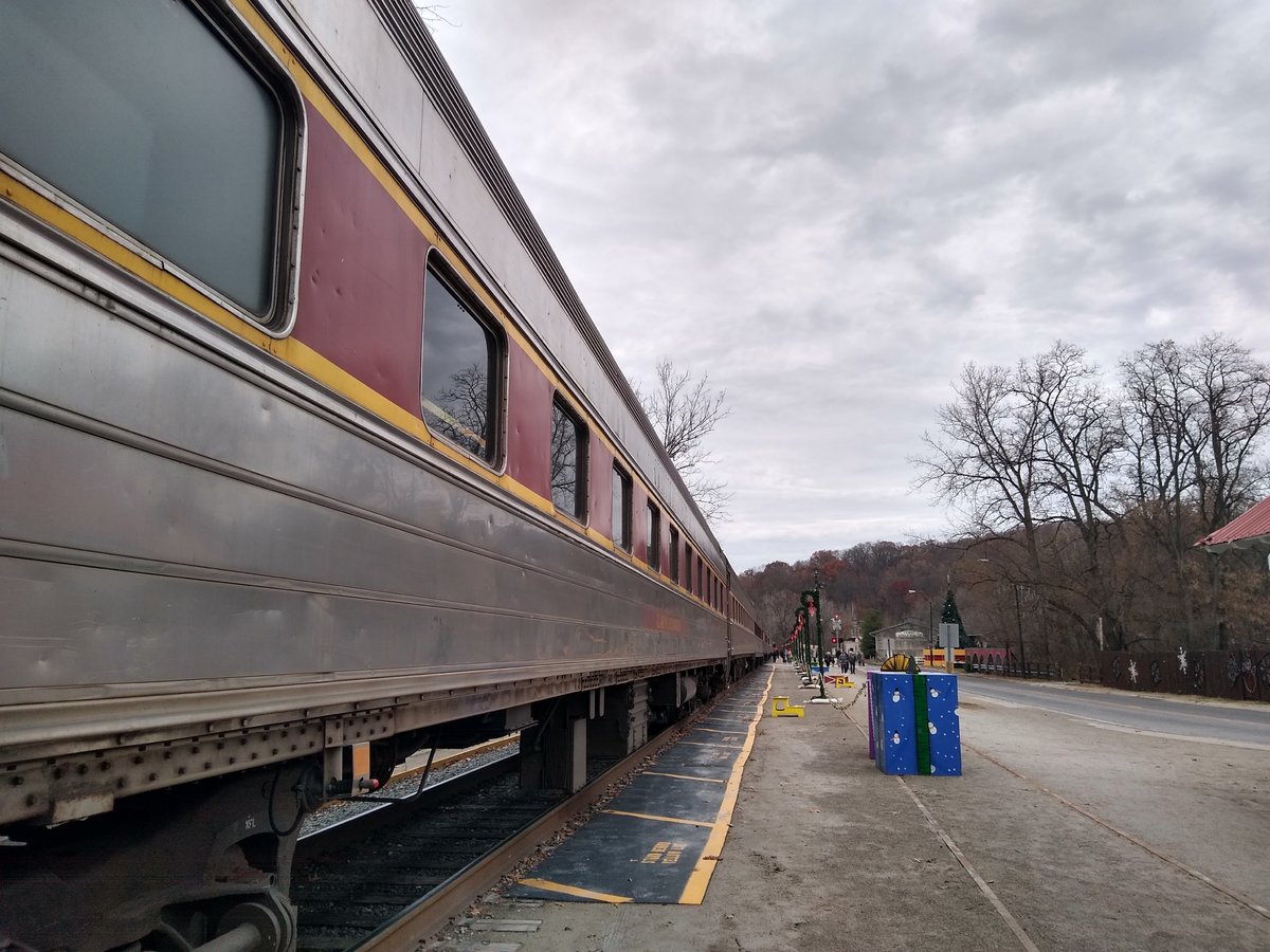
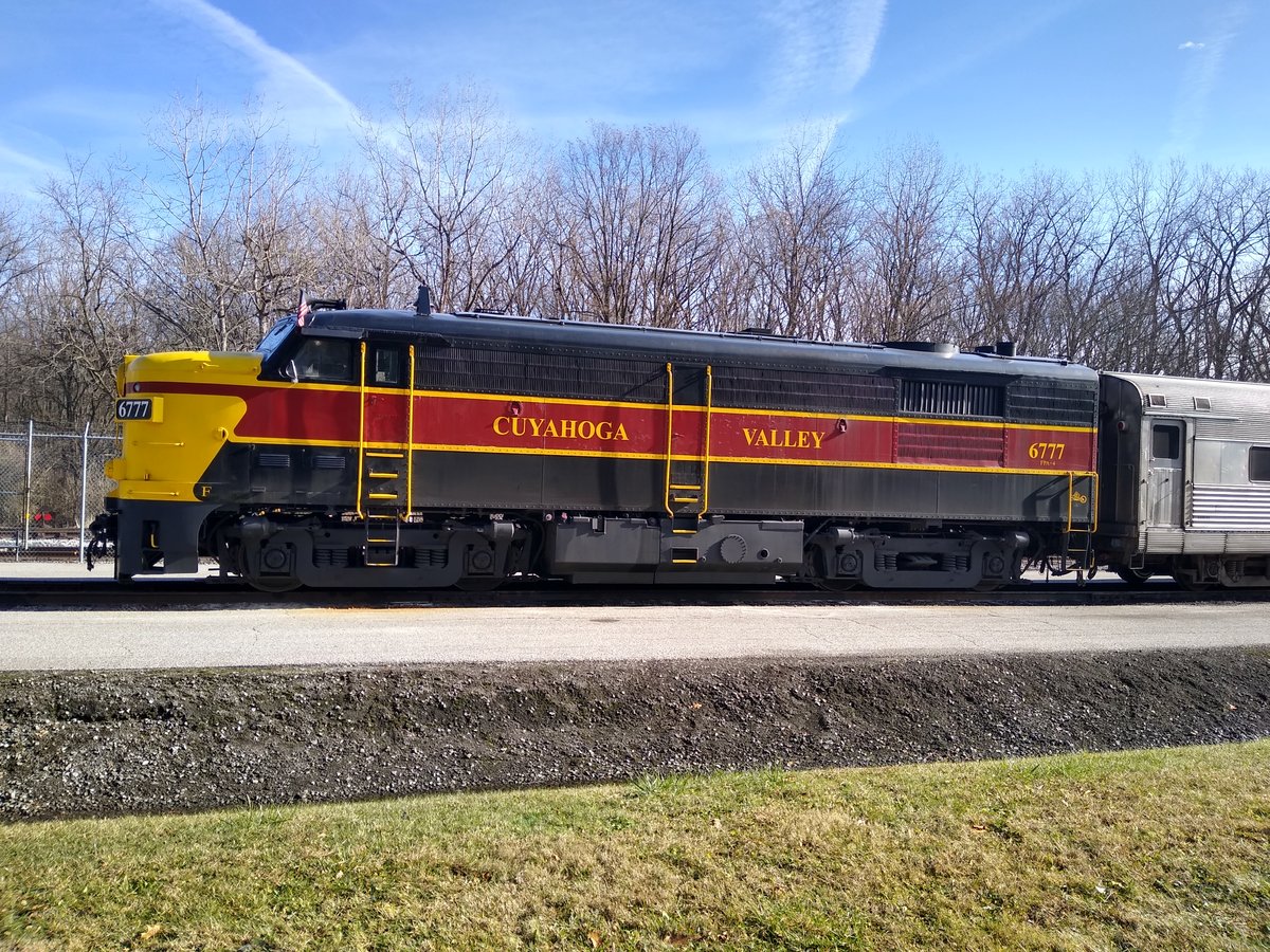
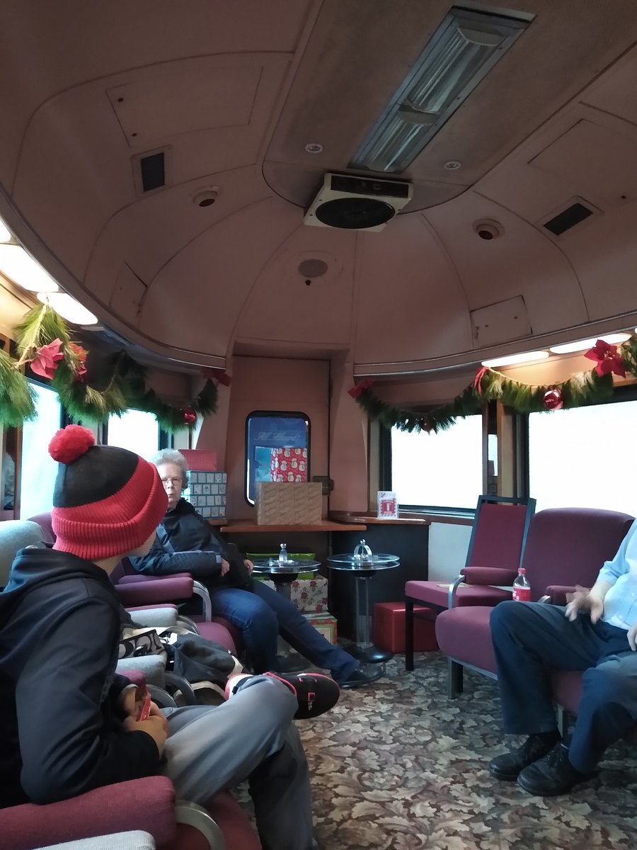
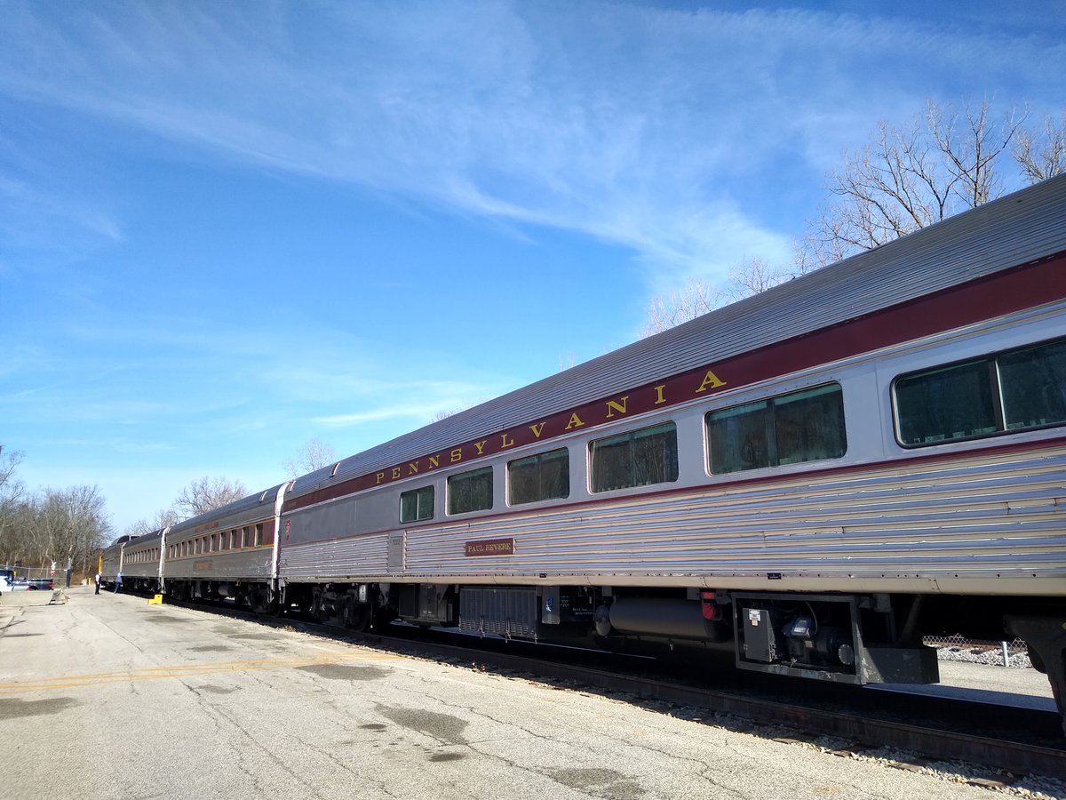
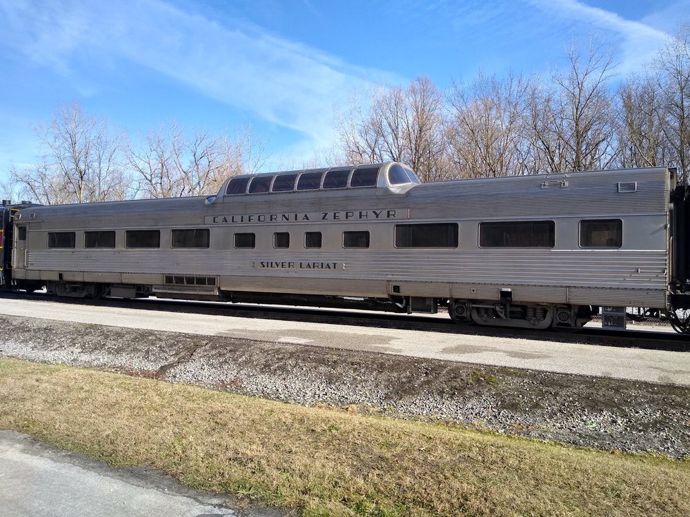
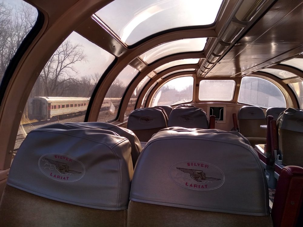
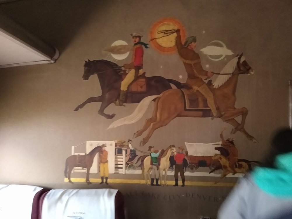
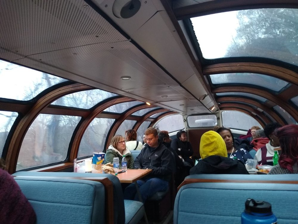
Went through volunteer orientation last weekend, got to see some of the cars and also got a trip out of it. Fun fact, the train is about a quarter mile long when fully built out. Also, this is the largest collection of California Zephyr cars in the world (I think that's what they said?) Coming into Peninsula Peninsula, aka the 'North Pole' for the Polar Express trains


-
These people belong in the suburbs JFC. Parking, PArKinG, PARKING! lol Edit: I'm all for strong communities, and a strong community group, but these people just sound overly protective of a city neighborhood that's finally coming to. They aren't adding anything to the overall community other than 'protecting' their personal views of the neighborhood from 1990.
-
See yinz tomorrow, (Urban)
-
Thanks for sharing this - just an FYI not sure if it was intentional or not, but the redaction areas aren't totally redacted (you can highlight and see the text). Similarly when I was in undergrad, we did a GIS viewshed analysis for wind turbines off of Erie, PA- that project has long disappeared but essentially it showed that for all the complaining people do about wind turbines in the lake, a very, very small number of people would be able to see them, if at all. It'd be a fun(?) project to recreate one of these days.
-
Hmmm, you'd have a chance for a view of downtown from the third floor city facing apartments (at least until Metro is wrapped up). I wonder if they were waiting for revenue to climb at their event center before moving on apartments (as of now, it seems like there's something in there maybe 4-6x a month?), they've got a light on on the third floor, but other than that it seems stripped to the studs.
-
I reduced the size for putting it on here, the original is about 50% larger of a file size (and detail). I'm impressed at the quality of some of these photo programs they were flying at the time.
-
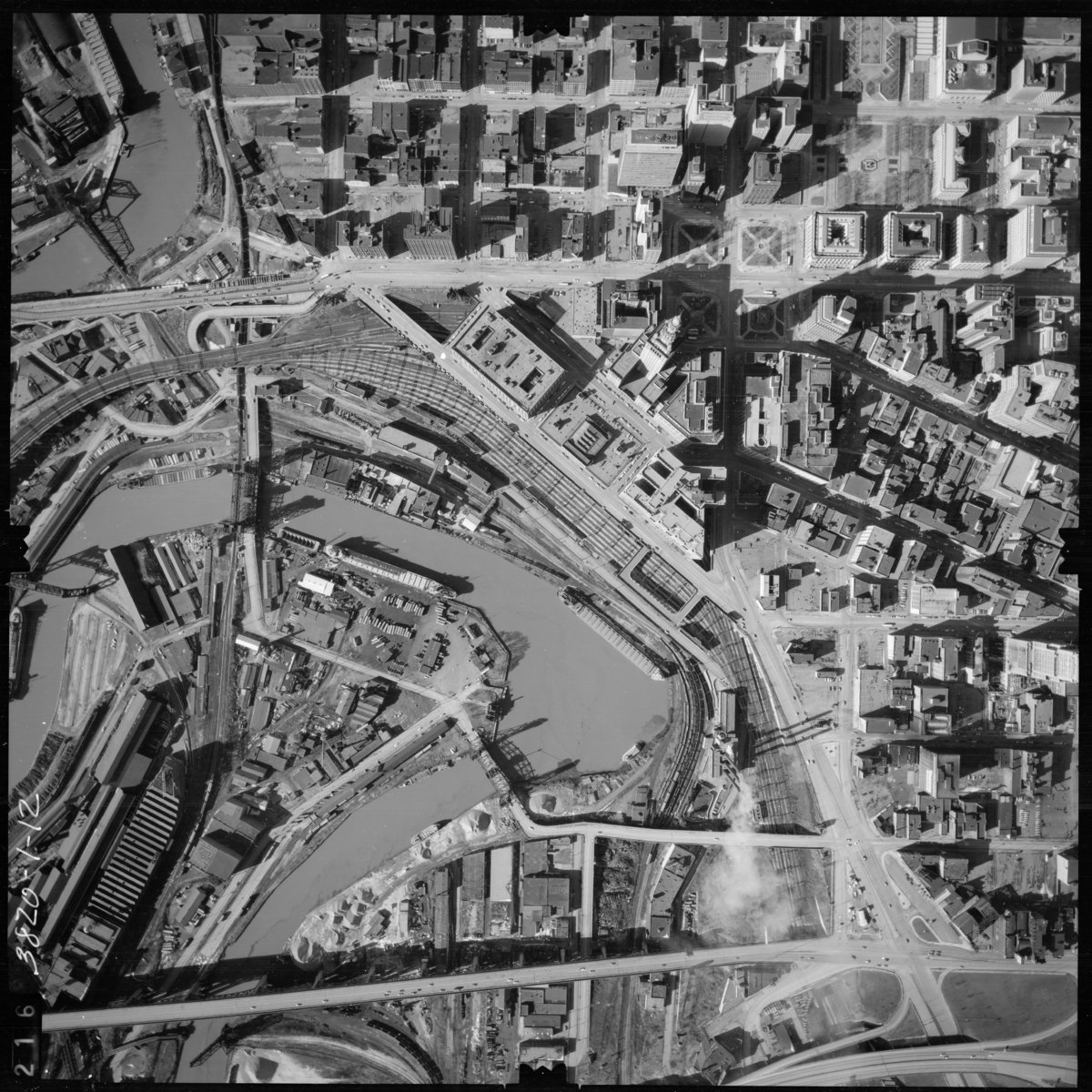
I posted about the availability of historical ODOT aerial imagery in the 'Just Plain Interesting Photo Finds..." topic, here's an example (from 1968 at 3650ft)

-
I'll grab a pic one of these days, they've been going steady for probably a month now.
-
For anyone who has GoogleEarth this can be a nifty resource from ODOT - historical aerial imagery that's pseudo georeferenced: http://www.dot.state.oh.us/Divisions/Engineering/CaddMapping/Pages/Public-Aerial-Image-Requests.aspx
-
lol keep in mind it's 2006, and this is 2' accuracy (at most), for reference what's currently being flown is QL0 (accuracy of 5cm), so needless to say the newer stuff will provide a lot of details that aren't really apparent here (like where puddles will form in the parking lot for instance). This is also aerial vs ground based collection and the aerial survey will penetrate trees and foliage (and actually would be helpful when trying to determine what type of vegetation is there). I was talking this over with my coworker, and we were thinking that maybe they extrapolate what's by the buildings from the surrounding area (granted it still doesn't explain the strange anomaly in the lower right corner).
-
I'm envisioning the 'Wildlife Crossing' that's being constructed in Europe right now haha
-
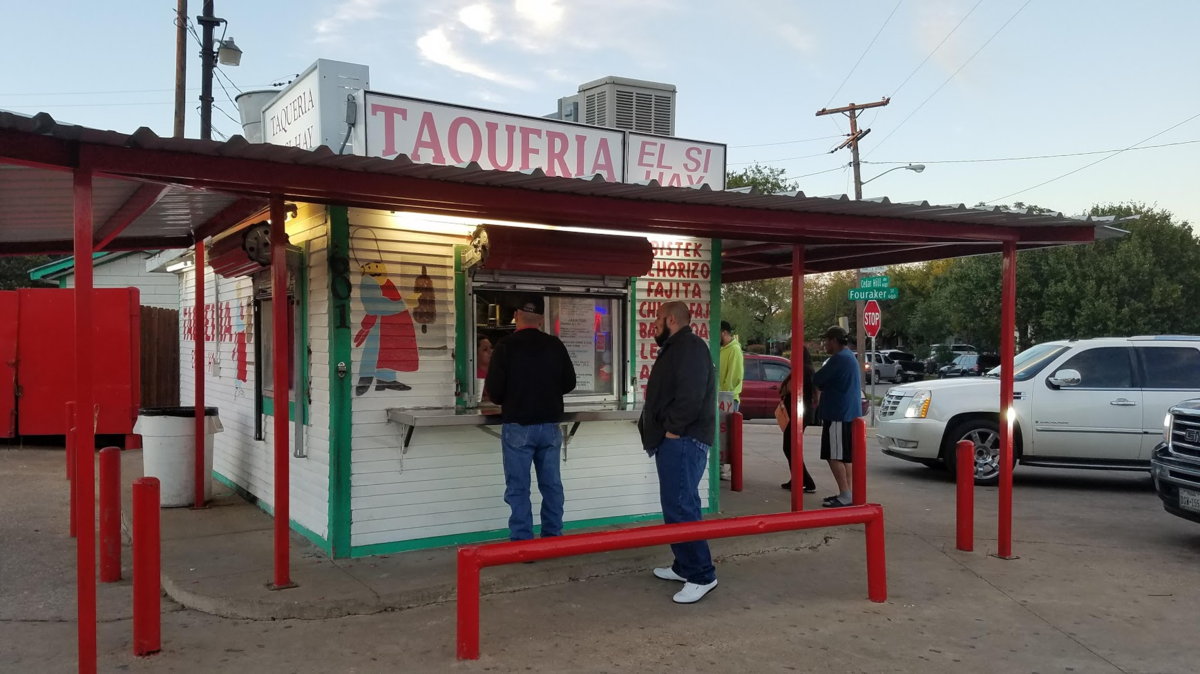
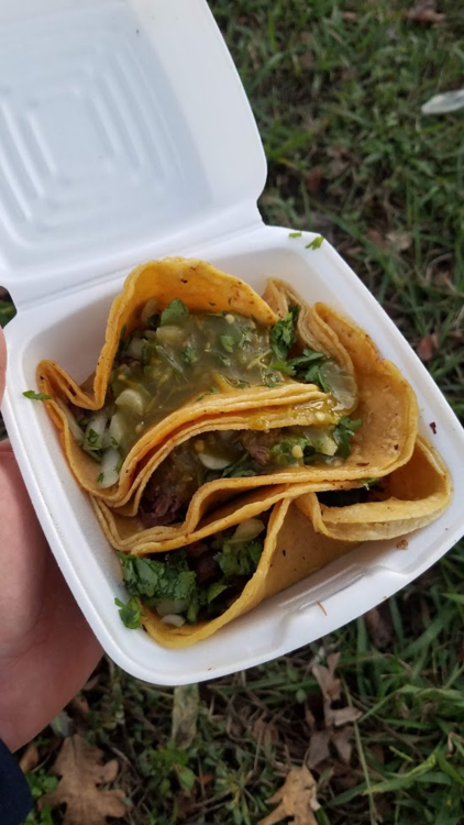
I visited last year and I mean, maybe not around UT but there's like old school/roadside taco joints like everywhere it seems. This is Dallas, but it's not much different than what you see in Austin all over And I saw Bevo! lololol This concludes my "I was in Texas last year and ate some amazing food TED Talk" Getting back to Cleveland, I wish we had more La Plaza's!


-
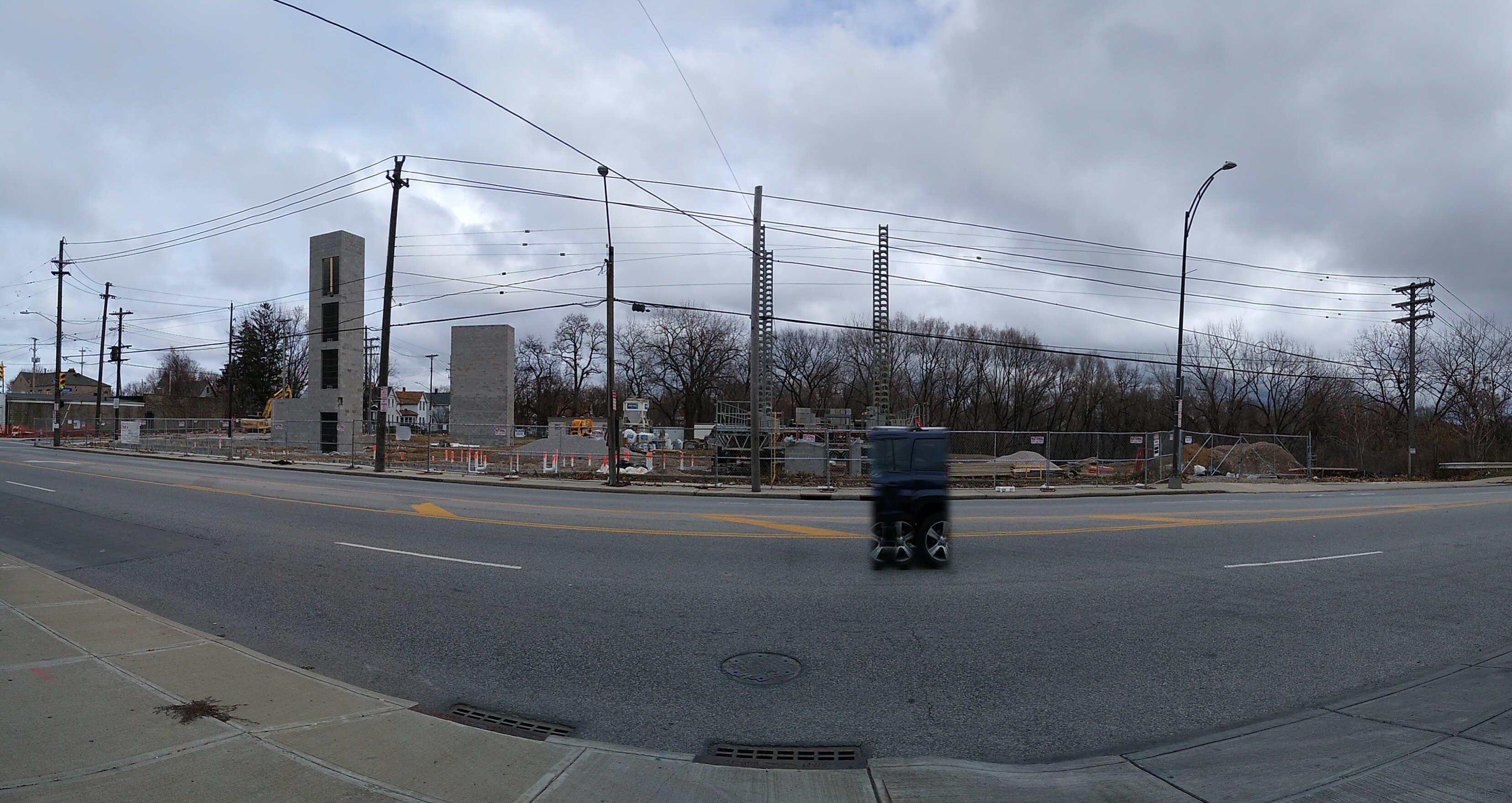
I really, really like the tiny ones at the top at the western-most building. The pano doesn't do them justice.
-
Well, the plat just came across the other day, so maybe it just didn't flow through all official channels in 2017?