Geowizical
Rhodes Tower 629'
-
Joined
-
Last visited
Everything posted by Geowizical
-
 I believe my renderings for HQ2 covered this pretty well
 -
This video from City Club Detroit is filmed in one of the rooms staged as a open house amenities presentation. If you look past the presentation you can sort of see the standard finishes. https://www.cityclubapartments.com/usa/detroit-mi/downtown/detroit/explore/ Click on "Virtual Tour", then "Amenities Tour" TBH, it looks marginally better than the photos we've seen from City Club CLE. The set decorations cover up a lot of the base finishes though (wow, big surprise!).
-
Probably Taylor Swift lol
-
Keep in mind it says "Phase 1" right at the top of the planning document, and this phase only covers from E55th to E79th - definitely nowhere near the entire length of Carnegie that needs redone. Maybe there's a chance that future phases could bury some of the OHW.
-
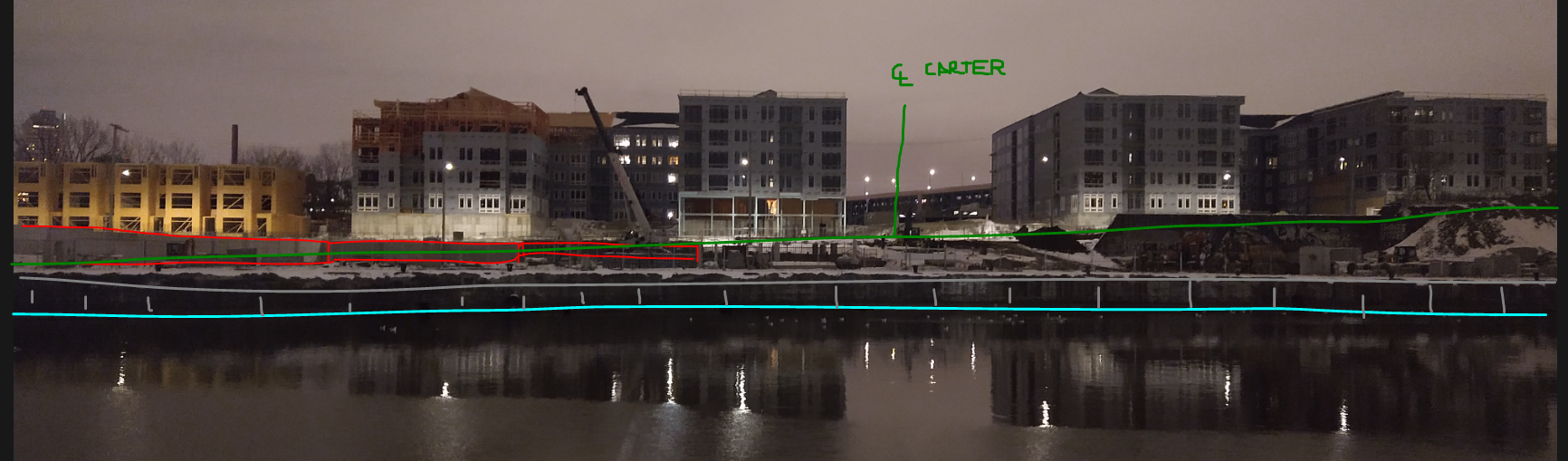
They're definitely "vertical" - a decent amount of the basement/foundation walls on BrewDog-side seems to be up, but it's misleading because of the CL of Carter Rd is pretty sloped so it seems like they are still underground.
-
I think we could charge SW a reasonable rate - they might even save enough for more/taller buildings lol
-
Gladly!
-
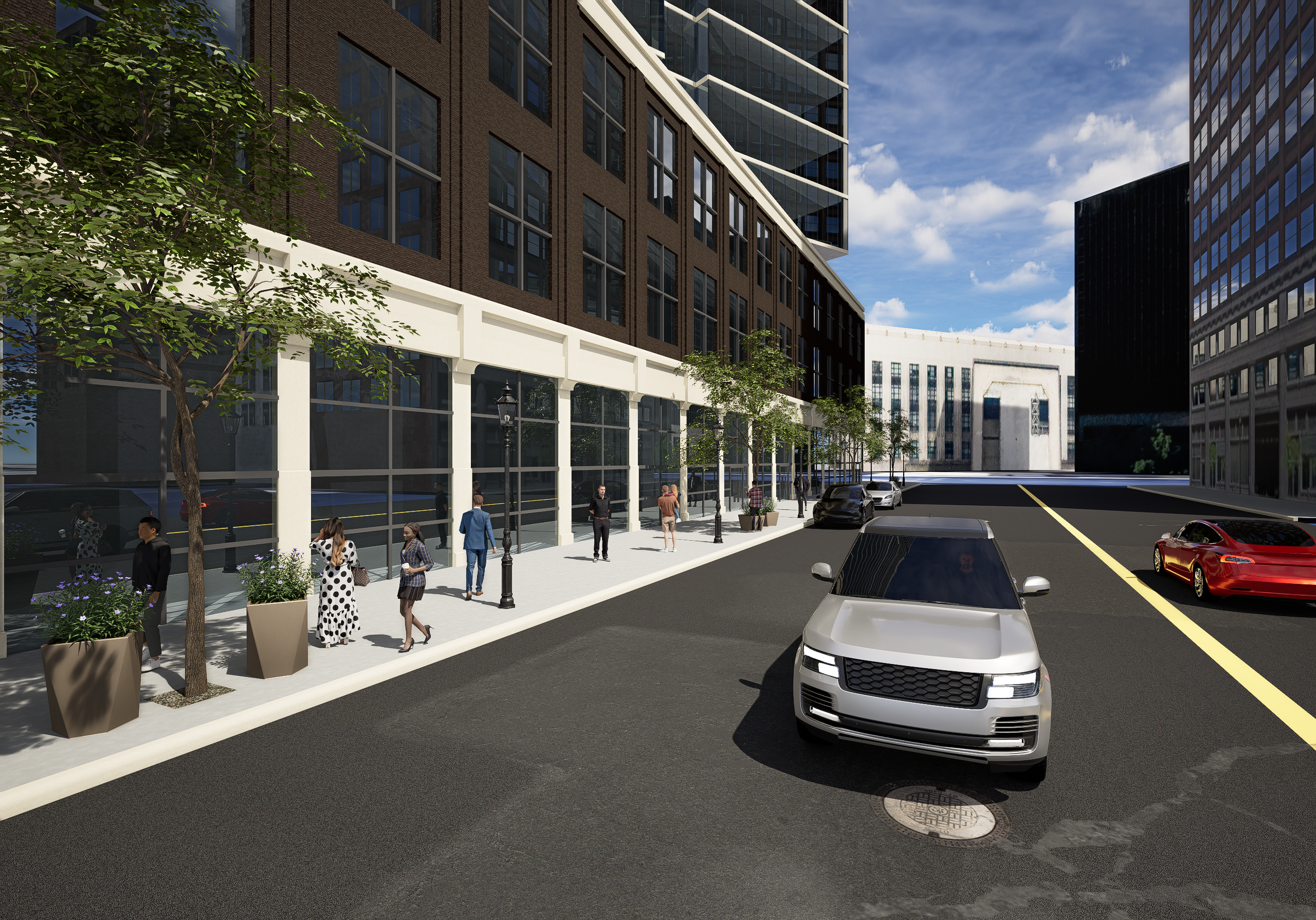
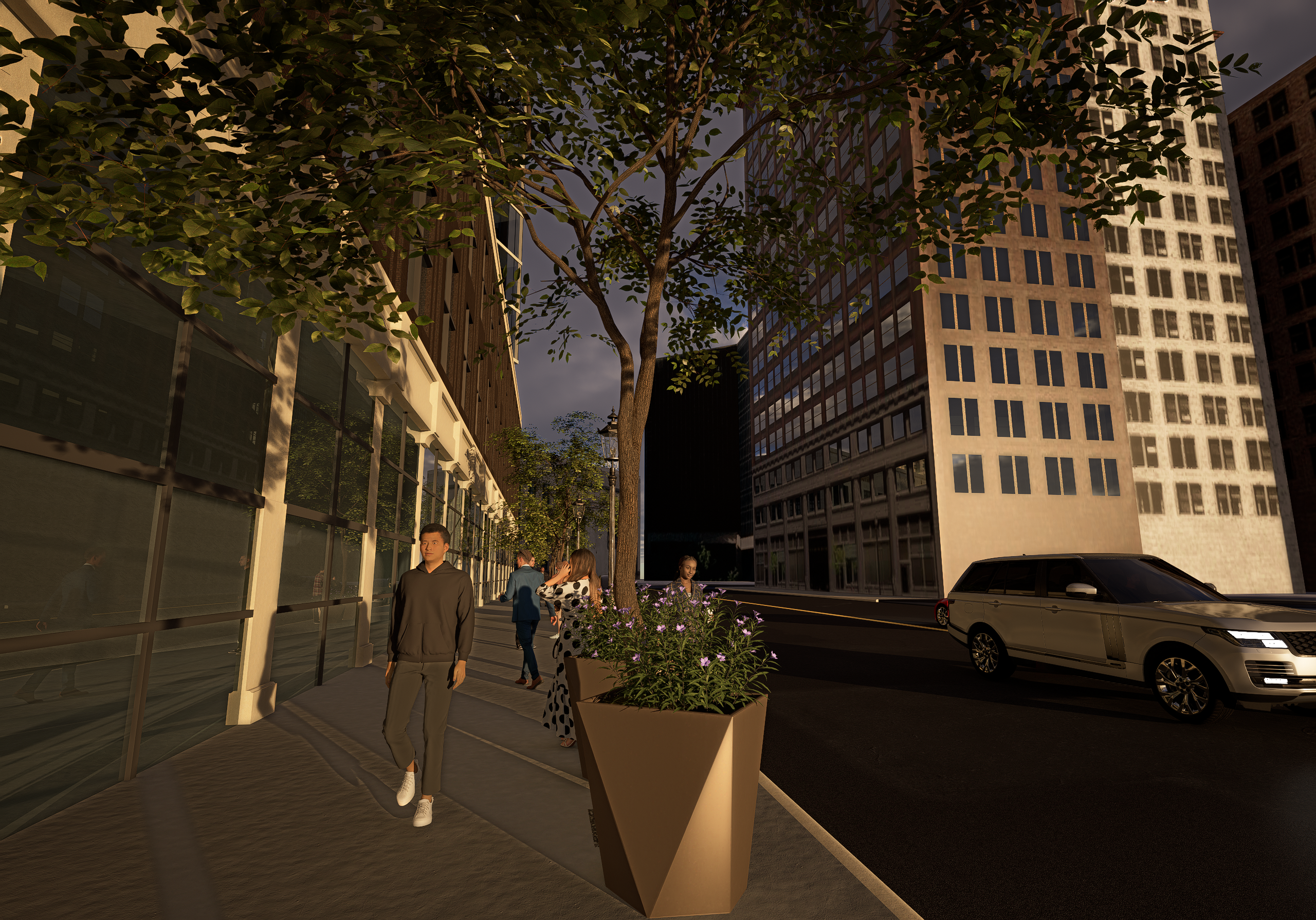
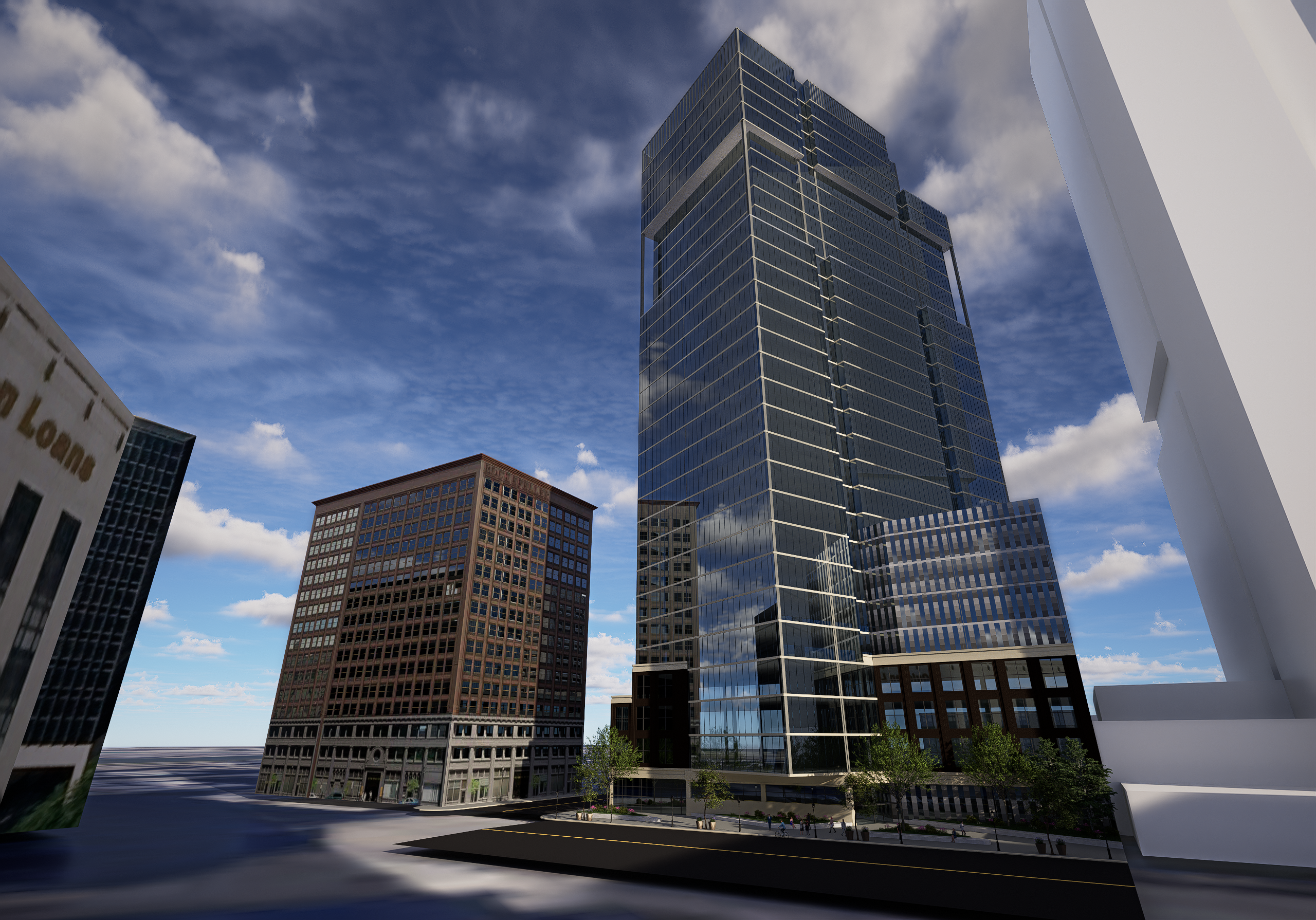
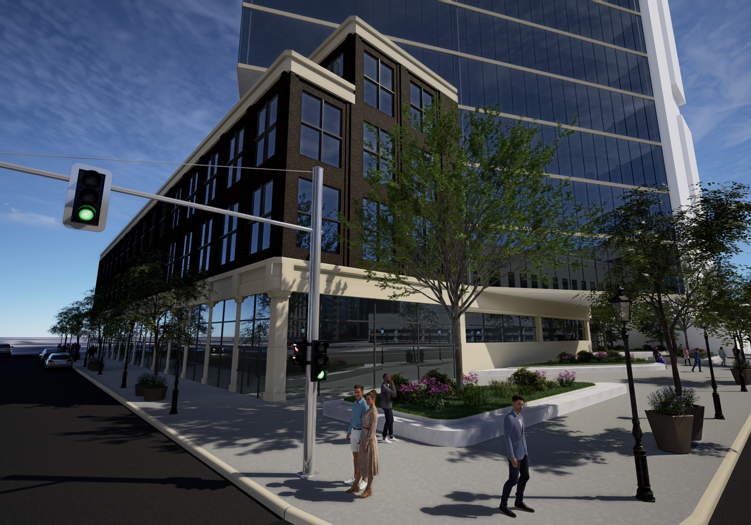
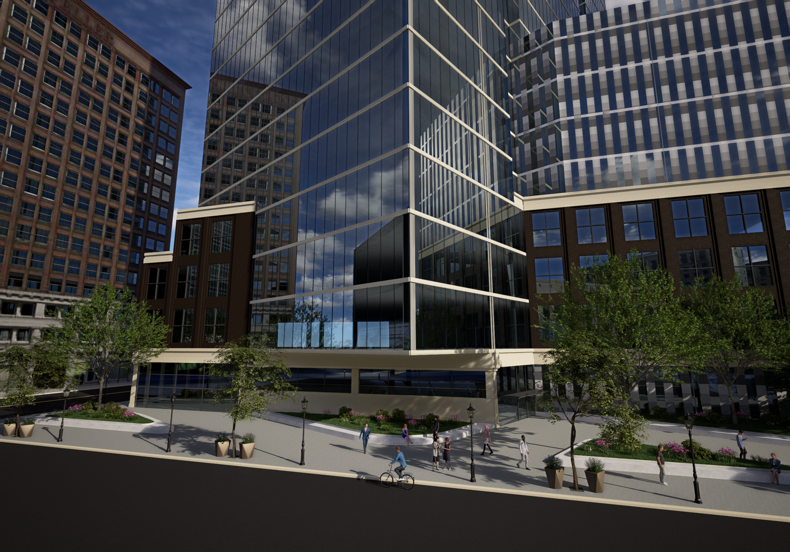
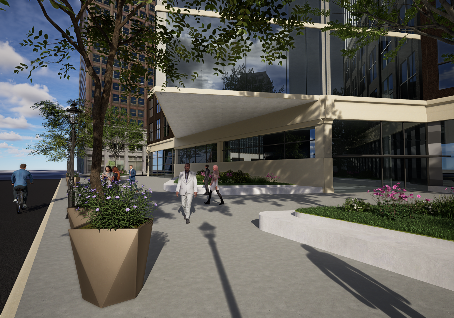
As promised! Some little tidbits on the design: Glass facade, exposed steel structure and vertical indentations expand upon motifs used in HQ1 Off-angle tower creates visual interest from street grid and perceived buffer space between HQ1 and HQ2 Shallow angle of tower crown compliments but doesn't detract from HQ1 sloping crown Metal/glass parking exterior screens resemble paint swatches Traditional-influenced brick facade for lining office and retail reflects and expand upon the existing warehouse district and Rockefeller buildings Superior plaza landscaping features built-in seating Still working on remodeling SWHQ1 so it won't be all white much longer. This whole process has been a promising first step towards our own "professional" architecture renderings, hope y'all enjoy! NW - Superior Ave NW - Superior Ave Entrance and Plaza W - Superior Ave Street NW - Downtown SE - W 6th Retail and Offices SE - W 6th Street


-
Hey y'all so I mentioned a rendering overhaul over at SWHQ, here's just a WIP behind the scenes on the new capabilities before I post some actual stuff. I'm hoping to get a sort of updated SWHQ2 rendering posted sometime this weekend but the devil is in the details and I'm trying to be as detailed as I can lol. You'll start seeing dynamic lighting and weather, models of existing buildings with full textures and fully-rendered concept buildings (ignore the SWHQ building below lol), realistic plants, people, cars, and a bunch more stuff. It'll also in theory make post-processing a ton faster too! Hopefully you'll see some of these new renderings pop up in NeoTrans in the future too. Anyways, cheers! Edit: there is no ground yet
-
Yeah I went about a month ago and there wasn't much to see, although we mostly went for the animals lol They have their three main exhibits still in the works: space, geology/earth sciences, and one other I can't remember (wildlife I think?), all set to open December 2024. If you want the full experience, wait until then I reckon. That being said the entire expansion is amazing and world-class inside and out, and even though there wasn't much to do when we went it was still super busy which is good.
-
^For sure. Also, @KJP's earlier article from a month or two ago suggested nearly 500' including some sort of base/parking levels.
-
I've been throwing something together recently, all the more reason to post it soon! Edit: I'm trying really hard to get this new rendering program up and running, hopefully it doesn't take too long and is worth it in the end
-
Well what do you know... 28*15 = 420 😎 Nice
-
Thinking about it now, Ideastream, among various news outlets, reported at the end of last year that the 90%/finalized lakefront master plan would be released in January 2024. https://www.ideastream.org/community/2023-10-23/cleveland-lakefront-master-plan-in-final-stages-intended-to-be-finalized-in-january With no lakefront presentation to the city during CPC's first meeting on the 5th, curious if anyone's heard any updates since the next CPC meeting is this Friday? Or if Field Ops is planning on doing another presentation event this month?
-
If anyone could direct me to the appropriate thread, I'd be more than happy to share and my full population analysis there (condensed for ease of access) for those interested in the growth trends for other cities in the Cleveland MSA as well. There's lots of interesting stuff in the data, especially looking at the last 10 years which is probably most relevant...
-
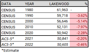
From my Cleveland MSA census data spreadsheet 😆 And to answer your other question: East Cleveland had the highest percentage population loss 2010-2020 (-22.7%) followed by Cleveland (-6.1%).
-
^2nd or 3rd-tallest in the country from the looks of it haha And why does that look so good as a supertall?!
-
Hey don't laugh we need one of those up here... 😆
-
Someone stole our skyscraper 😭
-
Not sure how well I'll be able to capture the elevations but I can start putting together a lakefront street plan view, to satisfy our curiosity for a month or two lol. Is it actually? (Genuinely curious) The blue steel is really awesome to see in person and gives the flats an added extra charm and grandeur. I think you could just end the western route 2 shoreway where the current Lakeside Ave/w 6th and w 3rd area is (see my plans in KJP's article) and not have to worry about touching the river portion of the bridge. I dont work for ODOT though... 😂
-
The thing about the massing/site is the 55’ drop of the Pit. What we’ve shown here is a 300’ and 250’ building, but because of the elevation change, the site looks short and stubby, as the atriums of the buildings are essentially 50’ above ground. I agree, more verticality would be needed on this site to make a visible impact.
-
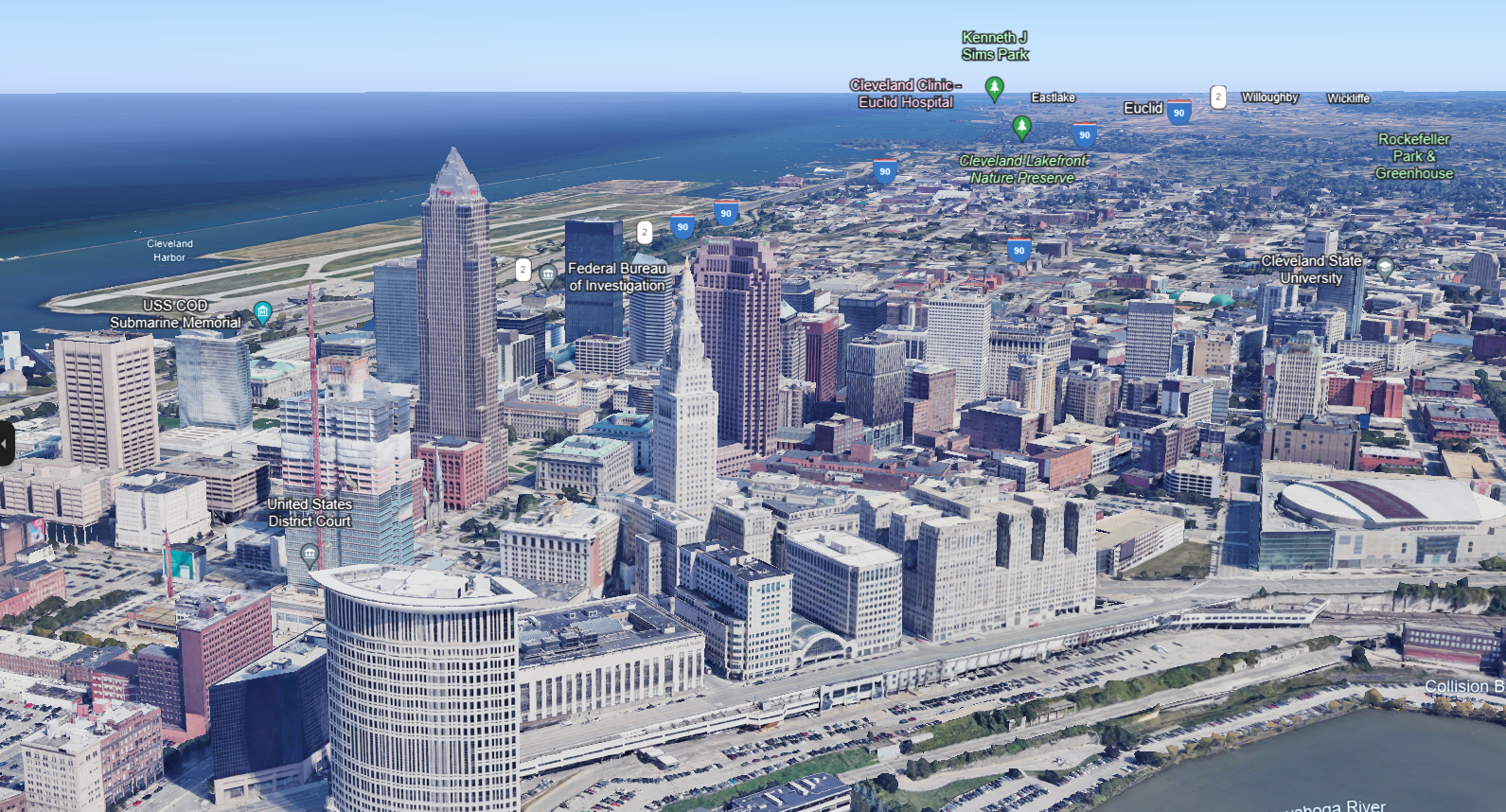
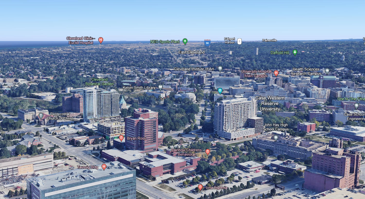
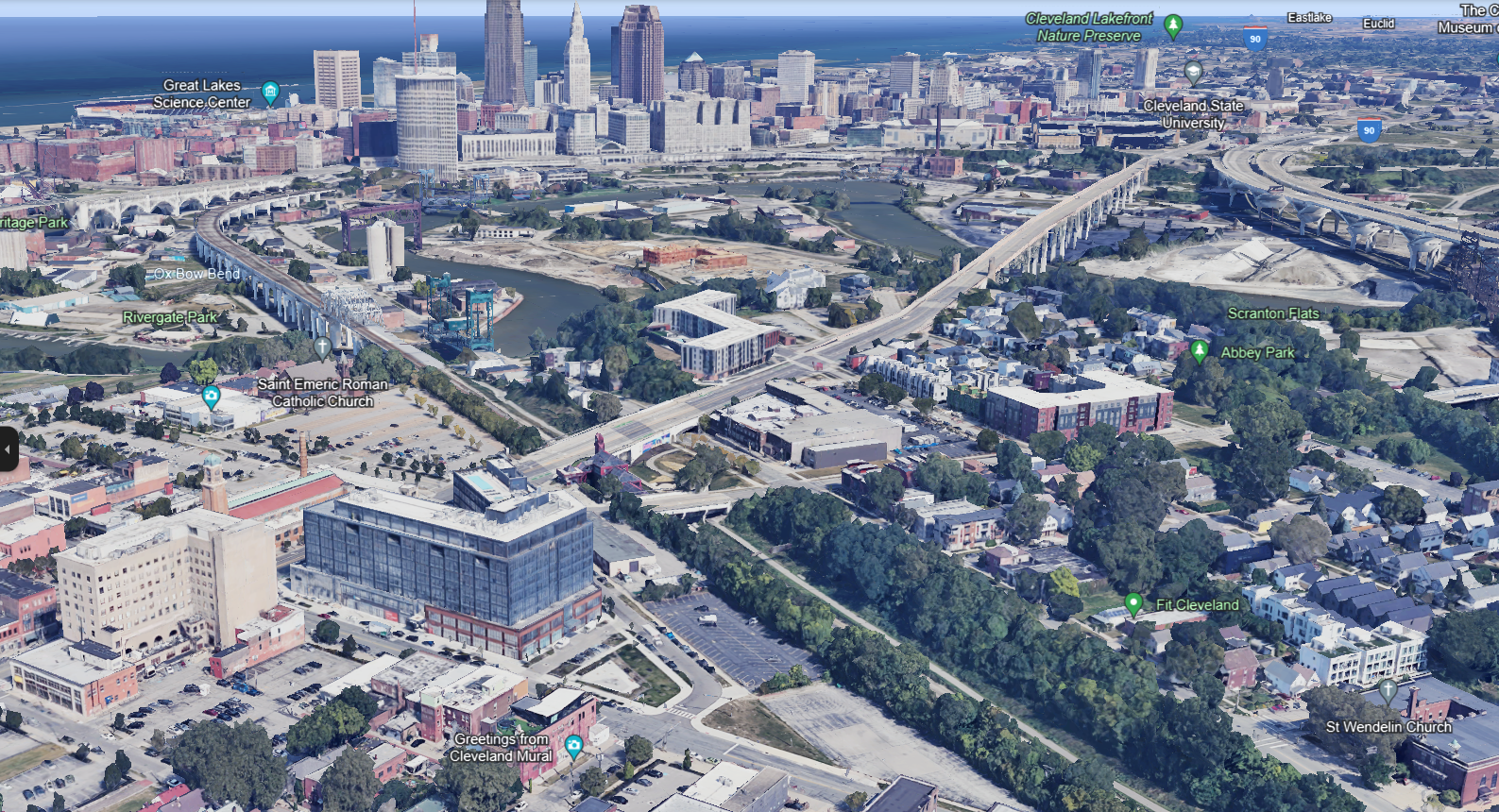
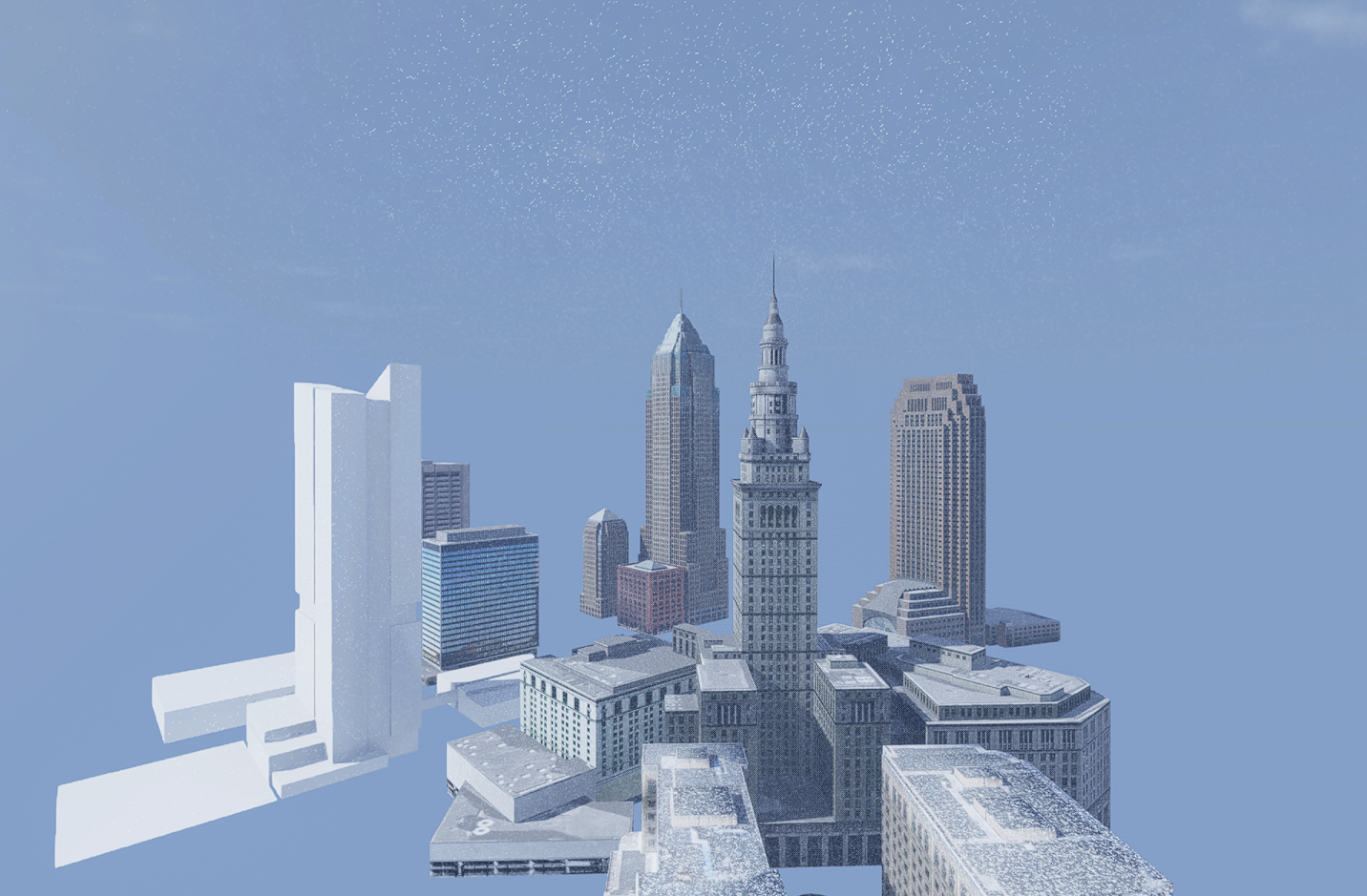
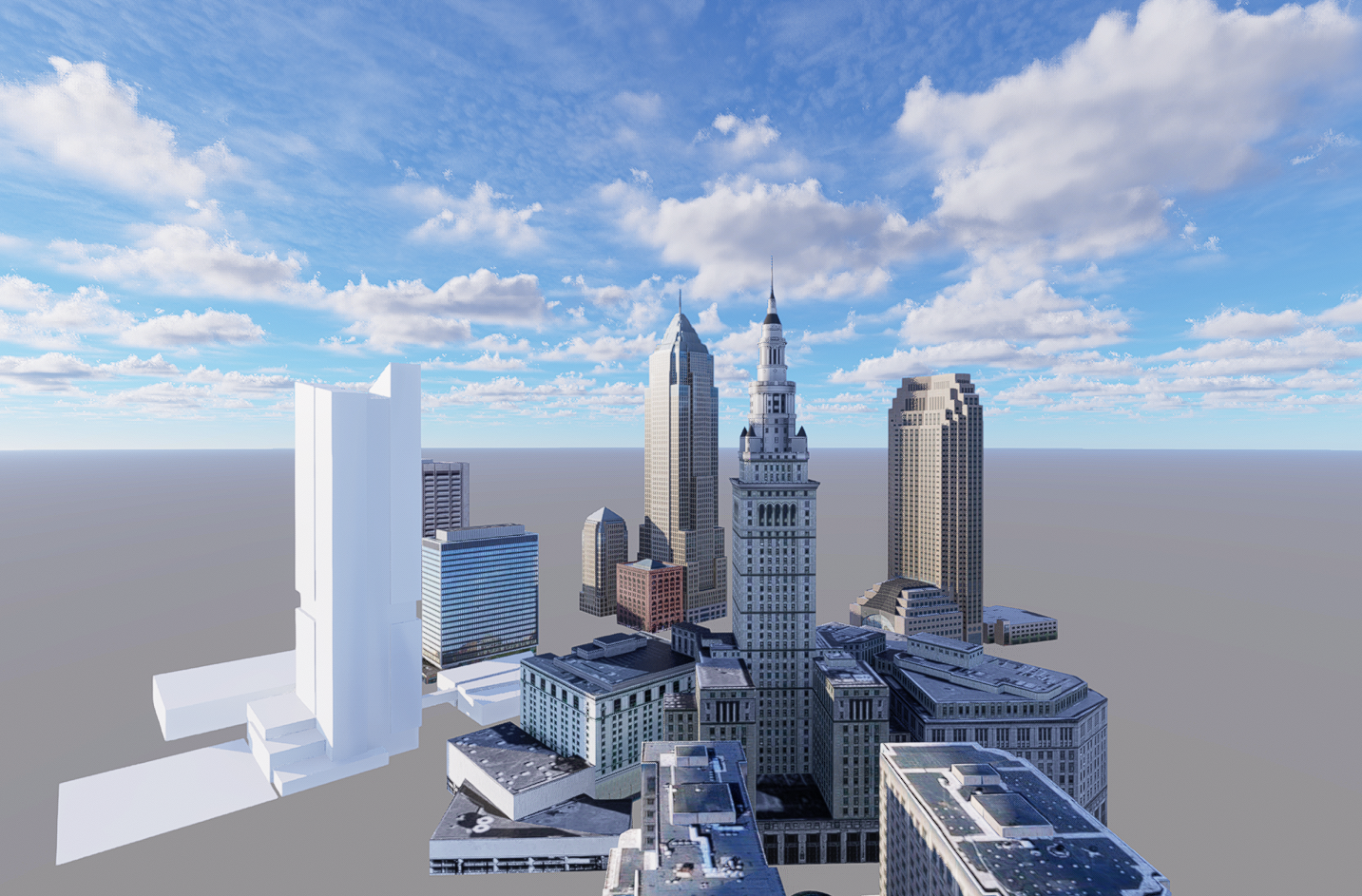
@ryanfrazierTo answer your question here since we moved the discussion: the new imagery is from 09/06/2023. Taking that into account, it seems it took about 3 months to get the imagery processed and verified, which isn't too shabby given they updated essentially an entire city's-worth of data. Also, somewhere in google earth (either in the web version or the actual application), there's a timelapse or clock feature where you can turn back and view old imagery if you'd like to compare.
Glad everyone could submit some feedback! - seemed like a no-brainer for them to update it 😎
@bwheatsthanks for sharing/breaking the news! What a great early present - I've been submitting countless feedback suggestions to Google over the past year (multiple accounts!!! haha) and they've FINALLY updated Cleveland 3D imagery (who knows if it sending feedback actually made a difference lol) For context: almost every major US city has imagery updated to 2022 except for Cleveland, which hasn't been updates since 2014 (sigh). It feels good to finally see the updated progress Downtown! University Circle! Ohio City!