
fcb
Dirt Lot 0'
-
Joined
-
Last visited
-
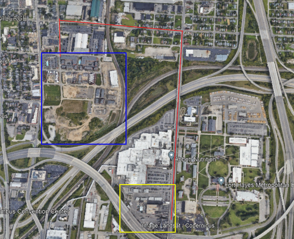
The only access under 670 from Jeffery Park to the Kroger Bakery site is an overpass with 4 sets of very active railroad tracks that would also need to be crossed at grade. I believe there would also need to be egress through Ross Labs property. To get the railroads and Ross labs to go along with this would probably be next to impossible. Currently the shortest walking/biking route between to the two sites is 2nd Ave which goes under the railroad tracks to Cleveland Ave in Milo/Grogan. The condition of the walkway thru this underpass is an absolute disgrace. I sure hope there are plans somewhere with the City of Columbus to do something about this connection between Italian Village and Milo and points south on Cleveland Ave. In the Google Earth image the blue box is Jeffery Park and the Yellow box is the Kroger Bakery site. The red line is Second and Cleveland Ave.
-
The bar area north of campus is not directly adjacent to campus. It is about a mile north on High St. This area used to only have 2 or 3 bars but now there are several more. The area is treated like a no mans land by the City of Columbus. It isn't campus and it is just south of what offically is Clintonville. 5 years ago these bars really wouldn't have been considered campus bars and had an older than college age crowd. I think the neighbors just want a little more support from the city to handle the new influx of college students partying in the area. Also the City has fixed up High Street in Clintonville and also down on campus but has totally ignored this area. The Hudson, High St. intersection has no turn lanes and backs up terribly during certain hours and the sidewalks are totally deteriating. It is a shame because there is some very interesting old building stock in the area. This area used to be a seperate town from Columbus. It was called North Columbus and was on the trolley line between Columbus and Worthington but was annexed into Columbus in the late 1800's.

